Click on a thumbnail to see the full sized picture
|
|
|
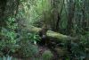
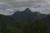
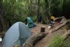
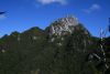
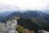
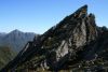
| 01 The track beside Farmhouse Creek | 02 Our first view of Federation Peak | 03 Camp night 2 |
|
|
|
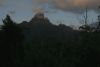
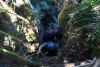
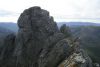
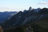
| 04 Sunrise on Federation Peak | 05 Federation Peak from Moss Ridge | 06 A near-vertical climb with packs up Moss Ridge |
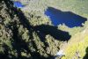
|
|
_t.jpg)
|
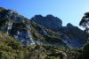
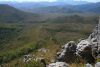
| 07 View above Bechervaise Plateau | 08 Lilly on Bechervaise Plateau | 09 Southern Traverse goes down there (Lake Geeves below) |
|
|
|
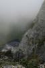
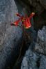
| 10 View back down Forest Chute | 11 W end of the Southern Traverse - I was terrified | 12 View up from the Southern Traverse |
|
|
|
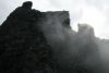
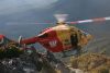
| 13 View to Lake Geeves from the start of the Direct Ascent | 14 Devils Thumb, Thwaites Plateau, E and W Arthurs | 15 Hovering load |
|
|
|
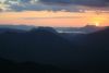
| 16 Hobart Hospital 20 minutes away | 17 Sunset over Mt Rugby and Bathurst Harbour from above Goon Moor | 18 The Boiler Plates |
|
|
|
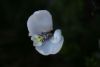
| 19 Tasmanian Christmas Bell | 20 Luckmans Lead - no shade and hot | 21 Western Arthurs from Arthur Plains |
|
|
|
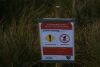
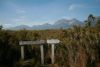
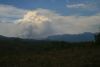
| 22 The sign | 23 Signage at Junction Creek | 24 Bushfire smoke self generating cloud |