

| 22 September 2004 | McKeahnie Trig (with side trips to Square Rock and Orroral Valley Lookout) | Photos | |
| Maps: Corin Dam 8626-1N Second Edition 1:25000, Environment ACT Namadgi Guide, map fragment | |||
| Preparation
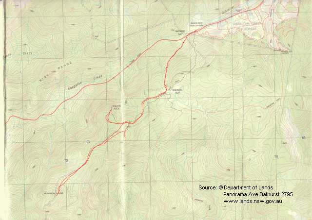
I'd been to Square Rock a couple of times and also to Orroral Valley Lookout. The McKeahnie Trig walk is number 7 in Graeme Barrow's Namadgi and Tidbinbilla Classics: Tough Bushwalks in Canberra's High Country and it was also scheduled as the Wednesday walk of the combined Canberra bushwalking clubs a couple of months previous. Square Rock is number 4 on the Namadgi National Park map, Walks on walking tracks. I also wanted to check it out for a walk for a group of friends in various situations and with various abilities. The track walk could be offered to families and the trig walk an extra for the bold and brave. I scanned the relevant portion of the Corin Dam 8626-1N second edition 1:25000 LPI topographic map and calibrated it in OziExplorer. I plotted a proposed track from the Square Rock Walk Car Park to Square Rock, then to the Orroral Valley Lookout, then back half way to the Square Rock Walk, then to McKeahnie Trig. From there, return to the start. The proposed track was 13.63km. I then created 7 waypoints and uploaded them to the GPS. Then, with just the waypoints on the map, I printed it for use on the day (this saves bashing about your $8 map, but DO take it with you for proper navigation!). |
| Getting There
The drive from Weston Creek, through Tuggeranong, Gordon, Point Hut Crossing, along Corin Dam Road to the Smokers Gap car park is 42km and can take about 45 mins. Park in the Smokers Gap car park, just past the recreation area. The car park is on the right (north) side of the road. All on normal, sealed roads. |
| Walk
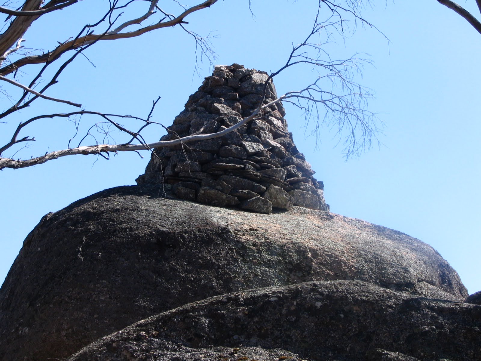
The walk begins at the western end of the car park (Way Point 1) and parallels the Corin Dam Road for a couple of hundred metres. It then crosses the road to the walk register. The first part of the walk is a gentle climb on a well defined track and includes a very fine rock stairway. It levels off and you arrive at Smokers Flat, then to the junction with the Smokers Trail link (Way Point 2). From the start, it's 1.7km. The next leg has another log and rock stairway about 3/4 of the way to where the Orroral Valley Lookout track branches off (Way Point 3). The leg is an easy stroll of around 1km. Continue a further 800m along the fairly level track to Square Rock (Way Point 4). Return the 800m to the Orroral Valley Lookout track junction. Be careful not to miss it, as it has no marker plate coming from this direction. Take the track to the right and walk the 450m on sometimes indistinct footpads to the Orroral Valley Lookout (Way Point 5). Now head about 1/2 way back along the footpad towards the Square Rock Track (Way Point 6). From here, head to McKeahnie Trig. Keep a little to the north of the compass bearing, following the spur line for easier walking, rather than the straight line compass bearing. There is no track or footpad, but the going is fairly open scrub after the Jan03 fires and there are plenty of appropriate animal trails. I reached the base of the hill at GR 699640. The climb up of 100m was a bit steep and took my breath away. But that's like every good thing. At last the Trig was sighted, looking exactly like I'd expected! As others have said, it's not possible to climb up the boulder base to the actual cairn. I had a brief rest on the southern side of the hill, vaguely contemplating going on to Mount McKeanhie ... but only vaguely. I left the trig at 11am and retraced my steps, skirting around the large black snake lying on a black log. I was back to the car by 12.30pm, having covered 12.2km according to the GPS. Distance: 13.6km Time: 9.10am-1.20pm, with 30 minutes of stops. |
|
|
|
| 1 Crack of Square Rock | 2 View from Orroral Valley Lookout | 3 McKeahnie Trig |