This walk was organised as a Wednesday walk by the combined CBC/FBI/NPA clubs and led by Doug F:
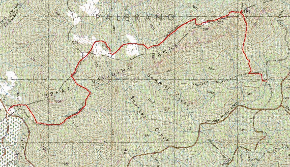
('Mt Lowden area east of Hoslinstown/Rossi in Gourock Range. Walk will start from the Lowden Road and take in part of the Great Dividing Range/Lowden Trig Fire Trail. Climb 400m. About 8 km. May be car shuffle. Walk flexible because of weather forecast. Meet: Quenbeyan Swimming Pool car park, 8.30am. Maps: Bombay, Bendoura. Weather forecast: Chance of a shower or thunderstorm. Cars: 40km ($4). Leader: Doug F.'). We met at 8.30am at Queanbeyan Swimming Pool and drove out the Kings Highway, turning right onto the Captains Flat Road. Through Hoskinstown and Rossi, then along the Lowden Forest Road. We left a car at our finish point, at the intersection with the Coxes Creek Road. The remaining 2 cars with 10 walkers continued a further 6km along the Lowden Forest Road, turning left into Straight Range Forest Road. We left the cars at the intersection with the first fire trail heading left, at GR345671(MGA94). |
The return leg of this walk is walk number 24 in Graeme Barrow's 30 Family Bushwalks in and around Canberra. This was an excellent walk in an area I'd never been in. Leeches, Lawyer vine and lyrebirds!
We set off along the fire trail which headed north, then west, but it was soon obvious that we needed to head north up to Mt Lowden. So we did a right turn and headed bush. The open forest soon became close and wet. Vines and leeches. Tree ferns. Then the gradient increased and we decided to press on through elevenses to reach a spot where we could actually stop in peace away from the waving blood-suckers. We reached the trig point (1346m) at 11.55am, having travelled just 1.5km but 350m up in the 2 hours and 10 minutes, which included a couple of de-leeching stops. We stopped for 15 minutes.
Next we headed WSW along the top of the range for 600m to the communication towers (marked Repeater Station on 1st edition maps). We stopped here to de-leech and lunch for 50 minutes. There were views to the west, but hazy towards the Brindabellas.
All that remained was to wander the 5km down the fire trail to the first car. The forest was drier on this side; a huge rock-pile hill was passed. A large lyrebird crossed the trail in front of us. We were down by 2.40pm and drivers went to pick up the cars.
Time: 9.45am - 2.40pm, with 1 hour 15 minutes of stops.


