This walk was organised and led by me as an irregular CBC Tuesday walk:
(Tuesday 1 January — Booroomba Rocks and Gorilla Rock— M/M,X. From Honeysuckle Creek, along the AAWT and the Booroomba Rocks Walk to visit the three high points of Booroomba Rocks. Great views! 2km to the west is Gorilla Rock, then south to the car. 4km off track. Around 10km and 350m total climb. Map: Corin Dam 1:25000. Limit of 8. Leader: John Evans – jevans@pcug.org.au, (h) 6288 7235; contact me by 6pm the previous Sunday to discuss options. Transport: ~$10. Further details at http://jevans.pcug.org.au.).
6 of us drove to Honeysuckle Creek camping ground.
Provided no one disagrees and because BS is driving a long way for this little wander, I thought we could add a little interest by slightly changing the walk:
Route Card
|
Route Card - Gorilla Rock and Booroomba Rocks (new plan) |
||||
| Leg | Waypoints |
Dist (km) |
Going | Est time (hh:mm) |
| 1 | 1-2 | 1.7 | From start at Honeysuckle Creek camping ground, follow the link track for 400m to join the AAWT. Turn N and follow the AAWT to the near-U turn to the east. | 0:30 |
| 2 | 2-3 | 0.8 | 310°M for 0.8km and 110m climb through the bush to Gorilla Rock. | 0:30 |
| 3 | 3-4-5 | 1.0 | 83°M for 1.0km and 50m down to saddle, then 70m up, left of knoll to top of drainage line. | 0:30 |
| 4 | 5-6 | 0.74 | 50°M for 0.74km and 190m up to the granite. | 0:30 |
| 5 | 6-7 | 0.4 | 356°M for 0.4km and 30m down, 20m up across the granite to SH1372. | 0:15 |
| 6 | 7-8 | 0.25 | 26°M for 0.25km and 30m down to the end of the Booroomba Rocks Walk. Great views from the edge of the cliff across to Blue Gum Hill. | 0:15 |
| 7 | 8-9 | 0.25 | 40°M for 0.25km along the edge of the cliff to SH1353. | 0:15 |
| Brunch | 0:30 | |||
| 8 | 9-10 | 1.0 | 60°M for 1.0km and 300m down to saddle - keep back from the cliff face! | 0:30 |
| 9 | 10-11 | 0.64 | 115°M for 0.64km and 80m down to join the AAWT near creek junctions. Plenty of regrowth here. | 0:30 |
| 10 | 11-1 | 5.5 | 5.5km along the newly aligned AAWT to Booroomba Rocks car park, then back to Honeysuckle Creek camping ground. | 1:15 |
| 12.3 | 5:30 | |||
Walk
Plenty of activity and campers at the Honeysuckle Creek camping ground. We hit the link track at 7.50am (see pic 1) and along the AAWT through lovely grassed ground and greening trees - recovering well. A brief pause at the takeoff point to don gaiters. This leg (leg 1, above) 1.7km in 25mins.
Easy walking on 310°M through grassed and open trees, gently up, to Gorilla Rock. This leg (leg 2, above) 0.9km in 25mins. We circumnavigated the rocks and you can certainly and easily imagine a gorilla (see pic 2).
Generally east down from Gorilla Rock to a saddle, then up through the 1200m and 1300m contours. The regrowth a little thick in places. Finally out onto the open granite slabs and to the cairn at SH1396. Excellent views all round, particularly back to The Spinnaker close at hand and, further out, Split Rock, Gudgenby, Namadgi. This leg (legs 3 and 4, above) 1.8km in 1.25hrs.
Next to SH1372 via a poorly chosen route attempting to go down a mini-cliff. A wiggle fixed that. Rock pools of water about. This leg (leg 5, above) 0.5km in 25mins.
So on to the edge of the Booroomba Rocks cliff, across the end of the Booroomba Rocks Walk and along the cliff top to SH1353. We carefully avoided a large brown snake. This leg (legs 6 and 7, above) 0.5km in 20mins. We enjoyed lunch with the spectacular view down across the BR cliff face and across to Blue Gum Hill. I paid some attention to the Blue Gum Creek cut as a route for a future walk (see pic 3).
We enjoyed the beginning of the next planned leg, coming generally ENE down the side of BR. The regrowth was thick in places and a couple of small tumbles were taken as the down increased. However, the dummy of a leader, me, thought I knew my way and decided to cut the corner. I didn't go down to the saddle and started my U-turn too soon and too strong, so that we headed up the gully to the N of the one containing the AAWT. I was surprised that we hadn't crossed the AAWT, but the ridge between the two gullies looked like Deadmans Hill, so I ignored advice to stop and determine where we were and plugged on for a while. As you can see from pic 1, a poor call. When I eventually took advice from the party's legends, the lights went on, we had to climb to the ridge top, then down to meet the AAWT.
And so a stroll back along the AAWT to BR car park, then back to HC camp ground. Ran into a mate there!
A walk with excellent granite and views. Thanks for your company Brian, Chris, Dick, Madeleine and Penny. I tried to bribe their silence at the Tharwa store.
Lessons learned - stick to the plan; concentrate on navigation; when what should be there isn't, stop, question why and determine my position.
Assessment
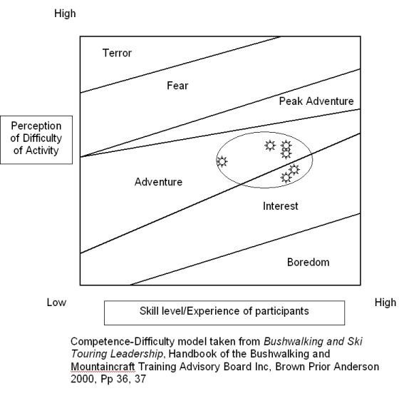
I asked the participants to do a little anonymous assessment of the walk in order to gauge a couple of measures of cohesiveness. We were a reasonably homogeneous group:
Distance: 11.9km Climb: 550m. Time: 7.50am - 2.30pm (call it 6.75hrs), with 40mins of stops
Grading: M/M-R,X; M(10)
KMZ file for Google Earth/Maps: Gorilla Rock and Booroomba Rocks


