This walk was organised and led by me as an irregular CBC Tuesday walk:
Tuesday 8 July - Honeysuckle Creek Swamp and Ridge - M/R,X. Explore Honeysuckle Creek Swamp and the ridge to the SE of Honeysuckle Creek space tracking station, including SH1364 and the tanks. Possible European and other sites. Trust me. Then to the south and west to visit some huge rock overhangs beneath the Spinnaker. Return via Orroral Ridge Road. Around 10km and 500m total climb. Map: Corin Dam. Leader: John Evans – jevans@pcug.org.au, (h) 6288 7235. Please contact me if you would like to co-lead. Transport: ~$10. Further details at http://jevans.pcug.org.au.
5 of us met from across Canberra and drove along Apollo Road to the car park for the Mt Tennent fire trail.
Further Information
Thanks to Madeleine H for pinching some of her 'tanks and tops' route. This should be a more gentle stroll, although a good climb up the ridge.
Civil twilight: 0644 - 1733
Walk
With a dire weather forecast of snow down to 900m, hail and the chance of a thunderstorm, I rerouted the walk primarily to leave the car at around 800m. And it turned out to be not too bad a day - both in terms of weather, a 6-bag day (does this exceed one's limit?) and a bit of a walk up a hill for those so inclined to enjoy such things.
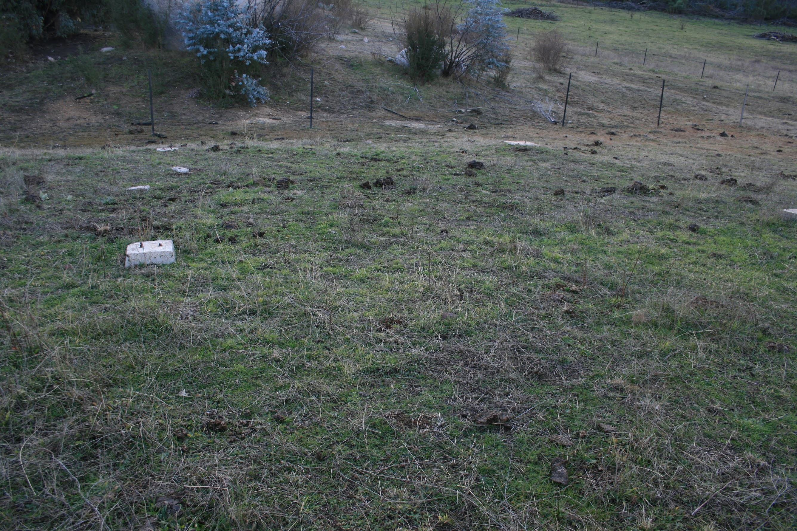
The cloud and fog was just clearing as we pulled into the Mt Tennent fire trail car park on Apollo Road, around 400m further up the road from where the fire trail takes off. But as we walked back down the road, it closed in again for a while. Down the fire trail we soon ran into orange plastic pipes placed along the fire trail and I was reminded that I'd recently read they were laying on electricity to Mt Tennent. We were to find out more later. Crossing Honeysuckle Creek, we began our plod up the fire trail. The GPS reminded me we were at the day's first bag - an old stockyard site, NA5 Stockyard. We identified it by some usual clues - the recorded location (spot on for once), the level area, weeds, a little iron and fencing wire about. A good team effort in the mist (see pic 1).
We plodded on up the fire trail, which Tony had run in a race a couple of years ago. Ian kept him talking to slow him down. It climbs around 200m. We met the digger boss coming down in a ute and soon came upon one of the work crews (see pic 2). Mist cleared and sun shining. The story is that the solar panels at Mt Tennent keep getting pinched, so they are laying on electricity up there. The trench is dug and a rope fed through the pipes, which are buried. TransACT come along when it's all laid and pull a stouter rope through, then a power cable. One of the guys reckoned the storm and weather would come within a couple of hours. The trench was open for another few hundred metres, then we branched off along the Bushfold Flats fire trail. Another crew was just up the Mt Tennent fire trail back filling the trench.
We came out onto the southern end of the cleared Bushfold Flats, a lovely area. There, as I had been told, we came across the rebuilt Bushfold Hut (see pic 3). A stout, utilitarian, somewhat sympathetic structure, no doubt freezing cold but also no doubt very welcome if it was required for use in anger. Around 150m to the E, just before the tree line, we found the site of the 'Bushford' building marked on the 1st edition Williamsdale map (see pic 4). See postscript, below.
Next we wandered NW back to the fire trail, through wooden uprights and a row of exotic pine-type trees. Made a B-line towards the dam on the new alignment of the AAWT and picked up a totem. A quick-ish stroll back up the AAWT to the Booroomba Rocks car park for morning tea. A rather pleasant trip.
The plan, as the weather was holding, was to wander down the road to a suitable point and head directly to a waypoint on Apollo Road which marked a hut site. This we did. The cross country bit, from the big bend in the Booroomba Rocks road to our objective was very nice - a gentle down to an excellent area around Honeysuckle Creek.
Using our reference material, the team swung into action. I began heading down the road to where I knew an old fire trail headed off, Karen headed up towards the end of the swamp and hit the jackpot. The waypoint was a little off, but the evidence of matching the site to a (30 year old) picture and sketch, bits and pieces of iron-ware, old fencing timbers down near the creek allowed us to claim a bag of NA7 Honeysuckle Hut and stockyard site (see pic 5).
The next objective was some granite up the hill on the other side of the road, a know distance down Apollo Road and an assumed distance up the hill. We searched for a while with no luck, then changed our objective to wandering up the ridge to the 1350m feature top we'd seen coming down the Booroomba Rocks road. A steep little climb of around 300m up over 600m across the ground. The leader chose the steepest, most difficult route up through some great granite blocks, just to provide a little enjoyment for certain party members. A couple of showers with snow flurries on the way up. However, the views were worth the effort! Lovely granite, views down to Honeysuckle Creek swamp (see pic 6), to the SW the ridge we originally were to follow (looks a bit granitic, but I guess we'll have to come back some time to do the remaining tops and the tanks) and further out to a unique view of The Belfrey from the E and Split Rock and a snowy Bimberi Peak. To the N, Deadmans Hill, Booroomba Rocks and Blue Gum Hill.
Time was getting on, so we popped back down for lunch. With this as an objective, the leader chose an easier and quicker route down. We did, in fact, hit a fence line (which was a reference clue we had) and then came out at the granite we were searching for, beaten to the bag by a party member who had stayed down searching. I can recommend the route from the road, rather than the top-down (which first requires a bottom-up) approach. Lunch was enjoyed at the old fire trail turn off.
Our remaining leg was to follow the old fire trail (shown only on 1st edn maps) back down across the SE side of Deadmans Hill. It began open and benched, a concrete ford where it crossed Honeysuckle Creek, a very overgrown area, then settled into a footpad down the still-benched old trail. A long time since a vehicle has driven it. Having kept the pièce de résistance till last, I enthused the party with the news that we were heading for a hayshed. Our 30 years old reference picture showed a grand structure. Alas, breaking into the open beside the creek, with Mt Tennent fire trail (and car high up on Apollo Road) in view, we saw no hay-stuffed barn, but a set of concrete foundations (see pic 7) for NA6 Hayshed. Two of the metal structures from the top of the walls leaned against a fence and the party showed me where more of the shed lay - down in a nearby rubbish dump. A sad ending to a fine day of bagging - may be 6 sites is over the daily bag limit.
We wandered back up the main fire trail, then the road to the car.
Postscript: Reviewing the reference material, Bushfold Flats is a little more complex, wrt identified sites. Provided the GRs are accurate (and that is a big proviso), the N end of the Flats contain 3 sites - TH2 Hut remains, TH3 Bushfold Hut (the Bushfold Flats shed visited on 25 Mar 05 and 21 Oct 05) and TH4 Bushfold Shearing Shed. The S end, which we visited today, contains 4 sites - TH5 1-2 Bushfold Shearers Quarters, TH5 2-2 Bushfold Sheep yard, TH6 Bushfold Covered Sheep Pen and TH7 Sheep yard. It would be my guess that the rebuilt Bushfold Flats hut is built on the site of TH5 1-2 Bushfold Shearers Quarters and 'Bushford' site is TH6 Bushfold Covered Sheep Pen. Back I'll have to go.
Timings
| Leg | From | To | Distance | Time |
| 1 | Start | Bushfold Flats sites | 3.7 | 1:15 |
| 2 | AAWT to Booroomba Rocks car park + morning tea | 3.8 | 1:15 | |
| 3 | BR car park | Honeysuckle Hut site | 1.8 | 0:45 |
| 4 | Climb to 1350m feature | 0.8 | 0:55 | |
| 5 | Descend from 1350m feature and site search | 0.8 | 1:00 | |
| 6 | Lunch | 0:20 | ||
| 7 | Old fire trail, return to car | 4.3 | 1:05 | |
Everyone seemed to enjoy the day. Maybe the change of route included more variety. The weather was kind, but a mite chilly on the hands at times. Hard to grade - from easy fire trail to a puffing climb.
Thanks to Ian, Jeff, Karen and Tony for excellent bagging skills, great company and fun.
Distance: 15.1km Climb: 500m. Time: 8:50am - 3:35pm (6.75hrs), with 40mins of stops.
Grading: L/E-R,X; H(12)
KMZ file for Google Earth/Maps: Around Honeysuckle Creek