This walk was organised and executed by me as a private walk:
Warks Rd - Lees Creek and Blundells Creek. The S end of Warks Rd through the regenerating Uriarra Pine Forest along Lees Creek and up Blundells Creek to the edge of NNP.
Drove out the Brindabella Road and parked at Condor Hut (site), just a few tens of metres past the signposted Warks Road.
Walk
An area I hadn't yet visited. Couldn't go on the regular Tuesday walk and I needed a half day wander to keep the legs turning over for next Saturday. Not a place to take anyone else, although I must say Lees Creek and Blundells Creek are very pretty after the weekend rain. Soft fire trail for a max 16°C day - I'd hate to do it in 36°C.
Through the little pine forest around Condor Hut and down a mogul-ed track, stepped across Condor Creek and onto Warks Road. Nice view back in the early morning light to mist clearing from Mt Coree (see pic 1). Plenty of native tree planting. Easy walking S to above Lees Creek. Some nice flowers and excellent views over to the Tidbinbilla ridge. The fire trail then curved W. The map marked meteorological station was a rain gauge - probably a little grander pre-fire, as there was a bit of metal on the ground. Indigofera in bloom.
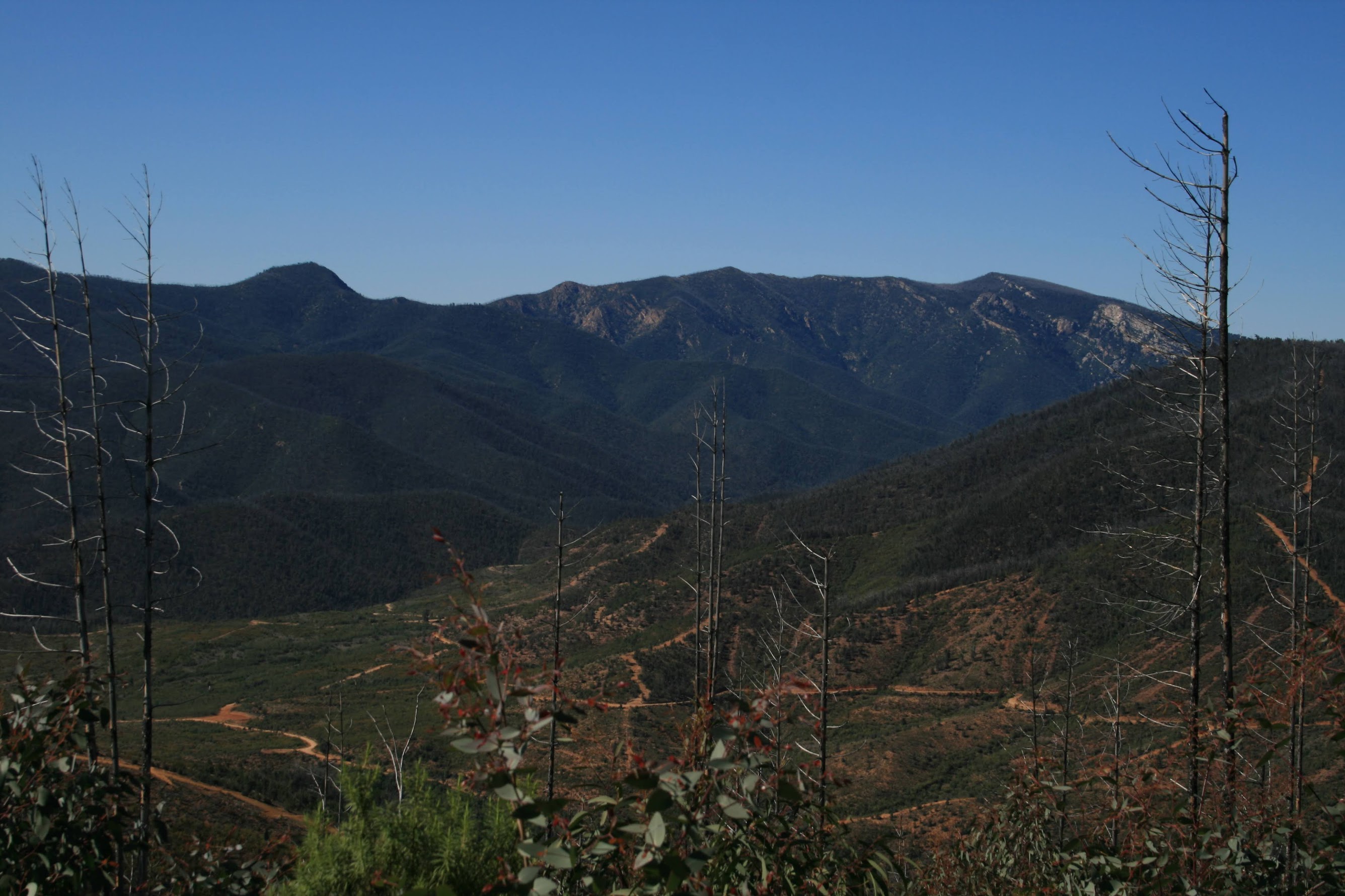
Warks Rd again turned SW, with Blundells Creek tinkling along merrily beside it. Cool in the shade. Wonderful bird life. Eventually came to the map marked weir (see pic 2). Did the U-turn a couple of hundred metres further on and walked a bit of Blundells Creek Road till I realised I needed to return to the corner and split the difference. Wandered various fire trails, past a device that looked like it was measuring silt washing off the hillside down into Blundells Creek. Took an unmarked fire trail up towards the saddle near the 330kV transmission line, then up along the ridge with great views to the SE to the Tidbinbilla Ridge above Lees Creek (see pic 3) and to the NW to Mt Coree and Devils Peak. Caught a glimpse of the 80r cliff above Coree Creek and down from Mt Blundell - is it worth a wander there? Down a wide fire trail - is this the slash seen from southern Canberra? Back onto Warks Rd and out to the Brindabella Rd, then the few hundred metres back to the car.
Distance: 19km Climb: 400m. Time: 6.30 - 10.50am (call it 4.3hrs), with no stops.
Grading: L/E,X; M(8)
KMZ file for Google Earth/Maps: Warks Rd