This walk was organised and led by me as a private walk:
Walk the Walk for Uganda planned route from Ellenborough St to Belconnen Way.
4 of us drove and parked on the side of Ellenborough St.
Walk track
It was still a little dark as we parked on the side of Ellenborough St and walked along the bike path to the easement up into the North Lyneham Eucalypt Plantation. One head-torch between 4 was not quite enough, so we continued along the bike path, which swept up between the plantation and the GDE. By the time the bike path was about to become an on-road cycle path, it was light enough to see enough to get through a gate into the plantation. Wandered along to Ginninderra Drive. Crossed Ginninderra Drive into the O'Connor Ridge Nature Park.
Wandered through the area as it became lighter. Crossed the bike path into the Bruce Ridge Nature Park. This time up through the bush to the ridge top track, past the two reservoirs and to within a hundred metres of Belconnen Way, sufficient to see the track and gate to cross to the other side of Belconnen Way, where we had started another ramble and recce on 21 Jun 09.
About turn and back, taking the ridge-top path through the North Lyneham Eucalypt Plantation where, by this time, the kanga hoppers were up to greet us.
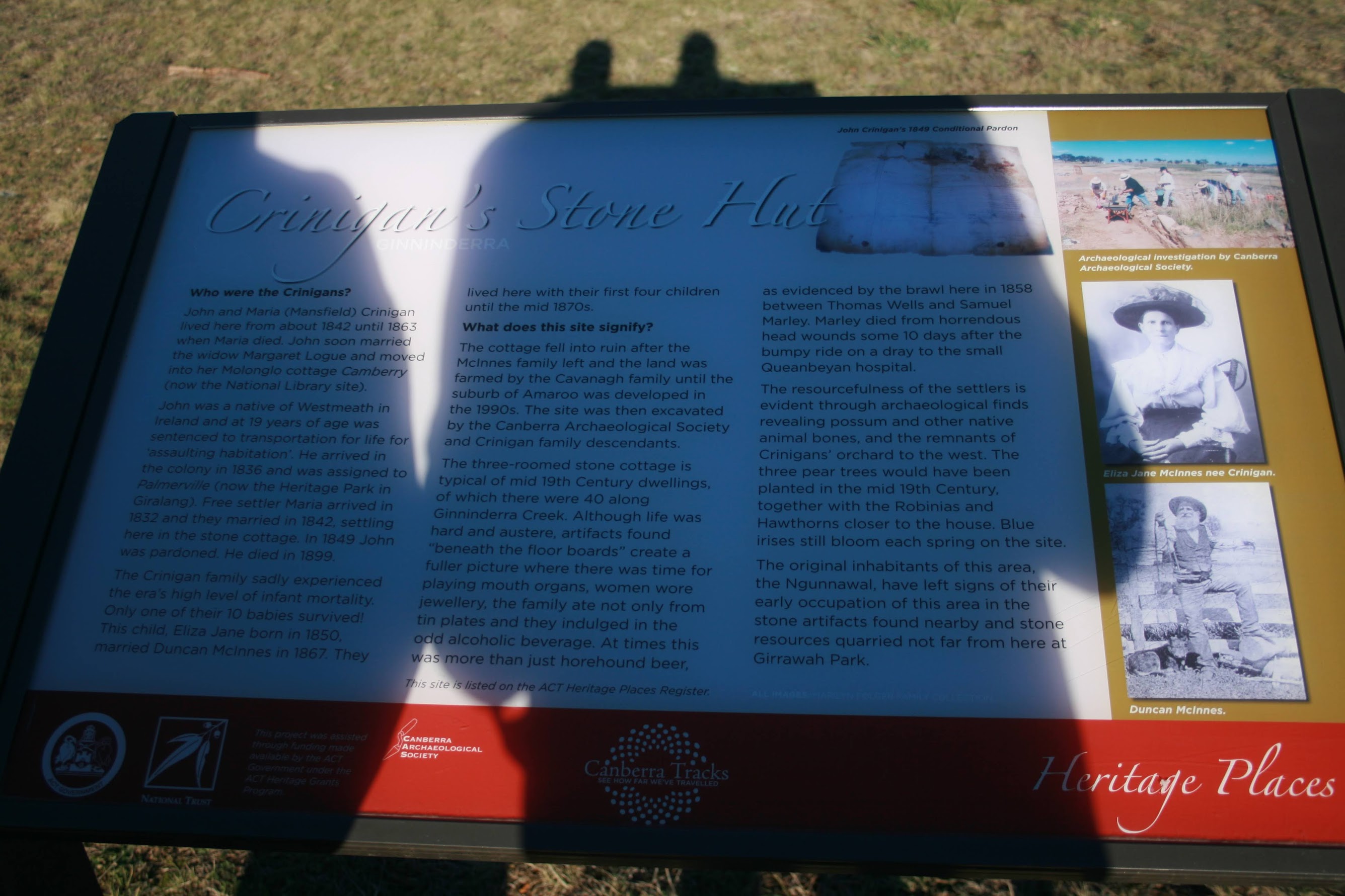
We then drove, under guidance from the 'locals', to have a look at Crinigan's Stone Hut (see pic 2 and pic 3) in Amaroo. There is excellent material on this site here.
Thanks Lily and Ante and Caroline. A great start to the day.
Distance: 9.3km Climb: 150m. Time: 6.25 - 8.35am (2hrs 10mins) with no stops.
Grading: S/E; E(5)
KMZ file for Google Earth/Maps: Walk for Uganda Training - Ellenborough St to Belconnen Way