


9-11 February 2010 The Dargals
Maps: Toolong Range 1:25000
Getting There
This walk was organised led by Max S as an ad-hoc FBI 'Tuesday' walk:
Tuesday-Thursday 9-11 February - Dargal area - H. This will be from Round Mtn, taking in Cool Plain, Musical Hill, Dargal’s FT, Wheeler’s Hut, Big Dargal, Pretty Plain Hut and return via Hell Hole FT. Some ad-hoc to avoid (hopefully) fire damaged areas. Exploratory, about 20 km each day, some off track plus climbs. Hard.
3 of us drove via Cooma, Adaminaby, Kiandra (2.5hrs to here), Cabramurra and the Tooma Road to the Round Mountain track head. In all, around 3 hours including a petrol stop in Cooma and a quick breakfast breakfast in Adaminaby.
Further Information
The walk is approx as follows -
Tuesday - From Round Mtn carpark along Round Mtn FT to old track to Cool Plain. West past Cool Plain hut remains and head SW hopefully thru unburnt forest, hopefully over Musical Hill. Aim for Paton's Hut and then Sth along Dargal's FT and then Wheelers Hut FT to Wheelers Hut. Camp thereabouts. About 19-20 km.
Wednesday - Climb Big Dargal and Dargal Mtn (love those names!) - about 8-9 km 500 m. Assuming weather OK - light pack. Return to camp to pack up. Off track to Dargals FT and thence to Pretty Plain Hut. Camp thereabouts. About 20 km for the day.
Thursday - Nth to meet Hell Hole Ck FT. East to meet Round Mtn FT OR Off track over Mt Toolong then to Round Mtn FT. Back to car, Again about 20 - 24 km.-
I feel tired already!
Photographs
Access all primary pics here. All thumbnails in the walk report are active - click for a larger picture.
Walk
|
|
|
|
|
| Track a | Beware old fire trails | Track b | Track c | |
|
|
|
|
|
| Track d | Track e | Track f | Track g | Track h |
Day 1
We were walking just after 9.30am. I was giving my new GoLite Pinnacle pack its first outing - very comfortable - but had decided to bring my old tent due to the weather forecast. 2.4km along the Round Mountain fire trail in 45mins, to a point where the Theiss Village fire trail left it. This fire trail is marked on the Khancoban 8525N 1:50000 map (old edition) and the one we'd seen in places across the N end of Cool Plain on 1-2 Dec 09. You'd miss it if you weren't expecting it. This took us 2.6km in 50mins W and SW to the Cool Plain Hut ruin, the way marked only by lumpy soil and shorter vegetation - it is no longer a maintained fire trail and is not marked on the Toolong Range 1:25000 map.
From here we chose the option to explore a little of Ogilvies Creek to the SW. Easy going along the edge of Cool Plain to get to it but, doing a u-turn at around the 1400m contour, we soon struck thick scrub on the S facing and steep sides. With the terrain becoming more gorge-like, we made the call to go up to around the 1500m contour. It was hard going on a warm and humid day. We eventually found the Theiss Village fire trail again, slightly dismayed that we were a mere 500m from Cool Plain Hut over the ridge. Our little excursion of 2.6km had taken nearly 2hrs.
Lunch was taken, then we set off down the 'fire trail'. Here it was a maze of deliberately placed logs (no doubt to prevent erosion and certainly to prevent vehicular access), but magnificently picked out by masses of white daisies. It clearly took us across Ogilvies Creek, but I don't believe that it followed the route on the old map. The fire trail was better defined now and passed through wonderful, unburnt, old-growth forest. A couple of showers got my pack cover and person cover out, but didn't worry my companions. What did worry us all was to come to a t-intersection with an obviously used fire trail and, tramping NW along it, to come to bitumen! We had walked approximately parallel to the Theiss Village fire trail from the crossing of Ogilvies Creek on an unmapped (either old or new version) fire trail to join the Round Hill Road. Even a direction check as we left Ogilvies Creek would not have assisted, as our route and the Theiss Village fire trail began in parallel. So we missed Musical Hill. Round Hill Road took us to the Tooma Road. This leg from lunch to the Tooma Road 3.9km in 1hr30mins.
We tromped 2.4km in 33mins of the Tooma Road to a track head car park, then in a few tens of metres and turned E onto the N end of the Dargals fire trail. It was now 3.30pm and we still had a way to go. My left foot was beginning to suffer with a blister developing underneath the ball.
The Dargals fire trail took us NE around the top of the Toolong Plain, with views to the empty backup from Tooma Dam up the Toolong Creek. We passed 3 fisherman walking out with big packs - full of fish. 2.6km in 1hr10mins to Patons Hut. An attractive hut, with photos inside of it's halcyon days in the grazing era.
A long bash, with my foot getting sorer by the step, S along the Dargals fire trail then SW along the Wheelers Hut fire trail to the Tooma River. 6.8km in 1hr45mins. The wade across gave some relief to my hot and sore foot. A further 2.1km in 35mins to arrive at Wheelers Hut just before 7pm. The usual routine - water, wood, a cuppa, tea and bed. Karen chose the verandah and mosquitoes because I threatened to snore.
25.6km and 500m climb in around 9hrs30mins.
Day 1 photos
 |
 |
 |
 |
| Max chooses the route ahead from Cool Plain Hut ruin | 1 Fire trail marked by daisies | 2 Patons Hut | Descending to cross the Tooma River |
 |
 |
 |
|
| Crossing the Tooma River | Wheelers Hut | 3 Slab construction of Wheelers Hut |
Day 2
Up to a serene morning view from the verandah to the E, then away by around 7.45am up through the forest to the W, heading up a convenient spur to get us up onto the Dargals Range. Thankfully, Kaz had a foam cut-out-pad in her first aid kit which I taped to the bottom of my foot. Even with day packs it was still a good climb of 395m over 2.4km in 1hr50mins, turning towards the N once on the ridge for the final climb to Big Dargal Mountain. Unfortunately the burnt and regenerating Snow Gums hid a lot of the view. The local March flies greeted us as we took a well earned rest. No time to get to Dargal Mountain to the NW, the route looking a little more open but still very scrubby. A slightly different return route took us to an open flank of Big Dargal Mountain affording views across to Dargal Mountain.
Returning to Wheelers Hut, we collected fire wood, packed up, swept out and decided from the many options presented to us by our trusty leader (which did not include the planned long leg S to Pretty Plain Hut, thanks to my sore foot - sorry to ruin it, folks). In the end we headed E across Dargals Creek, Broadway Plain and Broadway Creek to strike the Dargals fire trail again. A nice view back to Wheelers Hut and Big Dargal Mountain. To the intersection with Hell Hole Creek fire trail, marked by rustic and new signage. Was it to be a hell hole? - Max was welcomed by a spider bite drawing blood. Nurse Kaz to the rescue and pressure bandaged it.
A 5km slog along the Hell Hole Creek fire trail, again crossing the Tooma River. My companions took the opportunity to cool off via full immersion; I fiddled with the water, but drank plenty. I reckon we would have drunk 5 or 6 litres of water in the day, filling at many opportunities as we crossed streams and rivers. No shade over the plains, with sunny mornings and humid arvos. The clouds provided some relief. Then a 20m climb back up out of the river. It was taxing.
But at last the open S part of the Hell Hole Creek plain (not marked that on the map, but the plain of a feeder creek into Hell Hole Creek) came into view and the nature of the 'hell hole' changed markedly. Beautiful walking over the open grasses, heading towards a glowering storm in the NE. We stopped at some rocky outcrops around 1km to the N, setting up tents in the lee of them. It was 4.45pm and I was wacked. It was nice to camp (as nice as the hut accommodation was) and the grass was a lot softer than the floorboards. As Max had assured me, no rain.
13.9km and 750m climb in 9hrs.
Day 2 photos
 |
 |
 |
|
| Morning view from verandah of Wheelers Hut | 4 March flies at Big Dargal Mountain | Dargal Mountain from the flanks of Big Dargal Mountain | |
 |
 |
 |
 |
| 5 Looking back to Wheelers Hut and Big Dargal Mountain from Broadway Plain | Intersection of Dargals Fire Trail and Hell Hole Creek Fire Trail | 6 Walking onto the Hell Hole Creek Plain | Walking onto the Hell Hole Creek plain
|
Day 3
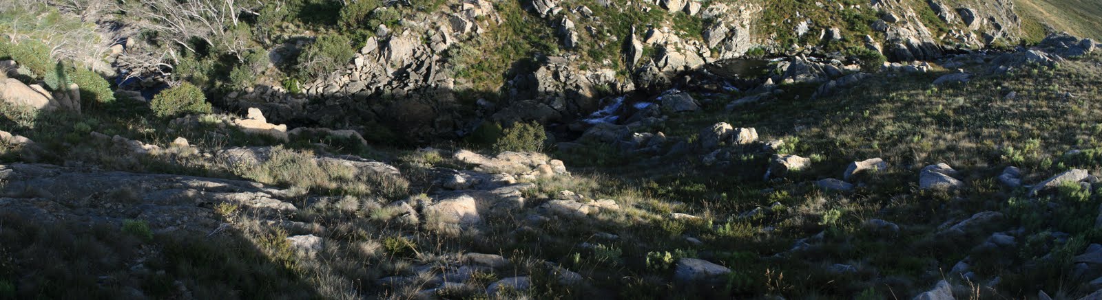
Another lovely sunrise. We were away by 8.10am, heading N along the W edge of the plain to where Hell Hole Creek began its plunge down to the Tooma River. We had some idea of what to expect, as bedtime reading the previous night was an ANUMC trip report in the area led by our acquaintance Tom G. It certainly was a great view - you can get an idea of the scale of the cut by my shadow in the top left of the photo here.
Next, 2.6km in 1hr20mins, heading NE and gaining around 100m as we paralleled Hell Hole Creek to its watershed ridge with Ogilvies Creek and Cool Plain to the N. Relatively slow going and we were drinking plenty. Max surveyed the scene and we decided to head W to Mt Toolong, leaving our gear at a GPS-marked spot.
A more pleasant climb than the previous day, more open, only around 100m over 1.3km in 30mins. A better reward, too, with all round views from the open top. The trig point was a pile of rocks and tin vanes on the ground, but a little spot to its SW provided lovely views to the Dargals, the Main Range distant in the S and Mt Jagungal to the SE.
Back down, we collected our gear and walked 2km to the NE to join the Round Mountain Fire Trail. Round Mountain looked tantalisingly close for my poor foot, but it was still a 5.5km tromp back to the car.
14km and 250m climb in 5hrs35mins.
Day 3 photos
 |
 |
 |
| Camp site near Hell Hole Creek | 7 Looking down onto Hell Hole Creek cascades | Looking down onto Hell Hole Creek cascades |
 |
 |
 |
| 8 Big Dargal Mountain and Mt Dargal from Mt Toolong | Tops to the S from near the Mt Toolong trig point | 9 Mt Toolong trig point |
This was a wonderful trip. The variety of country and scenery was great.
Thoughts:
Thanks Max, an excellent trip with many lessons for me. Thanks Kaz.
Distance: 53.5km Climb: 1500m. Time: 3 days
Grading: L/M-R: H(13)
KMZ file for Google Earth/Maps: The Dargals
Back to Walks Index
This page last updated 12Aug22