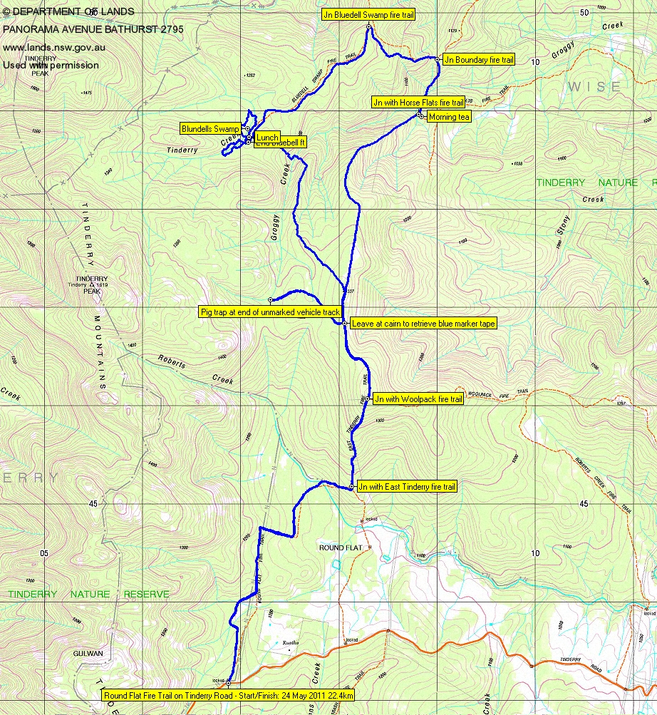


24 May 2011 East Tinderry Cattle Duffing Site
Map: Tinderry 1:25000
Getting There
This walk was organised and led by me as an irregular CBC Tuesday walk:
Tuesday 24 May - Tinderry Range cattle duffing site - L/E-M,ptX. Visit a reputed cattle duffing site in the Tinderry Ranges. All on Round Flat, East Tinderry, Boundary and Bluedell Swamp fire trails. Around 22km and 900m climb. Map: Tinderry. Leader: John Evans - jevans@pcug.org.au, (h) 6288 7235. Transport: ~$10 per person.
5 of us met and drove in Mark's truck through Michelago and up the Tinderry Road to the Round Flat Fire Trail.
Further Information
Thanks to sleuthing by Rob and Jenny H, David R (owner of the 'Michelago' property), tells me that cattle were stolen, driven to and yarded at Blundells Swamp on Tinderry Creek, slaughtered, salted and sold back to the locals! There is evidence of this still at the site (a clearing visible via Google Earth).
Photographs
You can also access all photographs here.
Walk
| Track maps: thumbnails are active - click for a larger picture | |||
|
|
|
|
| Track overview | Track 1 | Track 2 | Track 3 |
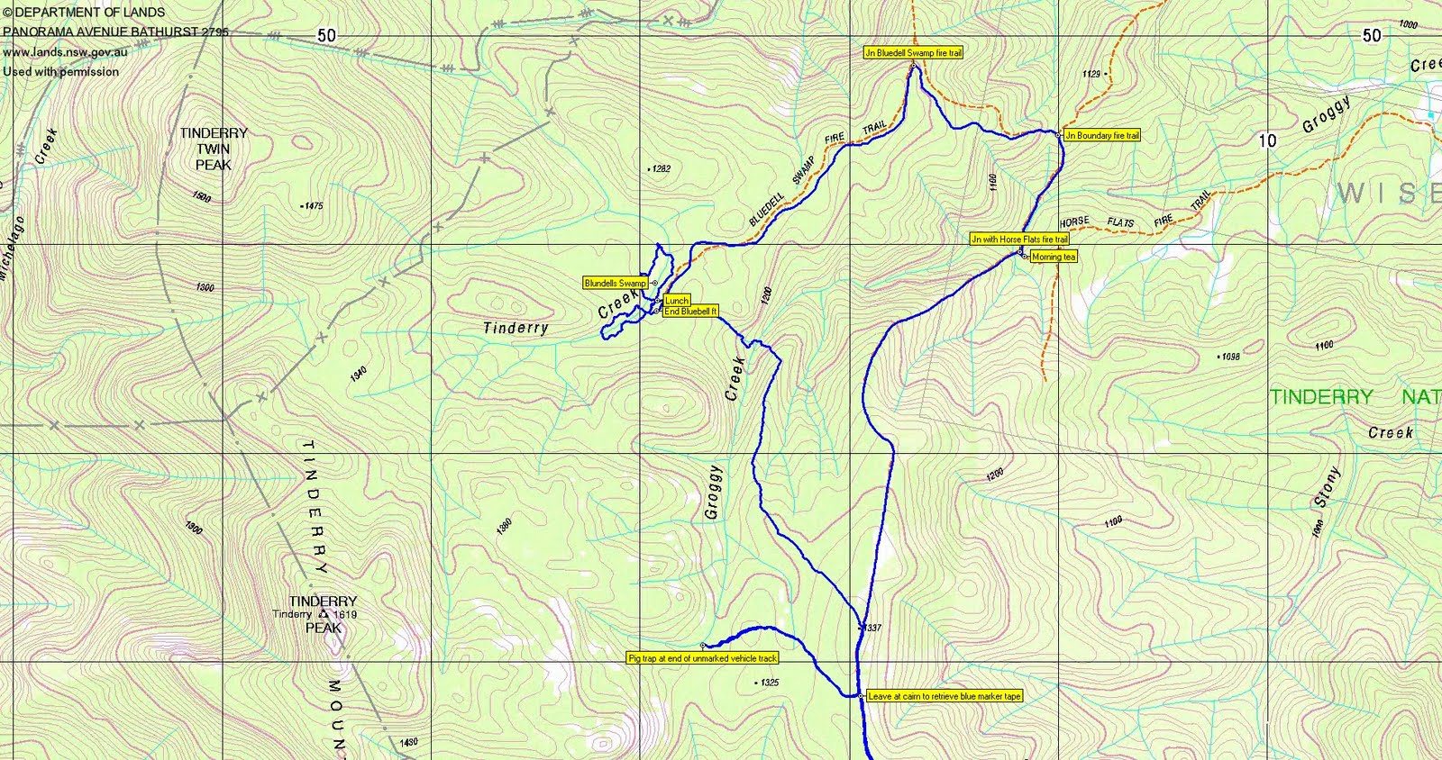
My 500th walk. Away at 8.30am on an overcast day with the occasional threat of a misty shower. 1hr and 10mins for a brisk 5km into the cairn marking the track down off the East Tinderry Fire Trail that we taped last Tuesday. We wandered down and retrieved the tapes. Back up at the cairn on the ridge, we covered a further 6km in 1hr 25mins in to the end of the Blubell Swamp Fire Trail. Linda was on her first Tuesday walk, so we stopped for morning tea. All easy walking on damp fire trail - quite pleasant to wander along chatting with little thought to navigation. Once past the first km or so of fire damaged area, this part of the Tinderrys offers most inviting walking through relatively open forest.
We past some nice stacks of granite boulders as we neared Bluebell Swamp (I presume this is its name, as it's at the end of the Bluebell - not Bluedell as on the 2nd edn Tinderry 1:25000 topo map - Swamp Fire Trail. My original contact called it Blundells Swamp).
The Swamp is a lovely creek flats area, with Tinderry Creek flowing swiftly along the SE edge. We first crossed to the NW side of the swamp and did an anti-clockwise loop up Tinderry Creek and back around down the SE side, across at the NE end of the swamp, back up the other side and across again. I think I'm the only duffer - we saw nothing (but an old billy and some new rubbish). Lunch.
Looking for a route back to enjoy a bit of the bush - now dry and more blue sky than cloud - we set off a little S of E across Groggy Creek, then found a nice ridge which took us parallel up along the creek, then SE up to the fire trail at SH1337. Very pleasant.
Bashed back along the fire trail (5.4km in 1hr 5mins) as the sky closed in a bit.
(Some of these fire trail timings might be useful to gauge whether the 55km in 24hr proposed walk is at all feasible.)
Thanks Mark B, Linda G, Max S and Phillip S for your company.
Distance: 22.4km Climb: 800m. Time: 8.30am - 3.00pm (6hrs 30mins), with 40mins of breaks.
Grading: L/E-M,ptX; H(13)
KMZ file for Google Earth/Maps: East Tinderry Cattle Duffing Site
Back to Walks Index
This page last updated 26Aug22