


21 July 2011 Border Markers around Queanbeyan
Maps: Canberra and Bungendore 1:25000
Getting There
This walk was organised and led by me as a private walk:
Thursday 21 July - Border Markers around Queanbeyan - S/E,X. In company with a local official, visit some border markers in Queanbeyan. Around 7km and 50m climb. Maps: Canberra and Bungendore.
2 of us drove to the Queanbeyan railway station, where we met a rail line official from Goulburn.
Photographs
You can also access all photographs here.
Walk
| Track maps: thumbnails are active - click for a larger picture | |||
|
|
|
|
| Track overview | Tracks 1 and 2 | Track 3 | Track 4 |
This was a rare opportunity to sus out a bit of the ACT border around Queanbeyan with company from a local official and, for the area around the Queanbeyan rail station, a rail line official from Goulburn. We began our tour of the area with a safety briefing and a bright fluoro vest to wear.
Not a successful hunt for border markers, as the area has been well used and disturbed over the last nearly 100 years. From the station, we wandered W. Did not find P14 or Q14. S14 and T14 were down near Railway Street, with an intervening industrial site between us walking along the railway easement and them, so we did not actually visit the sites (doubt whether they'd be evident). Forgot to look for the 49 Mile marker. U14 not found, it's location withing a metre of the curbing on Railway Street. V14, V14#2, W14, W14#2 not found. W14a and W14b were not found, as they were located on the Canberra railway line, which would not have existed when the original survey was done. X14 and X14a were not found, as the border headed up onto the steep area between the Canberra and Bombala railway lines.
We turned about and walked back towards the station. The XPT came through from Canberra. No O14 found. As we were on the platform, the historic steam trail making a run from Canberra pulled in.
We left our rail host, with thanks, and drove to the McEwan Ave road bridge over the rail line. No N14 (positioned in the middle of the road), L14 or K14. We got to within 9m of K14, separated from it by a high fence. The border corner could well be in the middle of a large concrete reservoir!
After a quick lunch back in town, we drove to the border where it crosses Yass Road. No G14 - the location right at the border signage, no F14 (a nearby old blaze on a tree with a nail in it, but the wrong direction for the F14 blaze), no E14.
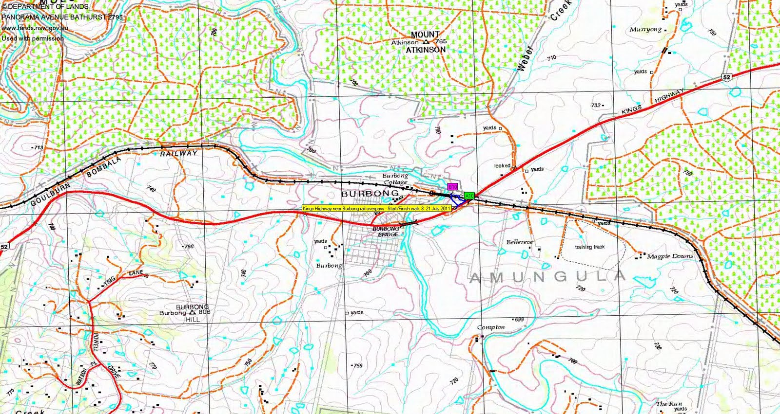
Next, we drove out the Kings Highway to the road crossing the railway line just E of the Burbong Bridge over the Molonglo River. At last, found border marker A10 under a pine tree. No B10.
My local official was interested in the rail tunnels, so we drove to the Brooks Hill Reserve and walked S to meet the railway line at the tunnel. A lovely structure of many thousands of bricks. On our return we visited the E7 blaze, found a geocache at E7 (my first geocache - I could take this up when I've visited all the border markers!) and the D7 blaze.
Thanks Paul and Geoff.
Distance: 6.9km Climb: 50m. Time: 11am - 3.15pm, with heaps of outages for talking, driving and lunch.
Grading: S/E,X; E(4)
KMZ file for Google Earth/Maps: Border Markers around Queanbeyan
Back to Walks Index
This page last updated 28Aug22