6 November 2012 Mt Stromlo Wild West Walks

Panoramic views to the West from the power line bend
Maps: Canberra and Cotter Dam 1:25000
6 November 2012 Mt Stromlo Wild West Walks
Maps: Canberra and Cotter Dam 1:25000
Getting There
This walk was organised and enjoyed by me as a private walk:
Tuesday 6 November - Mt Stromlo Wild West Walks - S/E. Complete suitable walks for the Mt Stromlo observatory brochure.
Further Information
No one to 'ride and stride' the S Clear Range with me, suffering a sore foot from last Saturday and with afternoon showers forecast, a perfect little ditty. We'll road test it on 29 Nov 12 as a CBC evening stroll.
Walk - Photographs
Click here to access all walk photographs.
Walk - Track Maps
Track map: thumbnail is active - click for a larger picture
Track
Walk - Google Earth
Walk - Track Notes
I parked outside the boom gates, which open at 7am and close at 6pm.
Walk ~300m up the road (the side under the surviving mature pine trees is safest), then turn left over a low embankment to join an old fire trail under the power lines.
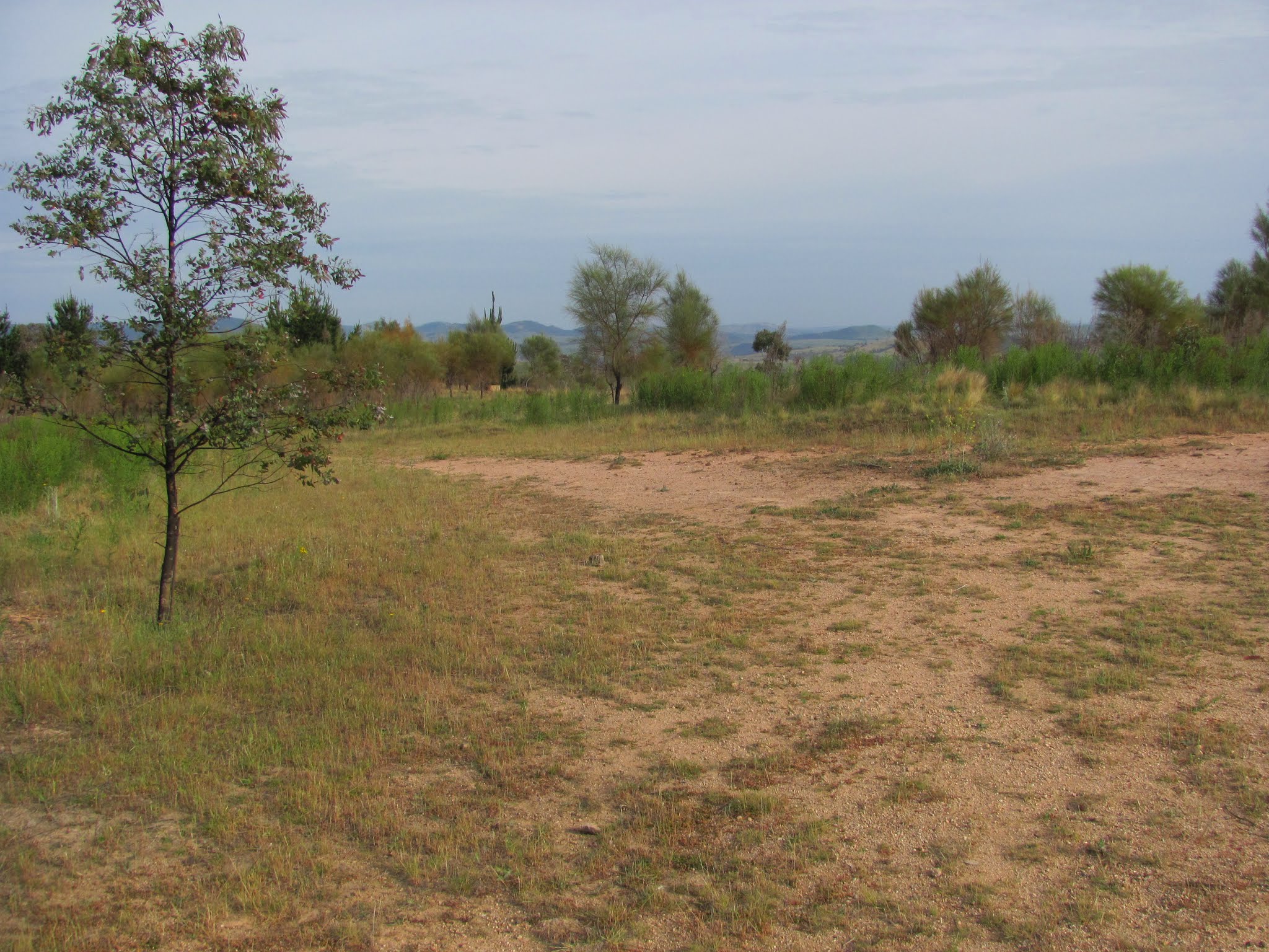
Great views to the West opened up,
with the best vantage point being at the top of the fire trail at the knoll near where the power lines make a right angled turn.
To the South you see the water treatment plant, with the Bullen Range and Tidbinbilla Range out the back; swinging to the right, look for the quadruped trig with black circle vane on top of bare Brown Hill, with the Brindabella Range coming into view at the back; then the new Cotter Dam construction site with the rounded Mt Coree above it to the right; Blue Range and Mt Blundell are to the right of Mt Coree; closer in is Mt McDonald; then you'll see a reach of the Murrumbidgee River running away to the West.
Turn right, still under the power lines and walk onto the bitumen road across the back of the residential Faulkner Court and head towards the grey side wall (with yellow trim) of the Advanced Instrumentation Technology Centre. You'll see the Mechanical Workshop up the rise to your left. Continue across the back of the AITC and head towards the beautifully restored Commonwealth Solar Observatory building. Make sure you check out the signage at various places.
At the end of the Observatory building, head left across the car park to the Directors Residence, a gaunt shell of a residence that would have enjoyed fabulous views on good days, but the occupants would have endured some cold times in the winter winds.
Continue to veer left across the grass over a little crest and beside the car park to the huge 74" telescope building (sadly another burnt out shell). Next comes the Scope cafe - a great place for a coffee or meal and the million dollar view. Opportunities to park here and start the walk too. The end of this road has the 26" Yale Columbia telescope building shell - I remember attending a great wedding celebration in this building.
Turn left and head up the sealed road-let towards the Mt Stromlo trig area with its communications towers.
You may see mountain bike riders here. There is plenty of Stromlo Forest Park signage at the top of their scary track ('Downhill') which plunges down the East side of the hill. The trig is just a couple of metres off the side of the road and provides views NE to Canberra city. Spot the sewerage line!, Black Mountain with its tower, Dairy Farmers Hill in the National Arboretum, nearby the Molonglo River flowing towards you, Lake Burley Griffin and the Canberra CBD with Mt Ainslie at the back, and the development of the Molonglo suburbs.
Pass the 9" Oddie telescope building shell and follow the concrete path towards the side of the Satellite Laser Ranging Facility. Keeping it on your left, swing through the fire trail gate marked V. After ~20 metres, take the right hand fork in the fire trail and head down along it in a North-ish direction, then up to the left turn off to the Duffields' grave.
A beautiful site (and sight), looking towards Mt McDonald and Mt Coree at the back. To the left is the Cotter Dam site and the Brindabella and Tidbinbilla Ranges. To the right of Mt Coree is Blue Ridge and Mt Blundell in the Brindabella National Park.
Return to the main track, turn left and continue through the fire trail gate marked W.
Walk down the fire trail, crossing the 'Western Wedgetail' mountain bike track, towards a complex intersection of mountain bike tracks with their blue signs and fire trails, before the next knoll. Climb through the gate (or use the mountain bike track on the right). At the intersection, take the fire trail which heads to the left of the next knoll, but only for 15 metres.
Turn left again and take the older fire trail down the spur to the West.
This track wends its way down the Western flanks of the Mt Stromlo area, with lovely views to the western hills. Careful you don't slip on the gravel surface. You know you're on the correct track when the Pork Barrel mountain bike track crosses our path, then the Black Snake Gully mountain bike path crosses. Towards the bottom of the descent, a small dam comes into view. We want to turn left onto a minor fire trail, just behind a small tree.
We now head generally South across the flanks of the Mt Stromlo area, although the fire trail has a little up hill kink with an open grassy drainage line on our left, before it passes below the Duffields' grave site area. Our track then levels out and continues South. Another kink, then a gradual descent, gives us view back up the slope to the Mt Stromlo buildings, so we really aren't far from home.
We eventually arrive at a decision point, a fire trail junction.
If time is of the essence, ignore the track down to the right. Instead, continue South for a few metres, then curve up a spur rising 60 metres (which will make you puff for a bit), veering left at a fire trail intersection. There are views, as we climb, to the balcony of the Scope cafe - are your friends waiting there for you? We arrive at a familiar gate, marked V, at the Satellite Laser Ranging Facility.
If additional time is available, or if you parked outside the boom gate, turn down to the right at this junction and walk the fire trail to a T-intersection. Turn left over the little culvert and walk the fire trail to the Space Weather Monitoring Site. Have a look around it if you like.
Follow the bitumen road back to your vehicle.
For members of the public:
1 A general level of fitness is required to complete this walk. The described walk could easily be broken into shorter Northern and Southern components.
1 Note the 7am opening and 6pm closing at the boom gate to the Mt Stromlo area.
2 Wear closed-toed shoes suitable for walking. Be careful and don't slip on gravel fire trails.
3 Particularly in Summer, it can be very hot in the afternoon on the West side of Mt Stromlo. Always wear a hat and sun screen and have water with you.
4 The weather can be changeable. Take a rain jacket if showers are threatening.
5 Mobile phone reception is available on the West side of Mt Stromlo.
6 Have fun! Enjoy the fresh air, the exercise, the fabulous views, the fauna and flora.
Distance: 7.1km Climb: 300m. Time: 7.10 - 8.50am (1hr 40mins) with no stops.
Grading: S/E; E(6)
Back to Walks Index
This page last updated 1Sep22