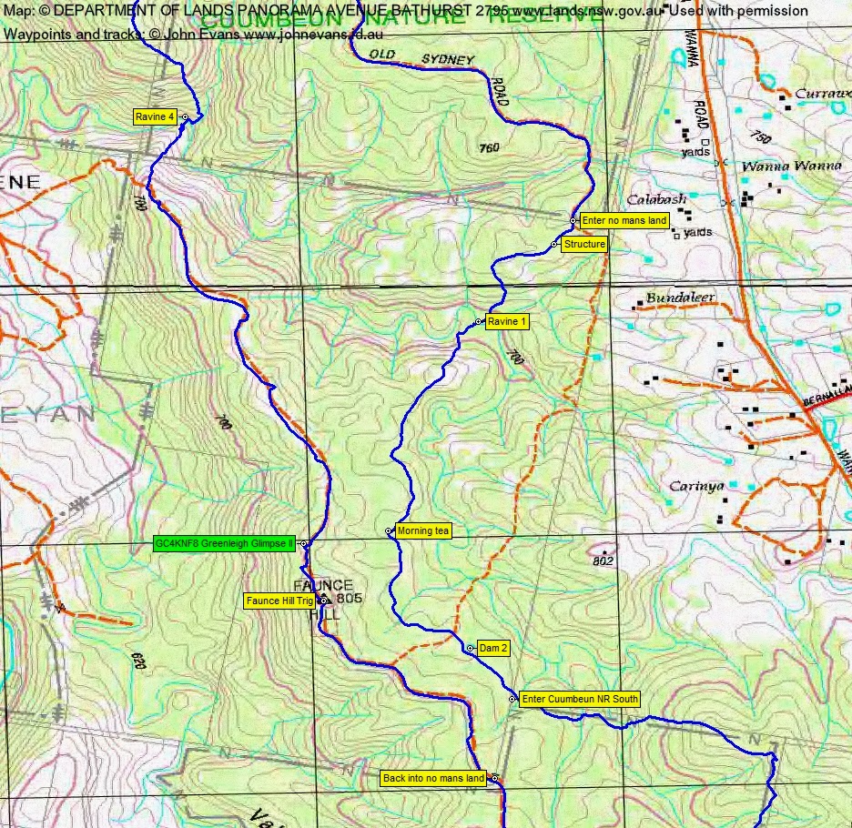
Cuumbeun Nature Reserve – Exit from Ravine 1 | Ravine 2 | Descending to Ravine 3 | Walking Ravine 4 to find an exit
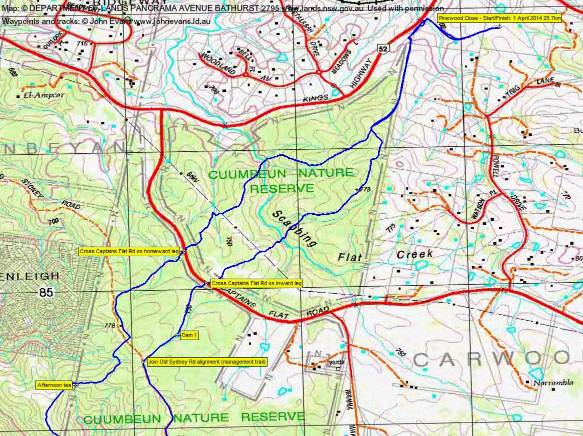
Tuesday 1 April: Cuumbeun Nature Reserve, Four Ravines – L/M-R. We start 10 minutes from Queanbeyan and walk in the northern and southern sections of the Cuumbeun Nature Reserve to a point overlooking Googong Reservoir, before returning via a different route. Where possible we will walk off-track but there are sections of fire trail. The off-track walking is quite fast in open eucalypt woodlands and there is only light scrub, apart from short sections in the ravines. The four ravines are all short but require steep scrambles with some exposure on the exits. This is a long walk so we will need an early start. Minimum Distance: 26 km with approx. 1000 metres of ascent. Maps: Bungendore, Hoskinstown Leader: Ian W. Limit: 8. Transport: Approx. 50 km return.

6 of us drove from Canberra and met just off the Kings Highway on Pinewood Close.
Summary
Distance: 25.7km | Climb: 925m | Time: 7.50am-4.20pm (8hrs 30mins), with 45ins of breaks | Grading: L/M-R; H(14-)
Track Maps
Track overview

Track 1
Track 2
Track 3

Photographs
Photographs are available, where you can start a large sized slide show.
Google Earth
Download the Google Earth .kmz file here.
Track Notes
Always good to go to a new area and this was for me. Light, open timber and no scrub (apart from the creek lines) made it a welcome change from pushing through the relentless Namadgi regrowth. However, the descents to and ascents from Ian’s chosen ‘ravines’ and the overall distance made it a good workout. Some quite spectacular gullies, a mere (long) stone’s throw from Queanbeyan and Googong Dam.
Turning at the southern extent of the walk, we covered ~500m of the Bradleys Creek Walk where I was last Saturday.
There was a little scramble to exit Ravine 2, but the pick of them was Ravine 3. A steep descent and, of course, an equally stiff ascent.
A couple of us got a second wind at Faunce trig. Marmaduke Rothschild (aka Roger E) happened to have some Googong geocaches in his GPSr and there was one close by. It was only just off the side of the management track and was a quick find, so we didn’t hold the party up :-). So a log of GC4KNF8 Greenleigh Glimpse II.
The most dangerous part of the walk was crossing the Captains Flat Road going in and coming home!
Great to walk again with the irrepressible Jacqui R.
PS. Jenny kindly sleuthed an article on recent finds of the Greenhood orchid on Mt Majura. See here.
PPS. Bingo! On 20 Dec 14 my copy of Tim the Yowie Man’s book In the Spirit of Banjo arrived. I was scanning and stopped at p62 Lazarus rising. There was a description of a ‘hut’ that sounded familiar, in an area that we’d walked. TYM’s full column is here. So the structure that we came across on this trip was Lazarus’s Hut!
Party
6 walkers – Roger E, Eric G, Jenny H, Jacqui R, Ian W (leader), me.