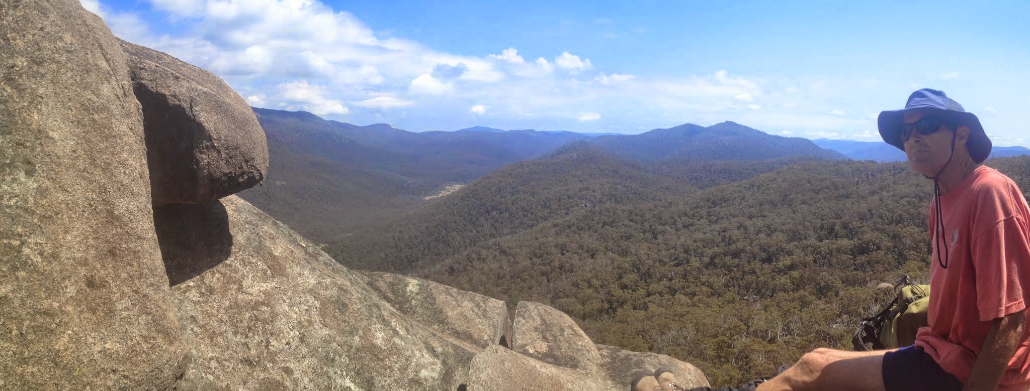
Rendezvous Creek flats from lunch on a knoll
Rendezvous Crags – M/R. A circuit taking in Rendezvous Crags and Orca Rock, on the spur at ∼776E 477N GDA94, exact route to be decided according to the weather. At least 10 km & 400m ascent & descent, mostly off track, some thick scrub, good granite, and at least one good viewpoint. Maps: Rendezvous Creek and possibly Corin Dam. Leader: Peter C. Transport: tba. Limit: 8. Late bookings considered.
9 of us drove in 3 cars to just south of Nursery Creek on the Boboyan Rd. Car shuttle – walkers disembarked, 3 cars to Rendezvous Creek car park, drivers returned in 1.
Summary
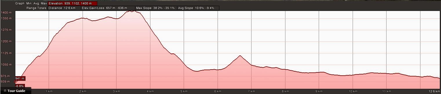
Distance: 12.9km | Climb: 660m | Time: 8.35am-4.05pm (7hrs 30mins), with 1 hr of breaks | Grading: M/R; H(12)
Track Maps
Track overview

Track overview Rendezvous Crags
Track 1

Track 1 Rendezvous Crags
Track 2

Track 2 Rendezvous Crags
Profile
Photographs
Photographs are available, where you can start a large sized slideshow.
gpx File
Download the .gpx file here. (Right click, Save Link As…, Save – if you want to use it.)
kml File
Download the .kml file here.
Track Notes
So good to be back in the bush after all the Cbr100Challenge training!
A scrubby 400+m ascent from the Boboyan Rd to just near the top of SH1362. 2.1km in 2hrs 20mins, including a 20min morning tea. So ∼1kph. Great views down to Glendale Crossing as we climbed in the misty morning.
Our next leg took us down to a saddle, north-west towards Nursery Hill, then south-west through a saddle and up the back of a knoll on the ridge. We chose a difficult line that took us down below our destination, so circled back through very tight scrub to come up the back of the magnificent objective. Climbing to the top, we fitted our 9 member party on the small summit and enjoyed the huge views down to Rendezvous Creek during lunch. The sun had come out and it it was starting to get warm. This leg 1.6km in 1hr 10mins.
Away at 12.40pm for the nearly 400m descent to the creek flats. Peter chose a gully and it gave us a good route down. Slightly easier going. A weed spotting/recording stop – under instruction from the walk organiser “This is a Noble Calling and no signs of impatience should be shown” we did just that. 1.7km in 1hr 15mins.
After that we tootled across to the Rendezvous Creek rock art site and had a look.
Back down on the valley floor we soon picked up the old vehicle track and pounded it back past Rowleys Rendezvous Creek hut site. Lightening and growling thunder threatened from behind the Mavis Ridge. A junction, with freshly mown path heading north-east, took us over to the bench and seats, then down to a bridge over Rendezvous Creek and so back along the Rendezvous Creek Walking Track to the cars. Our return was 7.4km in 2hrs 10mins.
A great walk via an inward leg over country I’d never covered before, to a destination never previously visited by me. So an excellent choice, thanks Peter.
PS. To add further frustration to the already extremely frustrated planner of this walk because she can’t walk with her sore foot, I called our lunch perch ‘Orca Rock’. It’s not. I’ve corrected photo captions and the text, but not the map segments.
Party
9 walkers – Melinda B, Peter C (leader), Roger E, Eric G, David and Meredith H, John J, Trevor L, me.
Next Tuesday Walk
Tuesday 17 February: Black Range section of Tallaganda National Park – L/R/X. The walk starts at the junction of the Forbes Creek road and North Black Range fire trail. The walk is mainly off-track, with moderate scrub. This is an exploratory trip and includes a steep and rocky descent of a tributary of Mulloon Creek. Minimum distance: 18 km with ∼400 metres of ascent Map: Bombay. Leader: Ian W. Limit: 8. Transport: 102 km return.