Murrumbidgee River from opposite Pine Island
Sunday arvo 11 September: Murrumbidgee River stroll – M/E,X. A late stroll on a sunny Sunday arvo near home
Just me.
Summary
Distance: 10.7km | Climb: 120m | Time: 3.50 – 5.55pm (2hrs 5mins) | Grading: M/E,X; E(5)
Photographs
Photographs are available, where you can start a large sized slideshow.
Waypoint and Track Files
Download the .gpx file. (Right click, Save Link As…, Save – if you want to use it.)
To use in Google Earth, do File, Open… and select Gps or All files as the File Type.
Track Notes
I don’t usually post private lone walks, but this one deserves it. I really enjoy the places around my new home in the far south of the ACT and here’s another example of the little gems that a geocache can take you to.
I’ve got a long time walkabout next Sunday, so thought I should put in a wee bit of training. So after church in the morning and a family lunch, the late afternoon sun beckoned me out.
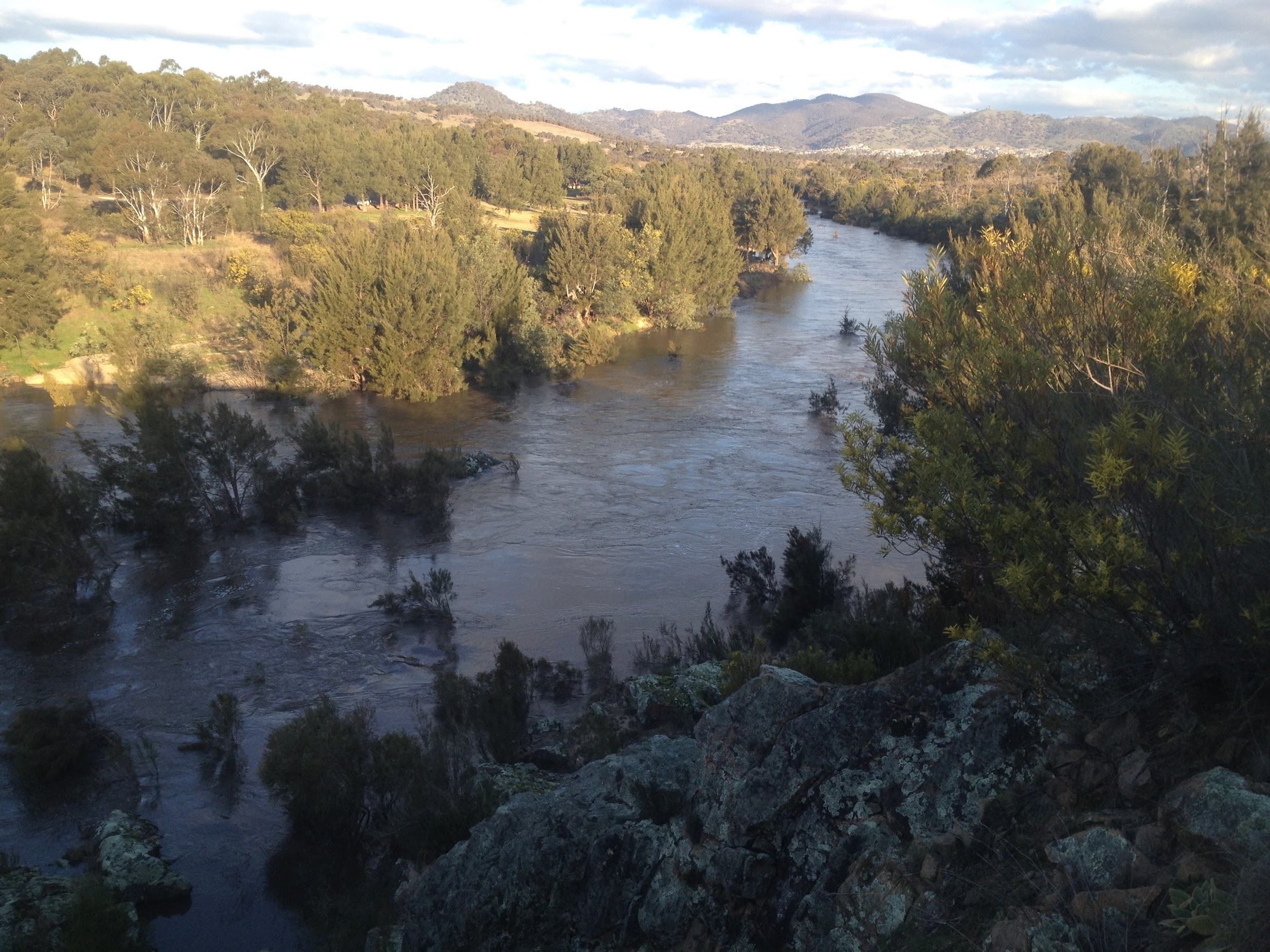
I left from home and followed the creek out our back (via sealed bike path) down to Point Hut Pond. Then down the old road to Point Hut Crossing, where the road was closed. The bridge was dry, so walked across. A wombat on the banks on the Murrumbidgee up from the far side of the crossing. The river was certainly flowing. Up the road a bit I found the gate entry to the west side of the Murrumbidgee River Corridor. Another point of interest is that the track leading down the river from here is on Open Cycle Maps which are viewable via OziExplorer.
Now everyone has been to the Pine Island Reserve, but here I was on the opposite side of the river. I’d hastily gathered a couple of geocaches onto my GPSr before I left but, getting closer, discovered they were on the other side of the river. I’m not a fair dinkum cacher because I left home without a pencil to log any finds, but the geocaching.com default Google map doesn’t show the Murrumbidgee River and that’s my excuse for bringing caches on the other side of the river.
Pleasant walking along the vague vehicle track above the roaring river. Pulled out the old phone and the Geocaching app gave me another cache on my side of the river. Yes, a Tank Engine one – his are always sweetly set up with pencil included.
An extra bonus at GC4KRPR Centrelink Cliffs – a really great view!
About turn and back home.
Track Map

Party
Me.
John Hall
12 September , 2016 8:26 amLovey way to spend a glorious avo John – thanks for sharing!
Johnny Boy
12 September , 2016 12:04 pmSorry, can’t remember who you are ;-). You forgotten how to walk? Cheers to you and Helen