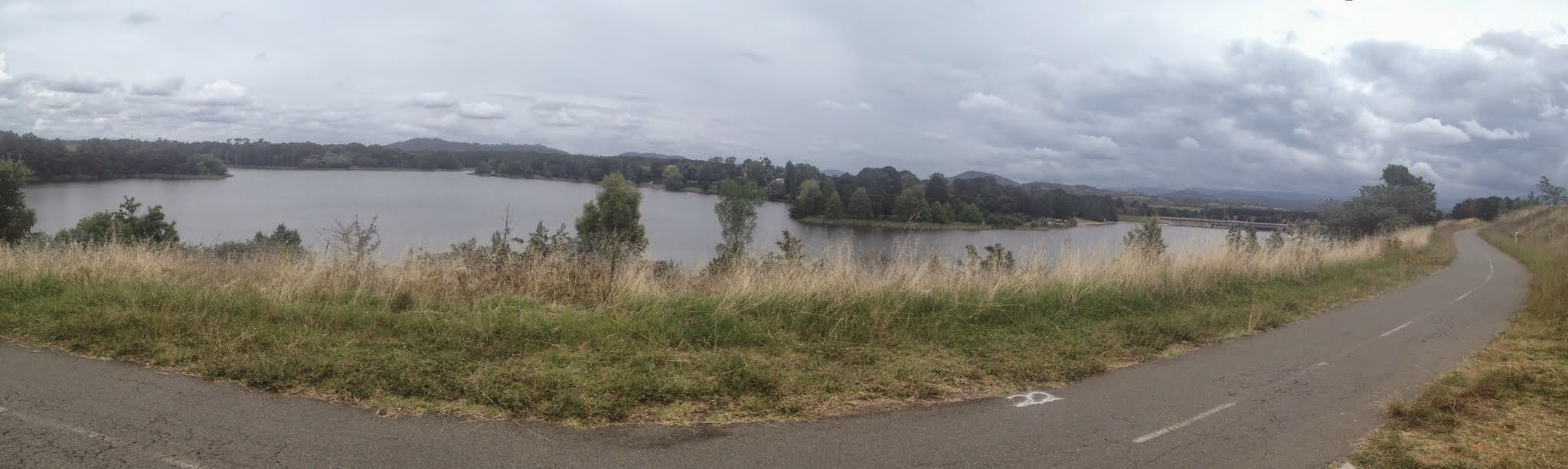
Government House and Lake Burley Griffin
Saturday 14 February: Cbr100Challenge Training – LBG – L/E. Join me for a lap or two of Lake Burley Griffin. Feet hardening for the Cbr100Challenge. As much or as little as you like. We’ll start at 6.30am. Ring me to find out where I am if you want to join later. Around 50km. Map: Canberra. Leader: John Evans 0417 436 877 john@johnevans.id.au . Transport: Drive yourself. Late bookings welcome.
2 of us met in the car park near Westside@ActonPark.
Further Information
The walk description doesn’t look too detailed, so let’s flesh it out:
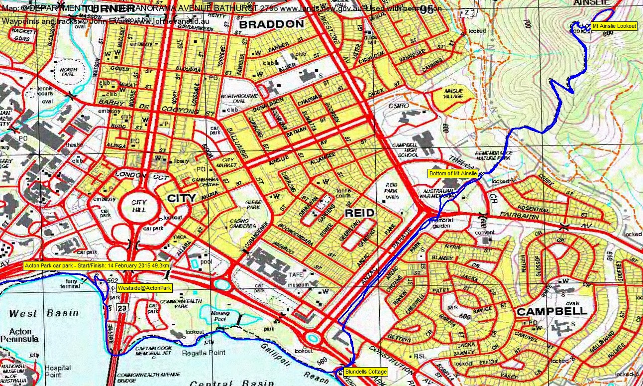
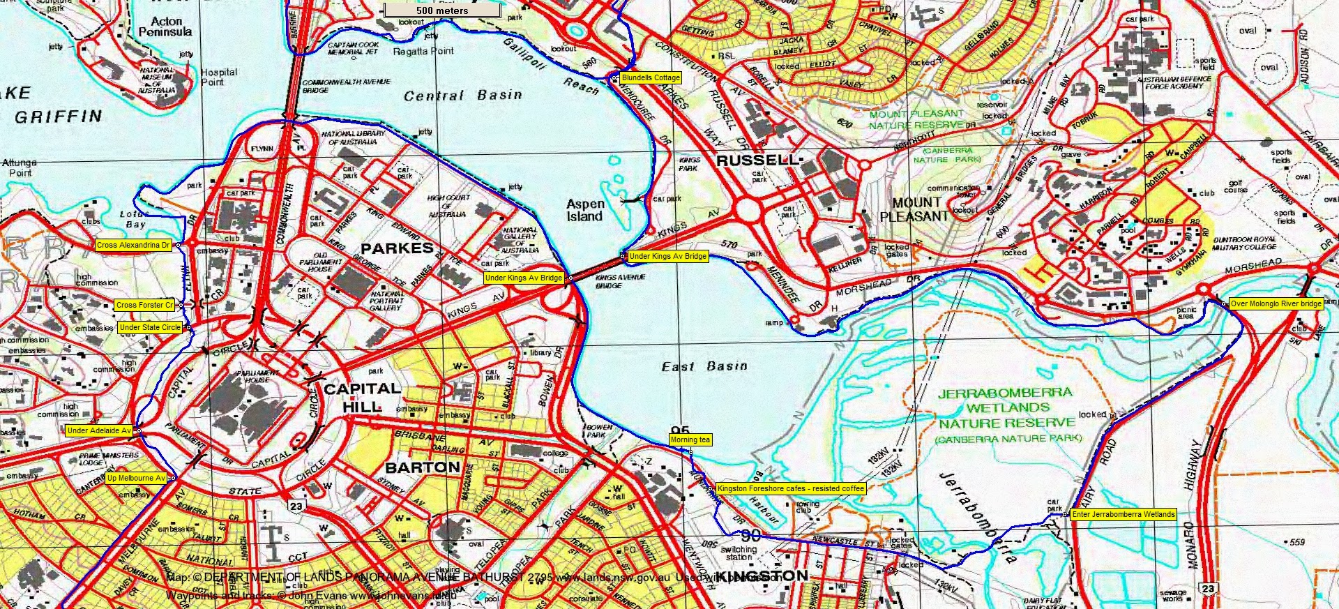
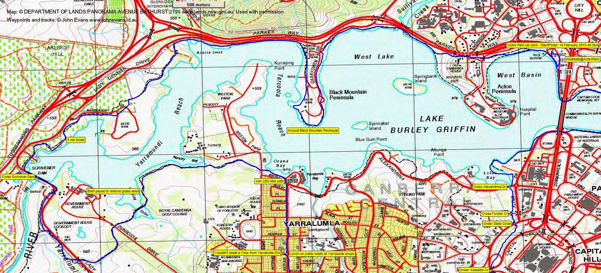
From Westside@ActonPark, follow Cbr100Challenge route to Mt Ainslie-return down Anzac Pde to Blundells Cottage-(opportunity to return to start, making a 12km walk)-clockwise round LBG through Jerrabomberra Wetlands-resist siren call of coffee at Kingston Foreshores-under Kings Av Bridge-under Commonwealth Av Bridge-(opportunity to return to start, making a 21km walk)-now do reverse of last of 100km route for Cbr100Challenge, which is-bike path to Scriveners camp-under Adelaide Ave-up Melbourne Av-to Tardis-southern extent of Red Hill NR-north past Davidson trig-north back to Red Hill-west down to Kent St (leave 100km route)-walk Kent and Novar Sts to edge of LBG-( opportunity to return east to start, making a 40km walk)-clockwise on bike path around western end of LBG including Black Mountain Peninsula and Acton Peninsula and back to start.
Summary
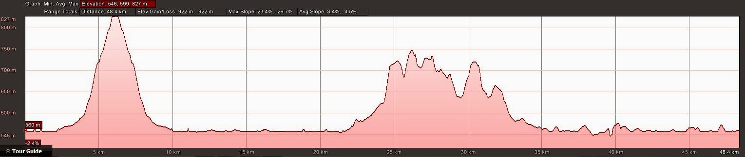
Distance: 49.3km | Climb: 920m | Time: 6.20am-5.00pm (10hrs 40mins), with 20 mins of breaks | Grading: L/E; H(12+)
Track Maps
Track overview

Track 1
Track 2
Track 3

Track 4

Track 5
Profile
Photographs
Photographs are available, where you can start a large sized slideshow.
gpx File
Download the .gpx file here. (Right click, Save Link As…, Save – if you want to use it.)
kml File
Download the .kml file here.
Track Notes
6 starters were booked, but only 2 of us in the end.
It all worked as in the Further Information above.
17.9km in 3hrs 20mins to morning tea, in the little park after we’d resisted the temptation to stop at the Kingston Foreshore (but then I was walking with an elite athlete who is not into that sort of thing). Beady swan eyes were watching us.
After our lap around Red Hill I started thinking of a coke (not being an elite athlete) so, it being after 1pm as we approached the Yarralumla shops, I called in to IGA for a bottle of same, whilst Chris pulled up a public bench on the corner for us. I was graciously permitted to sit next to said elite athlete. Morning tea to lunch was 17.2km in 3hrs 25mins.
Back at it, at the bike path at the end of Novar St, we parted company. Chris turned right and completed ∼40km back to the cars. I turned left. Pleasant walking, with cloud cover keeping the temperature down. But, boy, the bike path is hard on my feet! Without the elite athlete to keep me honest, I sat on a bench to remove grass seeds from my socks and had a 5min break at a convenient viewing point soon after crossing Scrivener Dam.
My next concern was to try to crack the 50km distance. My GPSr measures one distance; when laid out via OziExplorer on digital maps it is less (even before cleaning up the track); and it’s even less in Google Earth. So a lap of Black Mountain Peninsula was required. Closing in on the end, the odometer was showing 50+km. I even went past my car and, with aching feet, did another couple of hundred metres. When I switched it off, it read 51.07km. From lunch to the end was 23.6km in 3hrs 40mins.
A Pepsi from the boat hire kiosk.
But tonight the 51.07km turned into a cleaned up track length of 49.33km and shows as 48.4km on Google Earth.
Thanks Chris for your company and attempting to keep me honest.
Party
2 walkers – Chris F, me.