Split Rock
Saturday 16 April: Split Rock Geocache – L/E&R. Walk the AAWT from Orroral Tracking Station to Cotter Gap, then a scrubby up to Split Rock for geocache GC15298 Rock of Ages. Around 20km and 900m climb. Maps: Rendezvous Creek and Corin Dam. Leader: John Evans 0417 436 877 john@johnevans.id.au . Transport: ∼$12 per person.
10 of us drove in 3 vehicles to the Orroral Tracking Station car park.
Summary
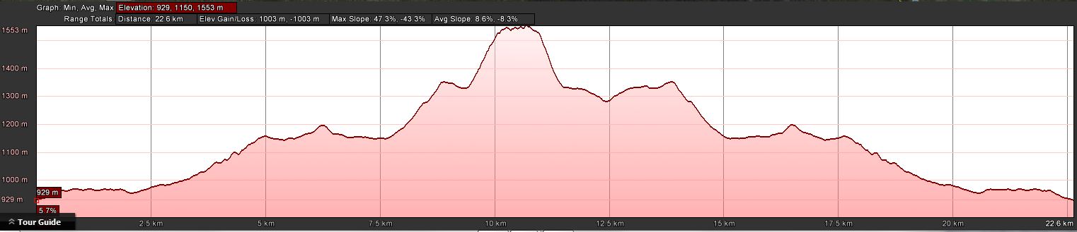
Distance: 23.1km | Climb: 750m | Time: 8.20am-4.15pm (7hrs 55mins), including 40 mins of breaks | Grading: L/E&R; H(12)
Photographs
Photographs are available, where you can start a large sized slideshow.
Videos
Waypoint and Track Files
Download the .gpx file. (Right click, Save Link As…, Save – if you want to use it.)
To use in Google Earth, do File, Open… and select Gps or All files as the File Type.
Track Notes
An overcast day, the sun only briefly appearing. A shower as we walked up to Cotter Gap caused most of us to don raincoats for 10mins.
This is a pleasant enough trip, the Cotter Hut Road a bit boring (5.7km in 1hr 12mins going in). Some of the party logged GC2EZ5Y Vilya on the side of the road and GC1ZK7X 20 Good Reasons opposite where the AAWT footpad leaves the Cotter Hut Road. We covered the 2km to Sawpit Creek in 25mins where we stopped for morning tea. Then the climb up to Cotter Gap plus a bit more, 1.8km in 40mins. The first glimpse of Split Rock for a couple in the party.
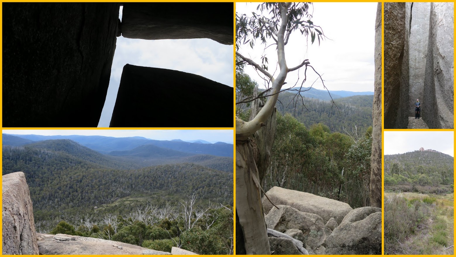
My joy for the day was Roger taking us up the direct approach to Split Rock. Previously I’ve gone a bit further to the east to pick up the crest of the spur and walk up it. The more direct approach was quite manageable as far as the scrub went, with just a bit of skirting boulders at the top. We ambled up at a fairly slow pace, taking 1hr 20mins to cover the 910m across the ground and climb a bit over 200 vertical metres.
4 of the party had not been here before. All of us enjoyed a wander down the split and around the elbow and along the second part of the split. Check out the video.
But there was serious caching business a few tens of metres to the west, so we backed out the split and scrambled to the usual lunch ledge. Here the other cachers made a quick find of GC15298 Rock of Ages and logged me in. Cankid’s 3000th cache. Congratulations to a great new friend! Time for home and social media contacts, then lunch looking out onto the grand view.
Down off the hill in 50mins. Then 4 of us made a dash to the west along the AAWT whilst the remainder of the party headed for home. We found and logged GC5T82H ANZAC’s Tribute. A quick return and we joined the rest of the party just before Cotter Hut Road.
Another two drips of shower as we headed back along Cotter Hut Road.
An excellent day with new and old friends. Thanks all!
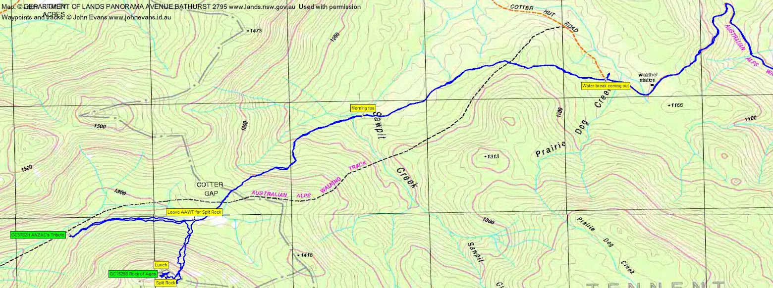
Track Maps
Track overview
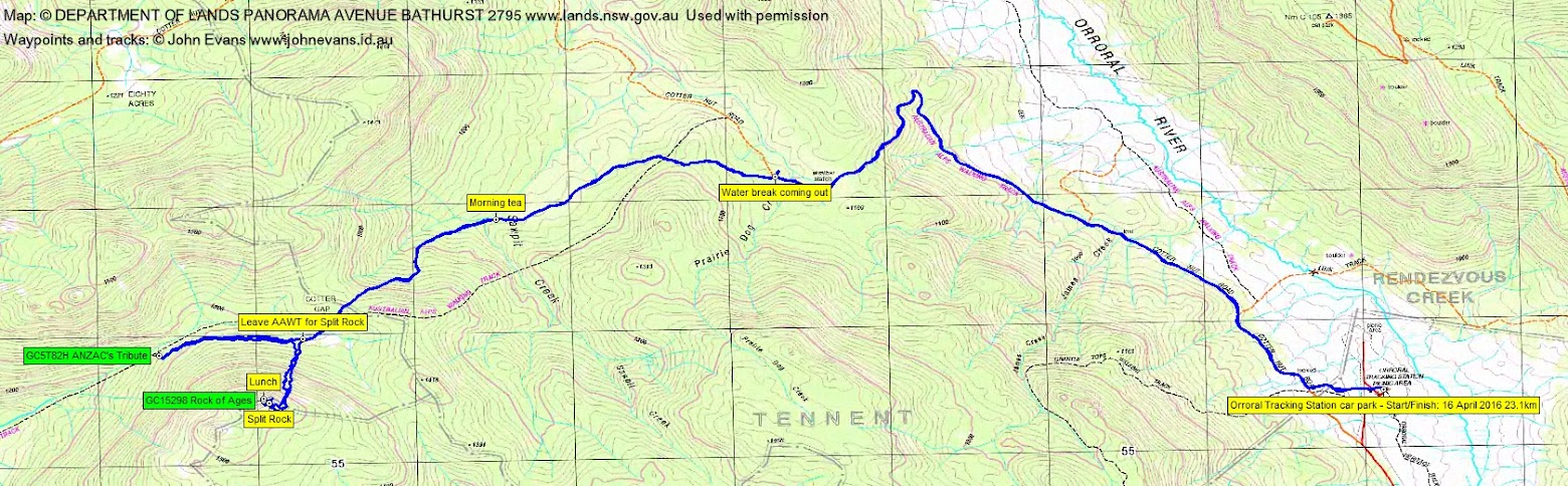
Track 1

Track 2
Profile
Party
10 walkers – Mike B, Cynthia B, Hugh C, Maxine C, Roger E, Martin K, Stephen M, Chris R, Llewellyn S, me.
Next Saturday’s Walk
Saturday 23 April: Washedaway Creek & Little Horseshoe Bend – L/R/W/partly X. From the fire trail junction at ~ 312E 334N (GDA94), south to join the intriguingly rocky Washedaway Creek, follow it downstream to the Shoalhaven River. Down the Shoalhaven, noting a great camp site for future reference, then up the ridge from Little Horseshoe Bend, admiring spectacular views, to rejoin the fire trail near Monitor Mount. Rock scrambling of unknown difficulty in Washedaway Creek, two thigh-deep wades of the Shoalhaven. About 12 km, main descent and ascent 400 m. 1 hr 50 min drive from North Canberra. Map: Touga. Leader: Linda G. Transport: $100 per car. Limit: 8.