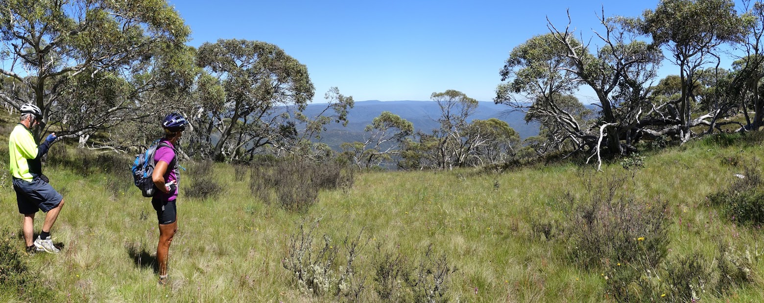
First clear views down to the west
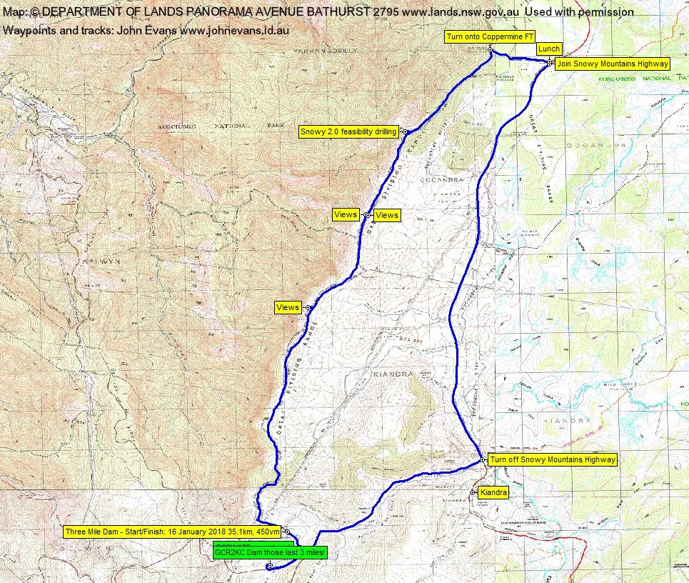
Tuesday 16 January: Wallaces Creek Trail – Mountain bike. From Three Mile Dam near Kiandra we ride along Wallaces Creek Trail for about 17 km in a generally northerly direction, along the crest of the Great Dividing Range, to where it meets the Snowy Mountains Hwy. We will then return to the cars either the way we came or along the Snowy Mountains Hwy. The trail is generally undulating with some views into the Yarrangobilly Valley and Talbingo Reservoir. Around 35 km riding. Participants should have some cycling fitness. I plan to use a trailer to minimize transportation costs with bikes. Map: Rooftop’s Kosciuszko Northern Activities Map. Leader: Mike B. Transport: $152 per car. Limit: 8.
Summary
Distance: 35.1km | Climb: 450m | Time: 10.25am – 2.15pm (3hrs 50mins), including 20 mins of breaks | Grading: L/E; M(8)
Photographs
Photographs are available, where you can start a large sized slideshow.
Waypoint and Track Files
Download the .gpx file. (Right click, Save Link As…, Save – if you want to use it.)
To use in Google Earth, do File, Open… and select Gps or All files as the File Type.
Track Notes
Mike’s trailer was an easy and effective way to transport our 3 bikes – he reckons at least another 2 bikes could have been loaded on. 192km from the Lanyon Valley to Three Mile Dam, taking around 3 hours (including morning tea in Adaminaby). A little chilly when we stopped, but the day turned out perfect … except for the march flies.
We unloaded and were pedalling across the dam’s earth wall by 10,25am. The first knoll had me walking, but I don’t think Victoria pushed all day, she is super fit.
A generally undulating fire trail along the crest of the Great Dividing Range. Easy riding, although my bony (certainly not bonny) butt is not made for a bike seat. Lovely unburnt snowgums and snatches of views down to the west. 6.6km in 50mins gave us the first opportunity to walk just off the trail for fine views, particularly west down the Yarrangobilly arm of Talbingo Reservoir.
Another walk and push for me up the flanks of Shaw Hill, then down, up, down to our second stop for views. Some interesting rock intrusions on the east side of the trail here.
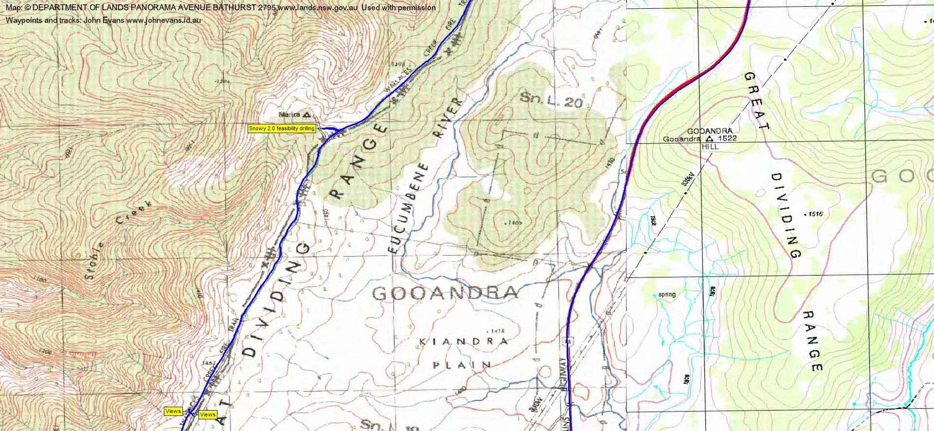
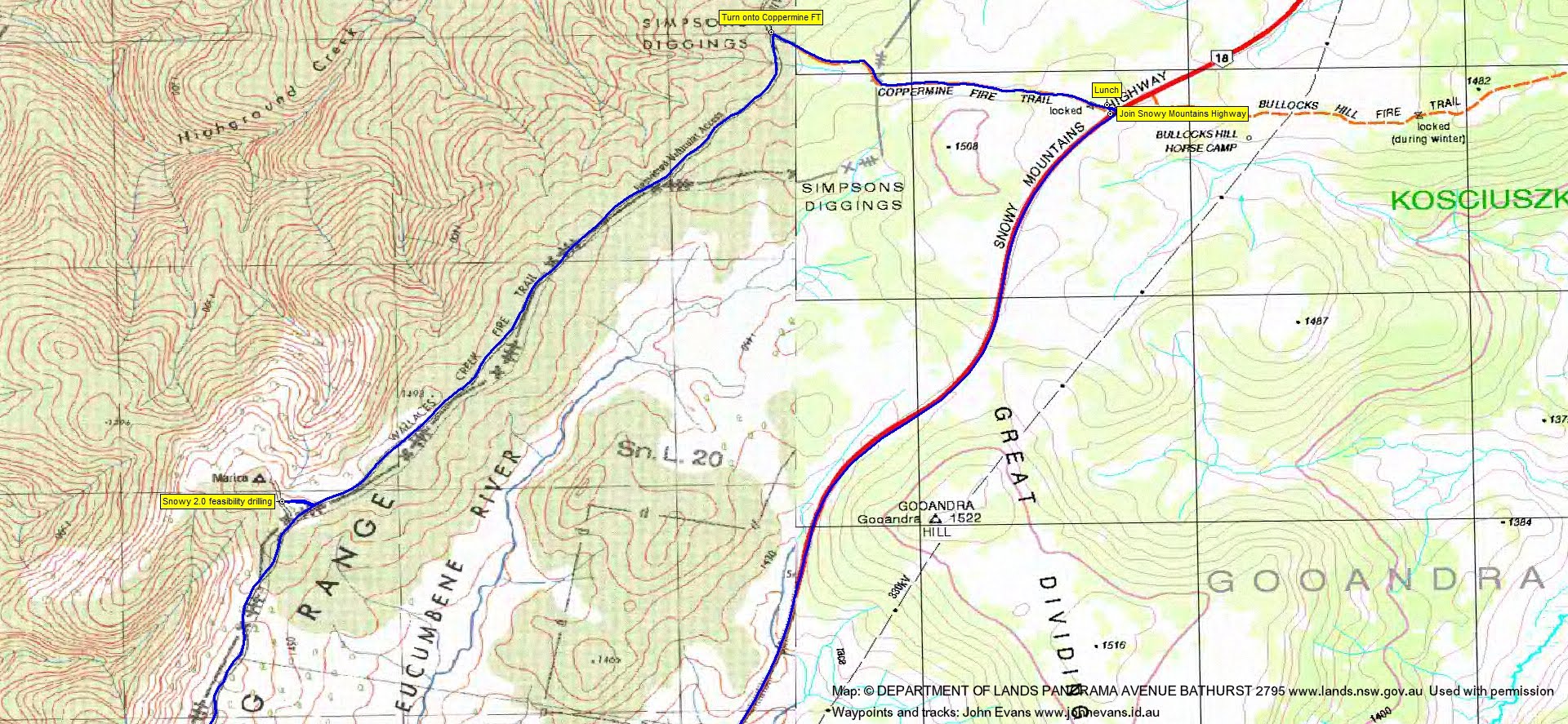
We were looking to visit Marica trig, but instead found Snowy Hydro 2.0 feasibility study drilling going on. We had a chat to one of the guys, who asked that we did not go through to the trig.
Back on the fire trail, it was now in improved nick, with lots of little 2.0 drilling site off-shoots. A fast leg to the intersection with Coppermine Fire Trail, where we came upon 2 feral horses and a foal. East to the intersection with the Snowy Mountains Highway and 20minutes for lunch.
We returned along the Highway, 30mins for the 11km ride to the Link Rd turnoff. More horses, one mob in the middle of the road. Several cars coming towards us, but not one overtook us. Along the Link Rd beside Bullocks Head Creek and a puff up the hill to Mt Selwyn.
Here we split, to mutual benefit. Mike and Victoria enjoyed a circumnavigation of Three Mile Dam and I nabbed geocaches GCR2KC Dam those last 3 miles! (aptly named) and GC3W165 snowbreak.
The long drive back to Canberra, home by 5.15pm.
An excellent day, thanks for organising it Mike.
Track Maps
Track overview


Party
3 riders – Mike B (leader), VT, me.