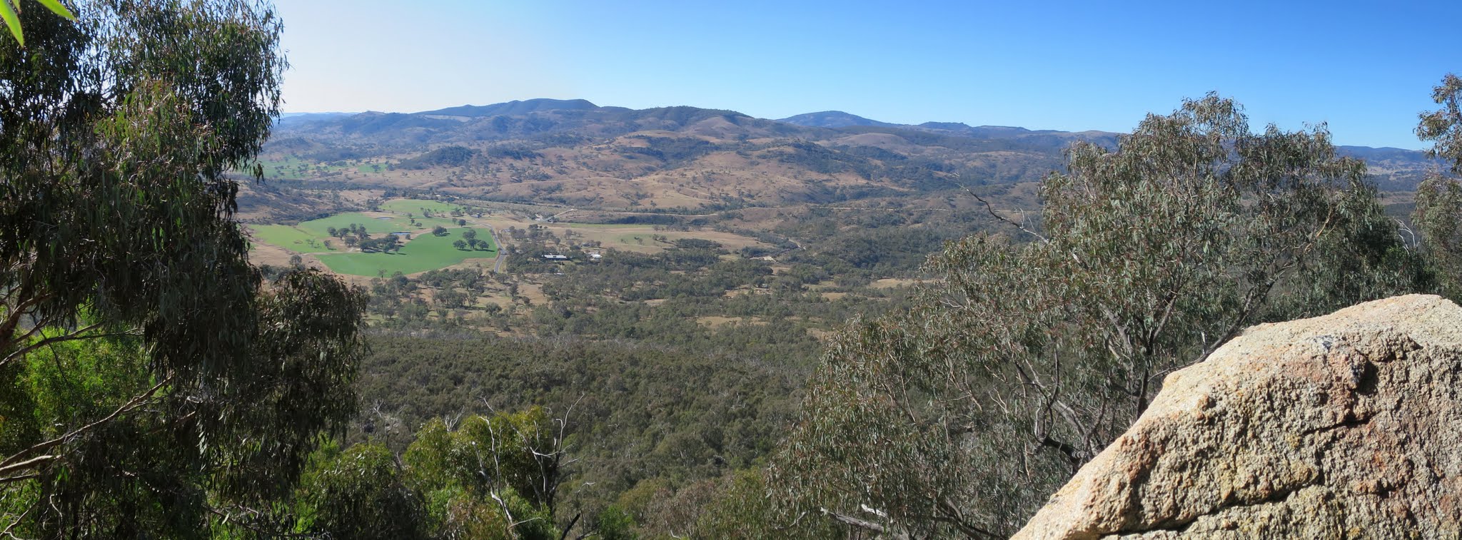
View down from the flank of Mt Tennent at 900m
Tuesday 17 May: Mt Tennent geocaching – M/R. Some impromptu caching on the side of Mt Tennent. Leader: Roger E.
2 of us drove and parked on the side of the Naas Rd near the AAWT.
Summary
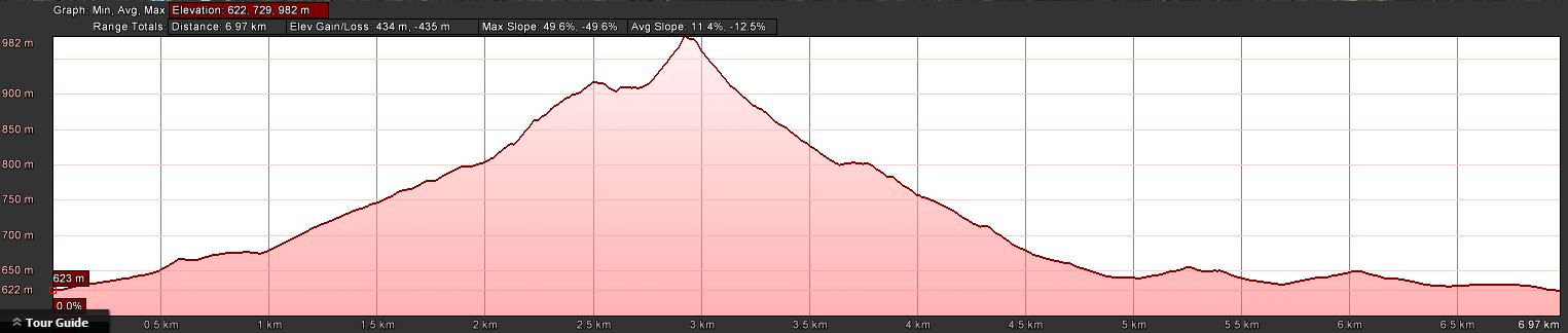
Distance: 7.0km | Climb: 435m | Time: 11.20am-3.00pm (3hrs 40mins), including 15 mins of breaks | Grading: M/R; M(10)
Photographs
Photographs are available, where you can start a large sized slideshow.
Waypoint and Track Files
Download the .gpx file. (Right click, Save Link As…, Save – if you want to use it.)
To use in Google Earth, do File, Open… and select Gps or All files as the File Type.
Track Notes
Roger arranged some impromptu caching on Mt Tennent with a late start. As I am an elderly retired gentleman (well, at least one of those is true) I was able to join him in lieu of the usual Tuesday walk.
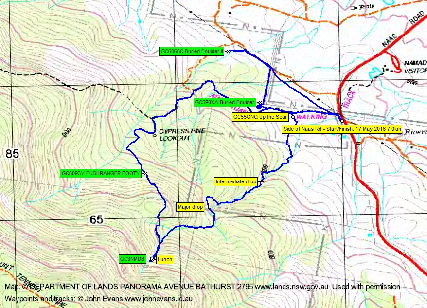
Not the usual way up Mt Tennent. We parked on the side of Naas Rd rather than the Namadgi Visitors centre and that saved us a few hundred metres of walking and a few minutes. Up the AAWT for a while, then 230m through scrubby going to find and log GC6093Y BUSHRANGER BOOTY.
From this point it was only 670 crow metres to the major cache of the day. But that was easier said than done and we huffed and puffed through Bursaria and Cassinia across to join the Mt Tennent scar at the 900m contour. Then it was easy going up another nearly 100 vertical metres to find and log GC3NMDB Tennent Trauma. A quick lunch was called, Roger eating fruit for two and me meat for two.
A return down the scar, the bottom bit taking quite a while. We went true left through the scrub around and down the major drop. A look up from the bottom revealed that one could probably scramble down the true left side of the drop. Again, true left through the scrub around and down the intermediate drop. A subsequent read of the cache description revealed that the true right side of this drop is to be preferred.
Down near the AAWT we picked up the clue for the multi GC55GNQ Up the Scar. But we certainly weren’t going back up today.
We wandered back up the AAWT a bit, then into the fencing corner to search for, find (thanks to Roger) and log GC5P0XA Buried Boulder.
Next, north up the fence to the gate, along the power line track for a bit, then up another creek without a paddle to find (thanks to Roger) and log GC6066C Buried Boulder II.
It was a B-line return to the car.
Thanks Rog.
Track Map
Track
Profile
Party
2 walkers – Roger E (Marmaduke Rothschild) (leader), me (JohnnyBoyACT).