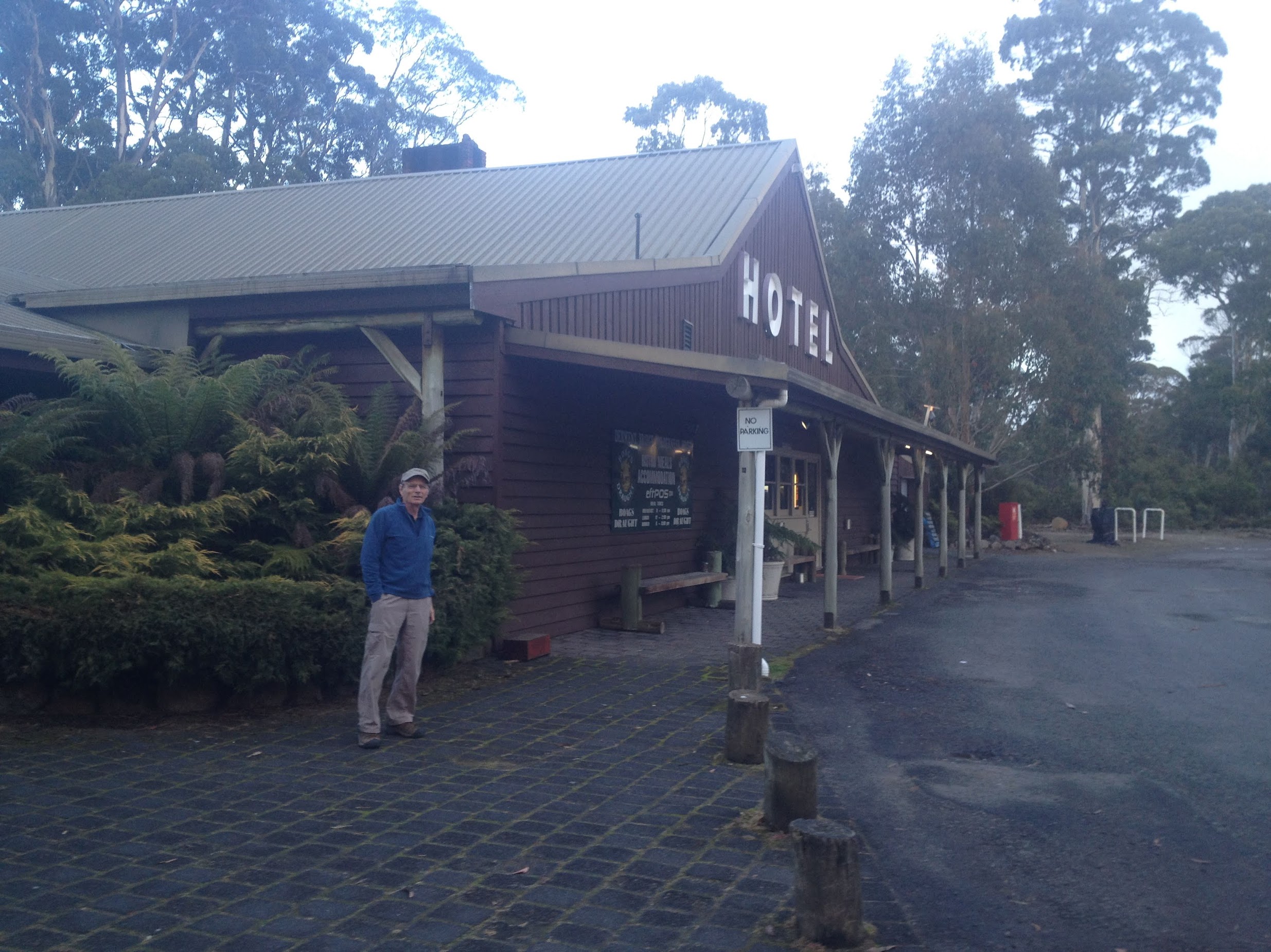
19 April 2015 4.55pm Max at Derwent Bridge Hotel
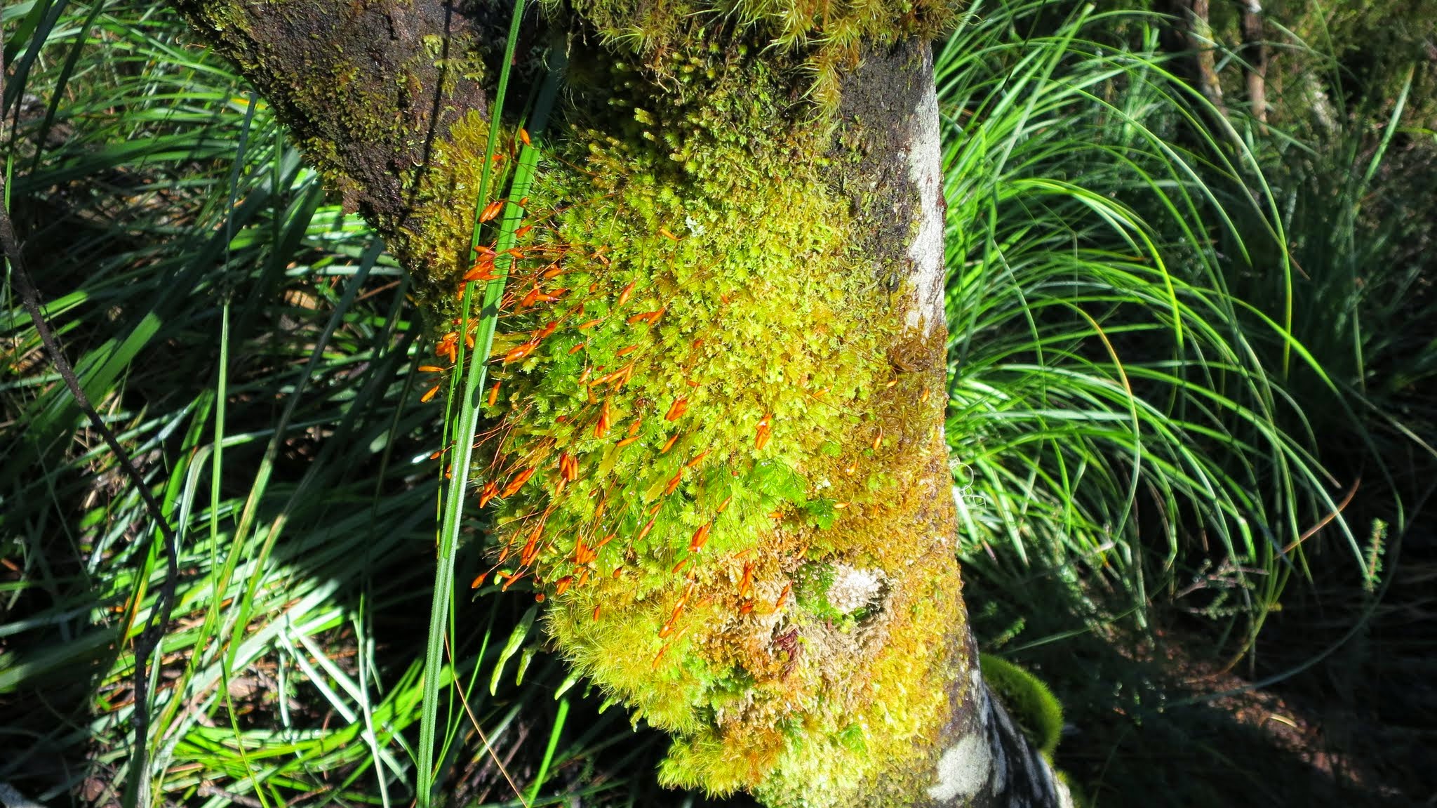
20 April 2015 10.07am Fabulous track side growth | Lodden River to N junction Philps Lead
20 April 2015 Philps Peak above Lake Vera
21 April 2015 9.30am Johnny Boy at Barron Pass

21 April 2015 2.12pm Frenchmans Cap – location, location, location
22 April 2015 Morning light on Frenchmans Cap
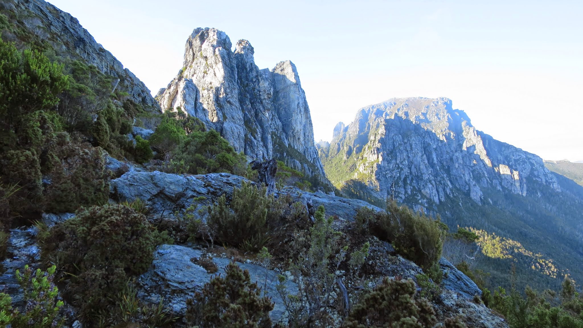
22 April 2015 9.41am Majestic sentinels of Barron Pass – Sharlands Peak and White Needle | Tahune Hut to Barron Pass

22 April 2015 4.16pm Philps Peak above Vera Hut
22 April 2015 We survived and enjoyed immensely. Thanks Max and Brian!

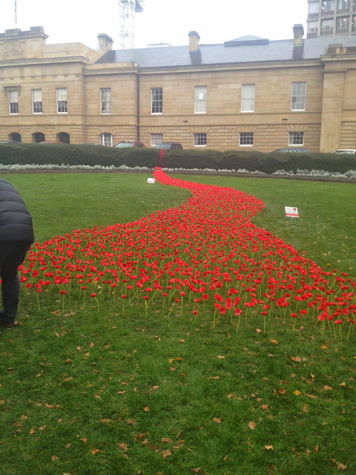
24 April 2105 River of poppies, Parliament Lawns | Hobart
Sunday 19 – Friday 24 April: Frenchmans Cap, Tasmania – L/M-R . Walk the Frenchmans Cap Track in Tasmania, organised and led by Max S.
3 of us flew to Hobart.
Summary
Distance: 46.6km | Climb: 2965m | Time: 4 days | Grading: L/M-R; H(12)
Preparation
Information and Pass: There is information on the walk at http://www.parks.tas.gov.au/?base=2255 . Purchase a National Parks pass online at https://passes.parks.tas.gov.au/ for $30.00.
Maps: Order the 1:50,000 Frenchmans Cap Map and Notes from TASMAP online at https://www.tasmap.tas.gov.au/do/product/WKFRENCH for $11.95 + $5.00 postage. Purchase the Lodden 4032 digital map from https://www.tasmap.tas.gov.au/do/product/25000DIG/4032DIG for $2.00 and Vera 4031 digital map from https://www.tasmap.tas.gov.au/do/product/25000DIG/4031DIG for $2.00.
Dangerous goods: Can’t take gas canisters or methylated spirits on aircraft; purchase in Hobart and leave behind before flying out; pocket knife must be in booked-through luggage; batteries should be in carry-on luggage (so maybe put PLB, GPSr, head torch, mobile phone, spare batteries, etc in carry-on luggage).
Food quarantine: See here. Can bring dried nuts; freeze dried camping food; processed foods including dried, cooked and canned fruit and vegetables; meat for human/personal consumption including salami, hams; cheese, milk and other dairy products; honey; noodles, pasta, rice, bread, cereals and sauces; tea, coffee and biscuits. Can’t bring fresh fruit. I enquired – can’t bring in semi sun-dried tomatoes.
Day 0 – Sunday 19 April: Travel to Tasmania
Photographs
Photographs are available, where you can start a large sized slide show.
Notes
Many thanks to my good friend Graham H for being our chauffeur (and for Wendy for offering his services!). I picked him up in my SUV and we drove to Brian’s, then to Max’s, and got ourselves and all our gear to the airport. Less cost (except for Graham’s sleep) than leaving the car at the airport or getting a taxi.
Don’t forget – batteries in carry-on luggage, matches/lighter in pocket, pocket knife in booked luggage, no gas or metho.
Flights to Sydney, then Hobart, where Max had organised a hire car. An excellent car agent revealed Max’s birthday!
We called in at Anaconda at Cambridge to buy gas and metho (can’t carry them on aircraft) then, with a little poor navigation by me, got ourselves heading through New Norfolk (a stop for lunch in a cafe) and along the Lyell Highway. The country side was looking dry, but lovely autumn colours as we drove beside the Derwent River.
We arrived at the Derwent Bridge Hotel and, wanting breakfast at 7am so as to get an early start, upgraded our accommodation from backpackers to hotel room! That allowed us to have a breakfast tray, as service was not available till 8am the next morning. A captive clientele, with a schooner of Cascade draught $8 and bangers and mash for dinner $28, but certainly no complaints. Very nice! A HUGE fire place and friendly service set the tone for our Tasmanian adventure. It sleeted a little, but the weather forecast was good.
Day 1 – Monday 20 April: Lyell Highway to Vera Hut
Maps
Track overview

Track 1
Track 2
Track 3

Track 4
Photographs
Photographs are available, where you can start a large sized slide show.
Track Notes
See the photos for the best track narrative – I can’t describe it any better than it looks!
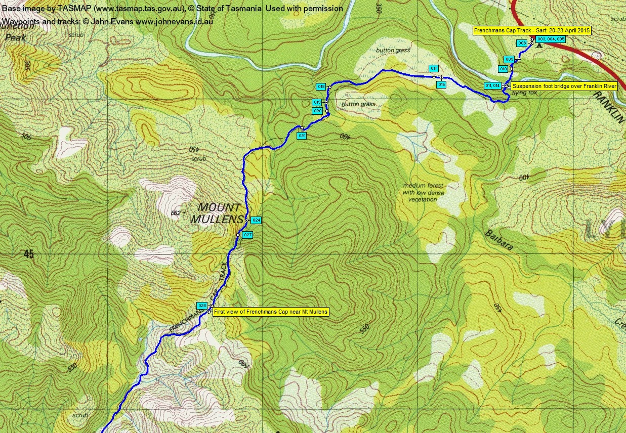
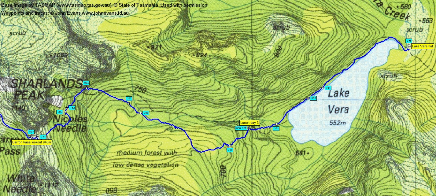
On the road just after 7am, driving west for 30mins to the track head. Snow on nearby hills. Parked the car at the track-head beside the Lyell Highway, got ourselves sorted and had a squiz at the signage in the nearby (bus?) shelter. (See photos numbered in the caption # 003, 004, 005).
Walking at 7.40am (008). I was certainly a little apprehensive and a lot excited. Cool as we started (I think I had on 4 light layers), a cloudy morning with sunny patches. Weather forecast excellent (as opposed to the fierce winds Canberra experienced and the flooding further north in NSW). In fact, we were very blessed/fortunate/lucky with the weather as it’s usually not mainly sunny, mild and without rain for 4 days in this part of Tasmania.
We signed in at the log book, the first party for the day. Within a couple of minutes we came to the boot scrubbing station (to prevent the spread of Phytophthora (Root Rot)) (009). Then down the steps (010) to cross the Franklin River via the suspension bridge (011, 014).
Some old boardwalk across button grass plains followed (016, 017), then a lovely period of typical damp Tasmanian forest (018, 019, 020). The track then began the long climb across the eastern flank of Mt Mullens (021, 024, 027). A bit of huff and puff with a full bag, but nothing like the rugged climbs to come!
The walk’s 1:50000 map has a “Mt Mullens lookout” so I strained to see the view of a distant Frenchmans Cap as we crested the rise. Lots of cloud (028) so lots of imagination required, but it did make the knees tremble.
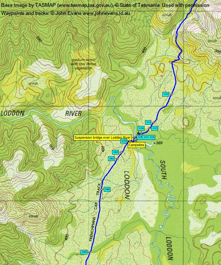
The Franklin Hills crossed, the route continued south-west across button grass (030) and other damp areas (031, 033, 034) of worn down track and newer boardwalk to the suspension bridge over the Lodden River (035, 037). A large sign pointed left to our destination (038).
After clearing the riverside damp area (039) the track traversed the Loddon Plains (040, 042, 044, 045). Some new boardwalk. 10.35am saw us at the northern end of the now-closed Philps Lead track across the ‘sodden Loddens’ (046). Thanks to a large $ contribution from Dick Smith, the new Laughton’s Lead track takes a route higher and to the west. A small patch of forest (047), then new track through scrub (048, 049) led us to a bridge over a creek where we replenished our water (055, 056).
The track continues generally south-west across the flanks of a hill system. Well-made new track with a drain on the uphill side and the walking surface hardened with the dug up substrate (057). Morning tea called loudly at around 11.15am (058). Here Karmen passed us walking solo, on her 5th trip to the Cap. We crossed paths with her many times during the trip and she was a wealth of knowledge. She camped alone on Barron Pass that night.
Back on the track there was ever-changing scenery both close and far (059, 060). Some very cool new track construction (062) heading down to the west junction with the closed Philps Lead track, and some lovely new curved boardwalk (065). The junction reached just after midday (066).
The track then turned west and north-west for a climb then descent. A beautiful area (067, 069, 070). At one stage we caught sight of Karmen’s back (072). Black fungi this time (073). On many occasions old track marker blazes were spotted – hats off to the rugged explorers who first came through this area!
A little mud at the top of the Rumney Creek heath (075), followed by some old boardwalk (076). Lunch literally on the track at 1pm with views (078, 081).
From here it was a mere 15 minutes till Vera Hut appeared (082, 083, 084). Dropped our gear, had a cuppa and a look around (085, 089, 090).
Summary: Distance: 15.2km | Climb: 780m | Time: 7.40am-1.45pm (6hrs 5mins), with 50 mins of breaks | Grading: L/E-M; M(11)
Day 1 pm – Monday pm 20 April: Around Vera Hut
Map

Photographs
Photographs are available, where you can start a large sized slideshow.
Track Notes
See the photos for the best track narrative – I can’t describe it any better than it looks!
After settling into the hut, we went for various wanders around the area. I walked a bit of the way around the side of Lake Vera, first following the rustic sign (091) down to the jetty (092). Crossed the tannin coloured Vera Creek (093, 094) and next checked out the several camp sites (097), and went on around the side of Lake Vera for a way (098, 100, 101, 103, 106). Met Brian on the way back (110). Visited the helipad with the nearby coal bunker (113). An Antechinus (114) in the grass. Big views (115). The loo is back up the track we came in (116, 121, 122). Must have picked up 2 small leeches, as there was a bit of blood and lots of scratching for days later. No one else was so attractive.
Two other parties arrived – Narelle, Heather and Janet (3 sisters) and French couple Max and Cindy. Excellent company and we spent each night with them (and others) as our itineraries were similar. Brian was lauded by all as a fabulous coal stove lighter, as the temperature fell below 10ºC (but soon was up around 22ºC – very comfortable). Tea around 5.30pm and in bed by 7.30pm. Vera Hut has 2 bunk beds, with each level capable of sleeping 5, so a 20 capacity hut. Contrary to our local high country where huts are only used in an emergency, Tasmanian huts should be used to minimise pressure on the fragile environment.
Summary: Distance: 1.6km | Climb: 65m | Time: 1.50pm-3.00pm (1hr 10mins), with lots of rubber-necking
Day 2 – Tuesday 21 April: Vera Hut to Tahune Hut and ascent of Frenchmans Cap
Maps
Track overview

Track 1

Track 2

Photographs Vera Hut to Tahune Hut
Photographs are available, where you can start a large sized slideshow.
Video
Track Notes
See the photos for the track narrative – I can’t describe it any better than it looks!
Up before 6am (who was snoring, hey?) and away by 7.20am (127). The first leg took us around the side of Lake Vera to its south-western end. Beautiful walking and scenery. I was particularly taken by the split log walkways with their meticulously fitted pegs (129) and the first of several near-vertically set logs with steps cut in them (131, 132).
The track turned west (134) and we began the slow climb to Barron Pass (135, 136). The track follows up beside a stream flowing from the Pass (138, 139, 143, 144, 145, 147). Hard up under Sharlands Peak we passed an entirely different rock composition (very sandy) (152), but the track keeps climbing (155, 161).
Suddenly we pop out into Barron Pass, the most acutely defined saddle I’ve ever crossed. Breathtaking views all around, but immediate attention is drawn to the north-west and Frenchmans Cap (162, 163). Majestic! Towering rock features immediately south (164) and north (167) with moi in the middle (165), and way down below us to the south-west a number of lakes draining into Livingston Rivulet which plunges 750m to join the Franklin River. Clytemnestra rears up south of the Cap (172). Max and Cindy had passed us just before Barron Pass.
The next leg was a slow sidle north-west across the flank of Sharlands Peak. Staggering mountain peaks reared above us (173, 175, 183), with the lakes below (190). An area of scree was crossed (192), the boulders having tumbled from high above (196). Glimpses back revealed the magnitude of Barron Pass and its sentinels (202).
At last the towers on our right began to diminish and we focussed on the next feature we were heading for. Apart from Pine Knob, it was the amazing mirrored feature of SH1033 – surely these strange shapes must have a name (207).
Just before morning tea we caught up with Max and Cindy (208) – because they had stopped! After a fearsome leader shot (210) they kindly snapped a group shot of us (211). We then sat about for morning tea, enjoying views to the steep climb up the pass just south of SH1033.
That feature drew closer as we got back on the track (213). We walked the edge of a beautiful green area (214). Then the climb began (216), getting steeper and needing all sorts of steps (217, 218). Our destination appeared again, so much closer (219).
Around here, a young guy with a daypack came running up. Very polite, he stopped for a chat with Brian for a tick. He had run in from the Lyell Highway, summitted the Cap at 12.20pm (we later read in a hut logbook) and would have run out that same day! He was training for a through run of the Overland Track!! Wow to be that young and fit!!!
Just as the climb was steep, so was the final descent to Tahune Hut (223). We arrived at 11.40am, finding a party of four guys at lunch in the hut.
Map
Track

Photographs ascent of Frenchmans Cap
Photographs are available, where you can start a large sized slideshow.
Track Notes
See the photos for the track narrative – I can’t describe it any better than it looks!
After lunch the weather was deteriorating with the cloud lowering, but we decided to go up. Started out at 12.35pm after another Antechinus ran by (224).
Lake Tahune is at 965m and Frenchmans Cap at 1446m. So a 480m climb over 2.3km. It was a relatively easy ascent, with only one little scramble. We climbed through the vegetation (228) with wonderful views back down to Lake Tahune (229). Met Karmen coming down. Getting higher, the track initially headed towards the North Col (231) with the Lions Head to the north (232). But the direct track is closed and being rehabilitated, so we took a zig and a zag with huge views up (235) and down (236). At the end of the zag (237), it was up (240), up (241) and up(242).
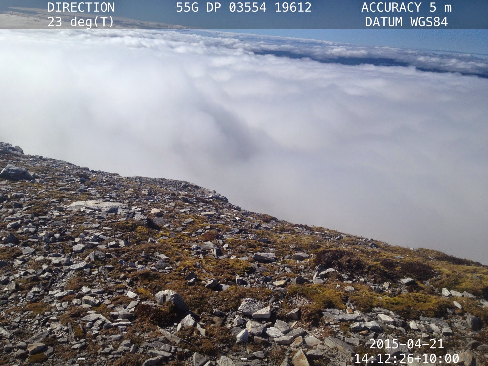
Just before 2pm we broke out above the cloud into the sun. A little snow on the crest of the ridge (243). From there, a mere stroll to the top (247). Happy smiles (248).
Video
Track Notes continued
Unfortunately all but one little distant patch was clouded in, but that did little to harm our enjoyment of the place and achievement. A number of pics (252, 253, 254). Rang home and tweeted a couple of photos. We were not alone (257). A venture towards the top of the face (258) and an attempt to photograph the Cap’s shadow (262). At 2.30pm it was time to pack up (264) and head down (265, 267 – not arty-farty, I just pressed the go button putting my camera away).
With the apprehension of the ascent behind me, there was the opportunity to appreciate the beautiful white quartz on the descent (268, 269) and to document the little scramble (273, 274, 275, 276, 277). At the top of the zig-zag descent, where the track to the Cap goes up and there is an intersection with a track to the North Col on so on down to Irenabyss, we met Max and Cindy on their way up. As Max said in the Barron Pass video, one has to climb Frenchmans Cap with a French man!
An uneventful descent completed (282, 285) by 3.40pm.
Another pleasant evening in the hut. The three sisters had arrived and there was another lone walker. Shelly turned out to be a friend of Andrew who guided me on my first Tasmanian trip 13-20 Nov 04. I do hope that they contact me.
Brian decided to sleep in his tent down by the helipad area, to catch the morning views. Amanda and Sally were camping down there too, and Karmen across the other side near the Lake Tahune ‘beach’.
Summary: Distance: 10.2km | Climb: 1500m | Time: 7.20am-3.40pm (8hrs 20mins), with 1hr 35 mins of breaks | Grading: L/M-R; H(13)
Day 3 – Wednesday 22 April: Around Tahune Hut and Tahune Hut to Vera Hut
Photographs around Tahune Hut
Photographs are available, where you can start a large sized slideshow.
Track Notes
See the photos for the views – I can’t describe it any better than it looks!
Shelly was up early to begin a lone, long day trip to Clytemnestra. Amanda and Sally were heading for an afternoon swim across Irenabyss. Max and Cindy were heading up the Cap again. Narelle, Heather and Janet were heading up Frenchmans Cap. But we all had a look about the fabulously beautiful morning scenery.
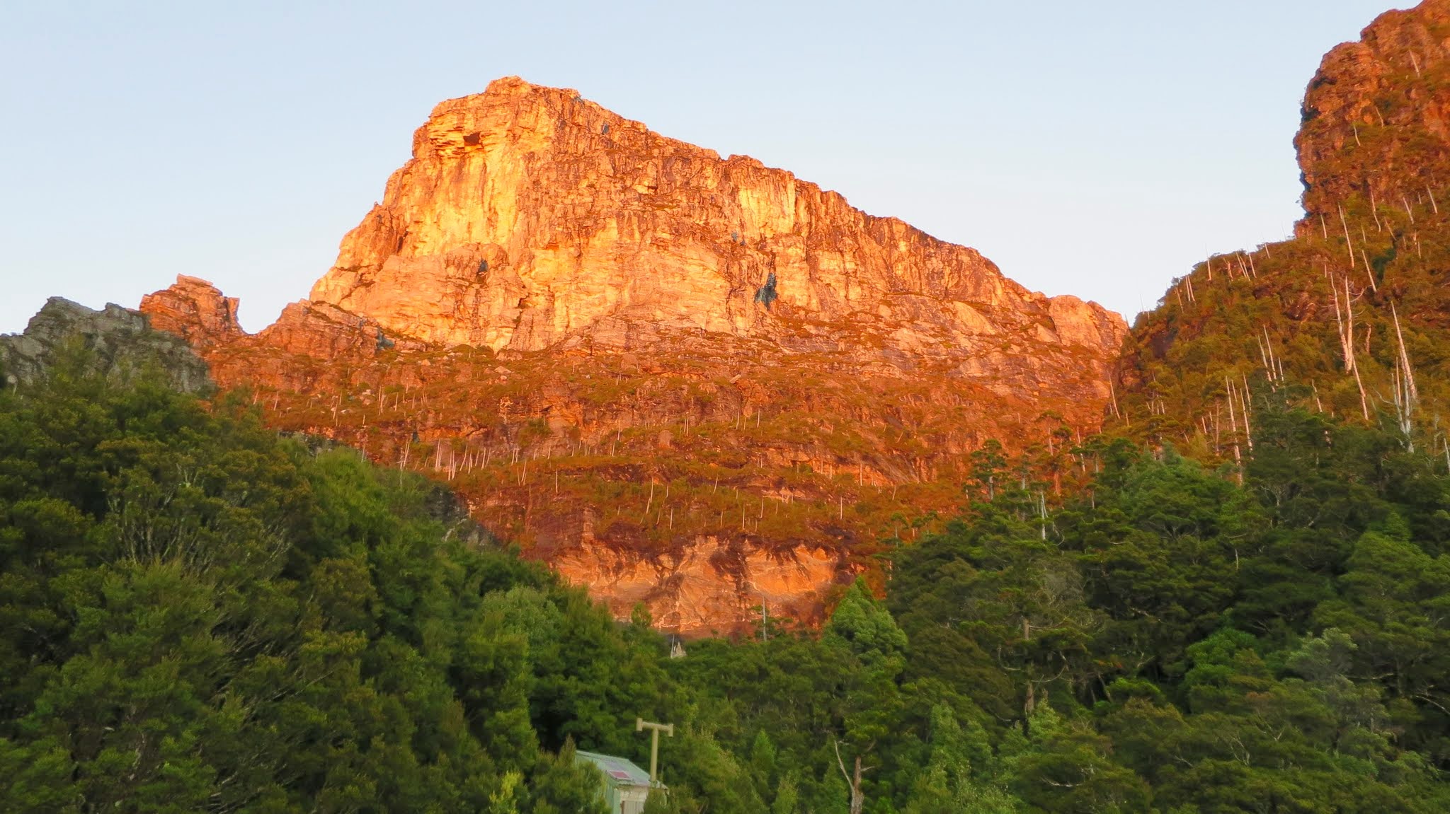
We first went to the helipad to take in the dawn and the morning sea of fog to the north-east (289, 291). We then turned around and saw the face Frenchmans Cap gloriously lit by the morning sun (293, 296, 297). Where to look – one way (299) or the other (306)? A zoom to the glorious Frenchmans Cap (307).
Then over to the side of Lake Tahune, near the camp site that Karmen had used, to see the the Cap reflected in the water (308, 314, 318).
Video
Track Notes continued
It was mesmerising (320, 327). Close at hand we were reminded of our status by the Old Mans Beard (330) and Max reflected (331) as the sun rose higher and the splendid light faded. Brian captured a beauty (next photo) – where’s that log – in the air or on the water?
But it was time to go.
Maps
Track overview

Track 1

Track 2
Photographs Tahune Hut to Vera Hut
Photographs are available, where you can start a large sized slideshow.
Track Notes
See the photos for the best track narrative – I can’t describe it any better than it looks!
We had several options available – go back up, push back to camp at the Lodden, or stroll back to Vera Hut. We chose to keep our party together and do the latter.
Leaving at 8.25am (335, 336) we dawdled back, arriving at 1.50pm. It was a great choice, with no major apprehensions or expectations giving us the chance to focus on and really appreciate the vegetation and topography both close by the track and in distant views. Another sun-drenched day. Karen walked out ahead of us.
The track retreated up to the east from the hut (337, 339, 340) then turned south-east above Artichoke Valley (344). A chance to really savour the green moss area and twinned hills (348, 350). The track ahead towards Barron Pass was now known (353, 358) and the towering heights above unchanged (364). Around 10am we crossed the scree (365) and took the opportunity to enjoy a small patch of Fagus (367, 368, 369). An over the shoulder glance to the Cap (enhanced by zoom – 371), then we were soon into the damp forest (372) heading towards the climb to Barron Pass (373).
We spent a long break at the top, enjoying a last close view to Frenchmans Cap (377). Another call to check on things at home, pick up some emails and engage with social media. At each side of Barrow Pass we passed walkers coming in – from memory, a party of 2 and a party of 3.
A slow descent, spending time to smell the roses (378, 380, 382, 384, 387, 388, 389).
Video
Track Notes continued
At 10 to 1 we stopped for lunch. A 40 minute break near the bottom of the descent, plenty of time to heat water for soup as we sat by the track (390, 391).
The expected ups and downs as we negotiated the track along the edge of Lake Vera (392, 393, 394). Arrived at Vera Hut. A lazy afternoon. Tea (396).
The last convivial night with the three sisters and two French.
Summary: Distance: 6.1km | Climb: 365m | Time: 8.25am-1.50pm (5hrs 25mins), with 1hr 20 mins of breaks | Grading: S/M-R; M(10)
Day 4 – Thursday 23 April: Vera Hut to Lyell Highway
Maps
Track overview

Track 1

Track 2
Track 3
Track 4
Photographs Vera Hut to Lyell Highway
Photographs are available, where you can start a large sized slideshow.
Track Notes
Our last day retreating from this majestic country. Off up the track past the toilet at 7.45am, having said good-bye to our hut companions.
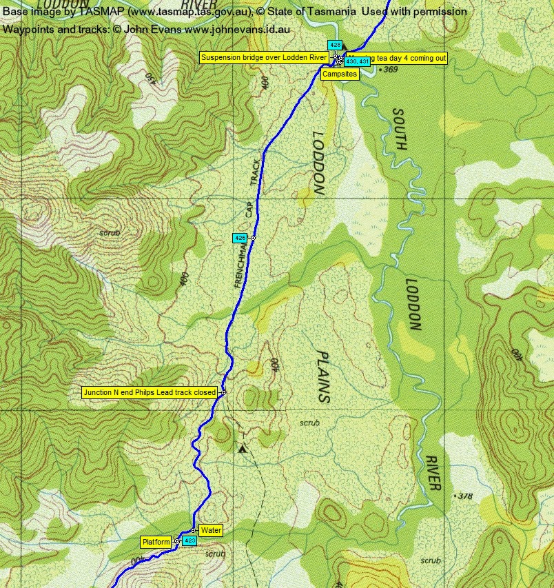
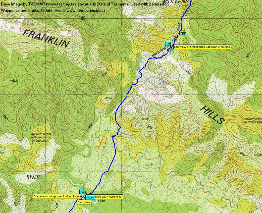
Tromped without a care through the Rumney Creek mud (399). Max and Cindy soon passed us. An opportunity to walk at our own pace and in some solitude to reflect on the experience (401, 402, 403, 406, 407, 410, 413). A little interest as we had a brief look at the track builders’ camp (415, 417) around midway along Laughton’s Lead. Across an intrusion of button grass (419, 420), then a short break (421). Spotted the camping platform off the side of the track (423) near the inward and outward watering point this time. More solo walking across the Lodden Plains (426) followed by a wait on the west side of the Lodden River for the others. I must have passed Max and Cindy at some stage, because they crossed the suspension bridge (428) whilst I waited.
Max and Brian arrived and we crossed and stopped for morning tea and water (430, 431).
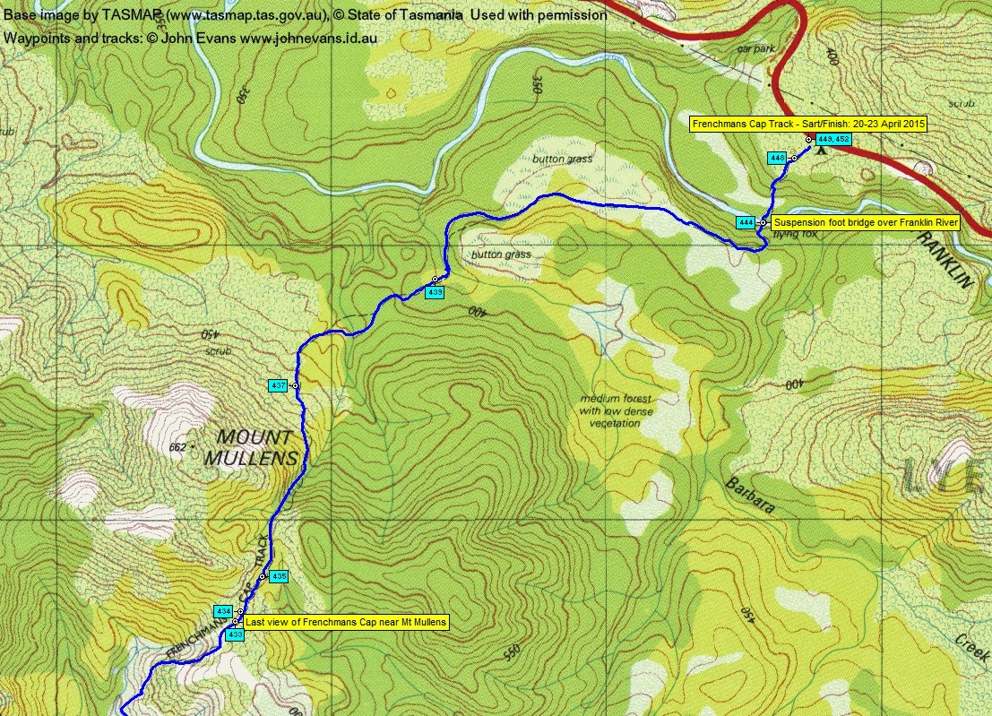
Again we spread out on the climb over the Franklin Hills to Mt Mullens. At one stage we passed a party of 7 girls coming in. In total passed 16 going in on this day – note to self, says Max, more going in towards the end of the week so start early in the week as we did. A final view of Frenchmans Cap (433). Track side wonders (434, 435).
Coming down the northern side of Mt Mullens at 5 past 12 we spied the Lyell Highway (437) a couple of kilometres away. A mud selfie (439). Across the Franklin River (444) and the last climb to the car park (448). Lots more vehicles than when we left (449).
We had lunch sitting in the shelter. The 3 sisters arrived and kindly snapped a final pic for us (452).
Drove back to Hobart to stay at the Grand Chancellor. A shower and change of clothes, then out to Mures bottom deck or fish and chips and beer (453). I slept well!
Summary: Distance: 15.1km | Climb: 600m | Time: 7.45am-1.05pm (5hrs 20mins), with 25 mins of breaks | Grading: L/E-M; M(11)
Last Day – Friday 24 April: Hobart and Home
Photographs are available, where you can start a large sized slideshow. To see the photos to best advantage, follow the link, click the down arrow at the right of the Google+ page and click Slideshow. Hover on the first photo and click Play.
Notes
A stroll along the docks in the showers to breakfast at the Harbour Lights Café. Very yummy! Then a walk through Salamanca Place (456) to the docks for a view across to HMAS Canberra (457) and a closer view of RV Investigator (462, 463).
Checked out (465), with the hotel kindly taking our gas and metho for disposal.
Flew home (466).
gpx File
Download the .gpx file here. (Right click, Save Link As…, Save – if you want to use it.)
kml File
Download the .kml file here.
Party
3 walkers – Brian S, Max S (leader), me.