 De Salis Cemetery
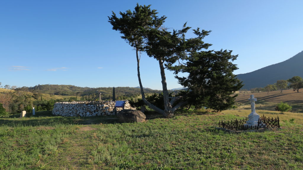
Monday evening 2 January: Southside Stroll to de Salis Cemetery – S/E. The de Salis cemetery at Tharwa is a unique, dry-stone wall enclosed burial site for the area’s pioneers of the late nineteenth century. The placement of plots reflects the social and cultural order of the time. The site is approached through a lovely avenue of poplars. A short 3km round trip, flat. Meet at the car park just over the Tharwa bridge on the left at 6.30pm. Bring a picnic tea to enjoy afterwards. Leader: John Evans, 0417 436 877, john@johnevans.id.au . Map: Williamsdale. Transport: Drive yourself. No need to book.
3 of us met.
Summary
Distance: 3.0km | Climb: flat | Time: 6.30 – 7.35pm (1hr 5mins) | Grading: S/E; VE(3)
Photographs
Photographs are available, where you can start a large sized slideshow. A chance to try my new camera (which makes a lousy photographer passable).
Waypoint and Track Files
Download the .gpx file. (Right click, Save Link As…, Save – if you want to use it.)
To use in Google Earth, do File, Open… and select Gps or All files as the File Type.
Track Notes
Nothing like a short stroll to get the new walking year underway. And a ‘bushwalk’ for Rudy visiting from Indonesia. Nice to meet and walk with Leanne who turned up too.
This is always a lovely ramble across the back of Cuppacumbalong and the Outward Bound base, through the avenue of mature poplars. We took a stroll down to the Murrumbidgee River, a little swollen after the storms of 2 days ago.
The cemetery is in a wonderful state of repair and a great site on this relatively cool evening. A southerly was blowing, rather than the hot north-westerly wind. We read the signage (see the pics), inspected the site and took it all away on several cameras.
A windy and cool picnic tea with my dear wife and brother-in-law on returning.
Well worth the drive out through the deep south of Canberra for this very short and easy walk, whether you’ve been here before or not.
Track Map
Party
3 walkers – Rudy P, Leanne S, me.