The Pimple and Tidbinbilla Mountain cliffs from Burkes Creek Rd
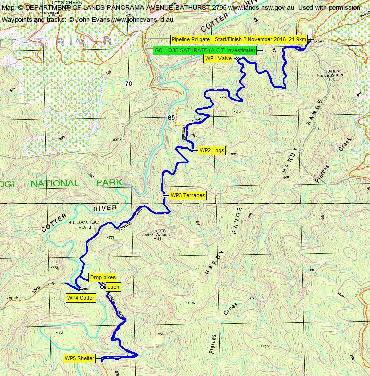
Wednesday 2 November: Pipeline Rd ride – L/E. Ride from the locked gate on Pipeline Rd in Pierces Creek Pine Forest area above the Cotter River. Do the stages of the multi-geocache GC11Q3E SATURATE (A.C.T. Investigate). Maps: Cotter Dam and Tidbinbilla.
2 of us met.
Further Information
This old codger lives in an old folks home now and has a very fit neighbour across the road who is an avid bike rider. So what better than to further cement our growing friendship, enjoy a beautiful spring day, pick off a multi-leg geocache and to go for a little ride.
Summary
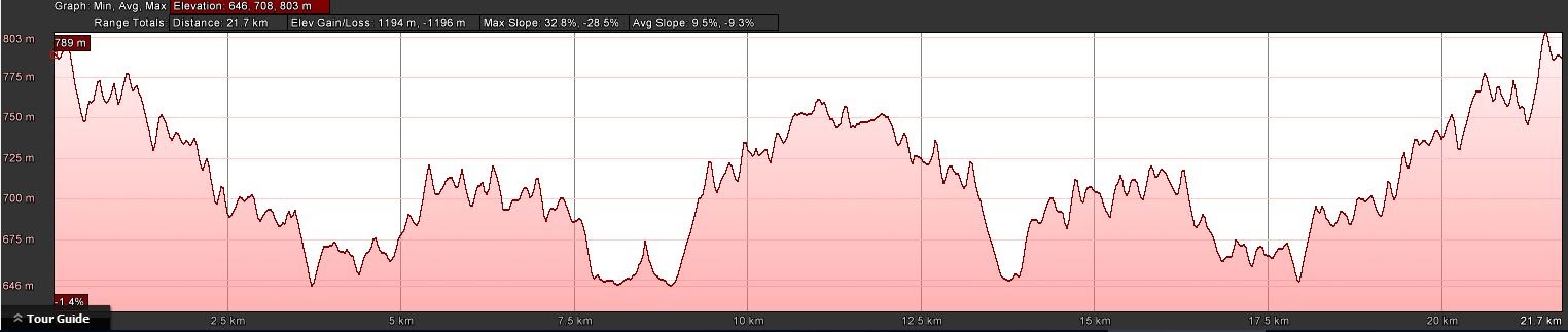
Distance: 21.9km (including 4.0km walk) | Climb: 1190m | Time: 8.40am – 1.10pm (4hrs 30mins), including 25 mins of breaks | Grading: L/E; H(12) (ride)
Photographs
Photographs are available, where you can start a large sized slideshow.
Waypoint and Track Files
Download the .gpx file. (Right click, Save Link As…, Save – if you want to use it.)
To use in Google Earth, do File, Open… and select Gps or All files as the File Type.
Track Notes
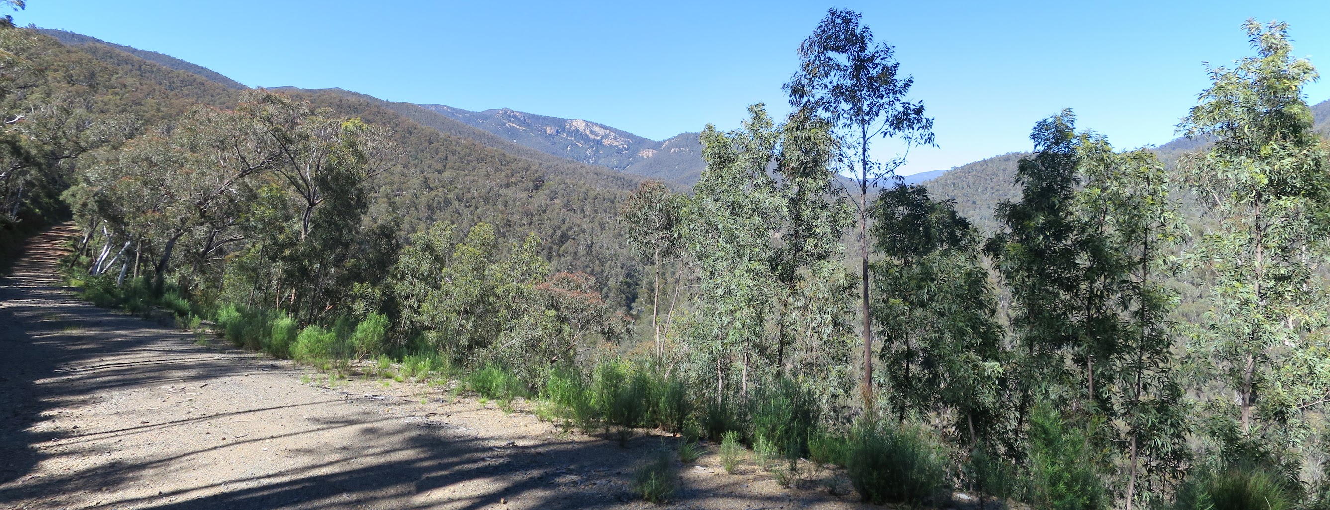
The last time I walked a bit of Pipeline Rd was 20 Aug 13, when we walked down it and climbed up onto Cotter Hill and on over into Pierces Creek Falls. We walked a bit of it today too – all the steep ups. There were a few of them – check out the trip profile.
Our trip took us down the road, stopping every now and again at known waypoints to collect information to calculate the final location of the geocache.
Pipeline Road is named that because it provides access to and parallels the Bendora Dam to Canberra gravity feed water pipeline. Our first stop was at a huge pressure release valve for the pipeline; there are several along the way.
Another feature of the road is the number of drainage lines which plummet down to the Cotter River from the Hardy Range. They must rush in the rain! To control the erosion by temporarily decreasing the energy in the flows, at each crossing of Pipeline Rd there are various culvert treatments. Gabions (cages filled with rocks) are an oft used construct. Two of our stops were at these. Huge views forward at times up to The Pimple and the northern white cliffs of Tidbinbilla Mountain. A couple of vehicles, one icon water, drove past us.
Our fourth waypoint was down on the Cotter River, where there is a concrete ford for Pipeline Rd. A beautiful sight today, the river flowing swiftly and clean.
Dummy me was enjoying the trip and conversation so much that we continued walking (ie. pushing our bikes) up Pipeline Rd, until I realised we were on the wrong side of the river. A quick downhill return and up though a network of tracks onto Burkes Creek Rd.
We decided to drop our bikes here and walk the last 2km to the final waypoint, a ‘shelter’ over yet another pipeline valve.
Here we turned around and walked back to our trusty steeds for lunch.
A reverse out, again with much pushing of bikes uphill. At some stage I logged GC11Q3E SATURATE (A.C.T. Investigate). Another 4X4 truck passed us, this one pulling up for a tick and a typical Australian greeting “g’day lads, going ok?” pleased us greatly since our combined age was 140+!
Published waypoints and track do not reveal the final GZ of the cache.
Drove back out via the East-West fire trail and Laurel Camp Rd to the sealed Paddys River Rd.
An excellent day, thanks Pat.
Track Maps


Party
2 riders and pushers – Pat D, me.