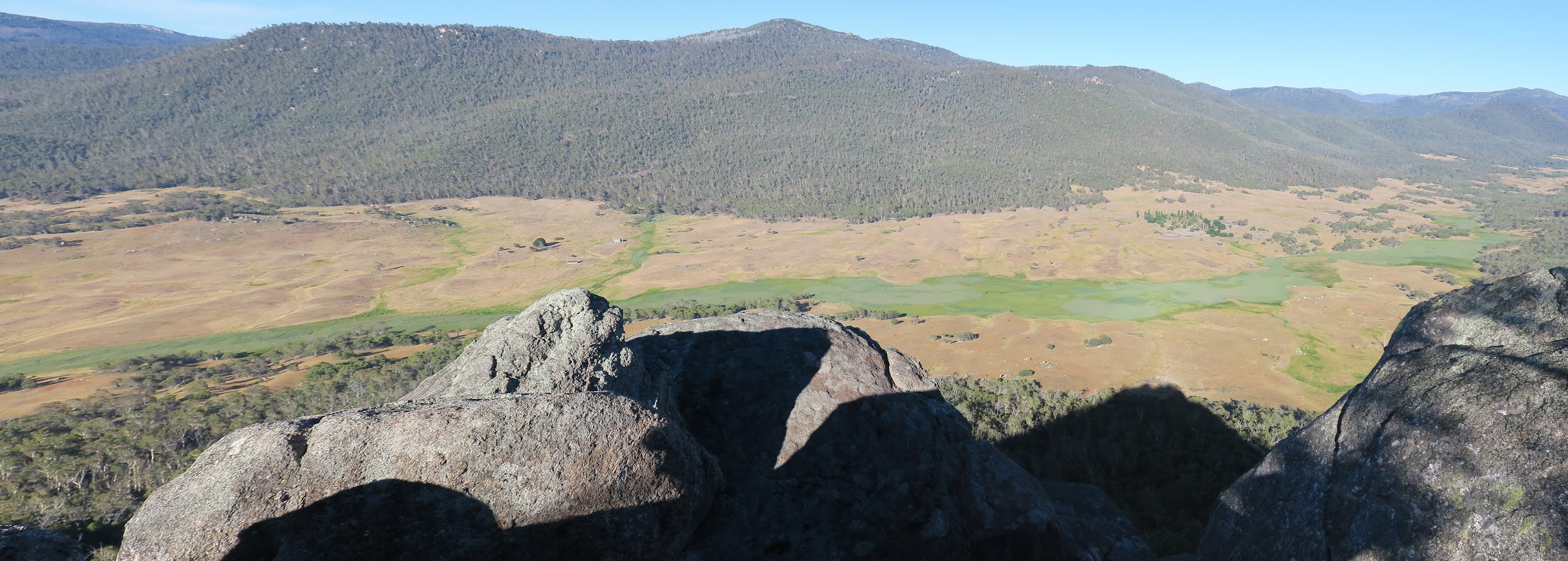
Orroral River from Orroral Tor
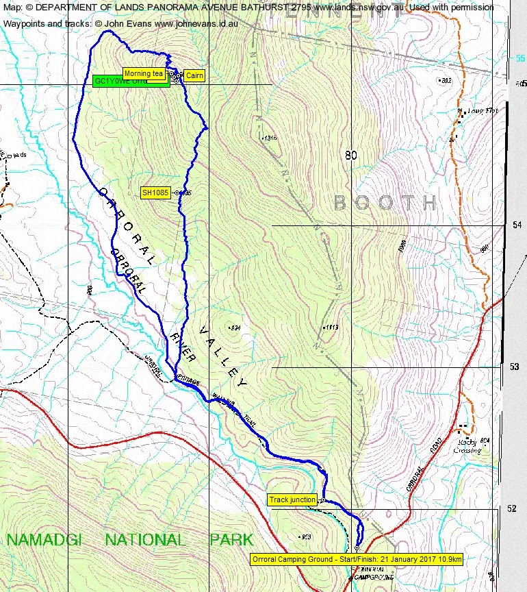
Saturday 21 January: Dawn sortie, Orroral Tor – S/M. Taking inspiration from an idea of Terence U, this walk starts and finishes early to avoid the heat. From Orroral campground we follow a pleasant track above the river out to Orroral Valley and then head up a wooded, scrubby spur to a fine rock outlook, then back along an old track near the river. About 7 km, 150 m climb. Map: Rendezvous Creek. Leader: Rob H.
Further Information
Last time I was here was 19 Dec 06.
Summary
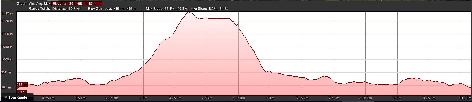
Distance: 10.9km | Climb: 450m | Time: 5.55–10.50am (4hrs 55mins), including 30 mins of breaks/geocaching time | Grading: M/M-R; M(10)
Photographs
Photographs are available, where you can start a large sized slideshow.
Video
Waypoint and Track Files
Download the .gpx file. (Right click, Save Link As…, Save – if you want to use it.)
To use in Google Earth, do File, Open… and select Gps or All files as the File Type.
Track Notes
I grumbled a bit when the alarm went off at 4am, then reminded myself that others living in Belconnen were already up. At least the meet point was opposite my old folks home.
A slow drive out, dodging the roos. Colour in the eastern sky as we turned onto Orroral Road.
Quite a few happy campers at the Orroral Camping Ground, one tent just by our path as we headed off along the high track of the Orroral Heritage Trail. Cool. Misty/foggy in the Orroral Valley and only when the sun touched the tops did it start to rise.
At the footbridge over the river we struck off bush, pretty much grid north. Open going at first, then a little scrubby as we climbed to the SH1085 knoll. More open down the other side. We went through the saddle area, then turned NW up the gentle climb to the back of Orroral Tor. Rob had last been here in 2014 and he led us unerringly to the slot on the NE side. We scrambled up, first time walkers doing a great job and enjoying themselves. A couple of cairns. We broke out onto the top and the fabulous views (check out the video) at 8.10am and Rob called morning tea.
I got the nod to head for the geocache GC1Y0WE Orroral Tor about 50m away. With the time pressure to not hold the party up, a couple of false leads and 4.5/5 difficulty scrambling, I was glad to find the cache and still be alive. Duly signed, I headed back.
A cautious descent for the party. First N, then generally W to the valley floor. One slot had us passing our packs forward so we could squeeze through.
An amble back to the footbridge, a lot of it on an old vehicle track. Lovely views across the valley and the green rushes hiding the Orroral River, up to the geodetic observatory and Mt Orroral up the other side.
An excellent ‘dawn sortie’, over by 10.50am before the day heated up. Great company from new and old friends. The new starters did really well on a slightly under-rated (if you get my meaning) trip. Huge thanks to Rob for putting it on.
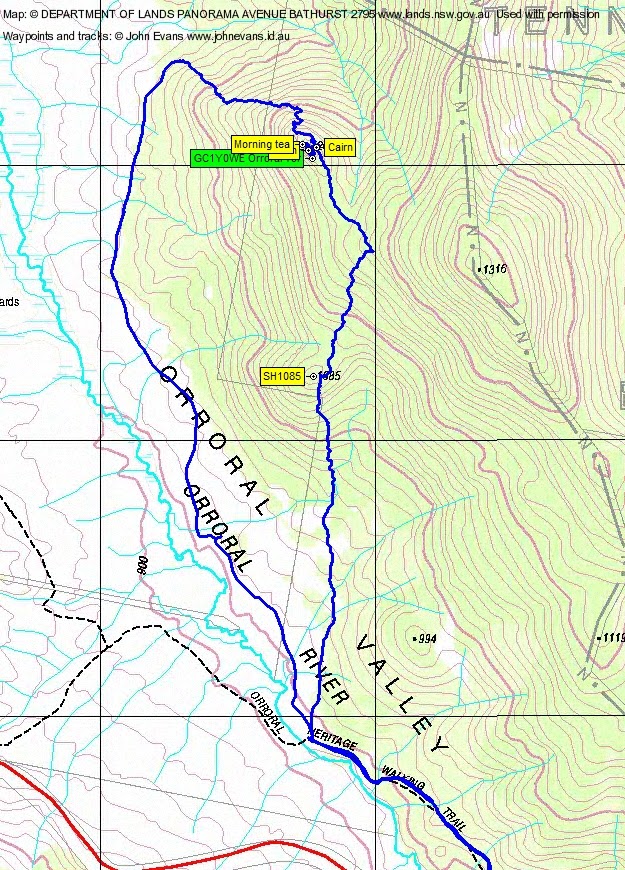
Track Maps


Party
7 walkers – Anita D, Angela G, Michelle G, Rob H (leader), Bev O’S, Phillip S, me.
Anita
21 January , 2017 6:11 pmThanks for the post John – an enjoyable day out.
Anita