Crumbling ‘Calvary’
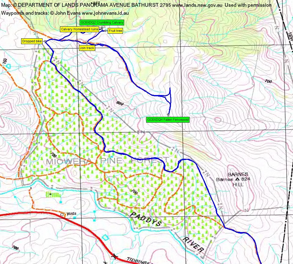
Monday 23 January: ‘Calvary’ caching – L/E. A ride from home along Point Hut Rd and Tidbinbilla Rd to the Paddys River bridge for geocache GC5P120 Paddy’s Pass. Then in through the TSR to ‘Calvary’ for GC6XDQ2 Crumbling Calvary. Walk a little of the south Bullen Range crest for GC6XDQH Fallen Fencepost.
Further Information
Last times to ‘Calvary’ were 24 Jun 14, 20 Jul 13, 6 Jul 13, 29 Jan 11, 29 Nov 09, 4 Aug 07.
Summary
Distance: 32.1km | Climb: 590m | Time: 7.10 – 10.20am (3hrs 10mins) | Grading: L/E; M(8)
Photographs
Photographs are available, where you can start a large sized slideshow.
Waypoint and Track Files
Download the .gpx file. (Right click, Save Link As…, Save – if you want to use it.)
To use in Google Earth, do File, Open… and select Gps or All files as the File Type.
Track Notes
I got this idea from my good mate Pat who lives opposite. He took me into the Miowera pine forest last Thursday and I didn’t have time to go further. Until today.
A ride out via Point Hut pond, Point Hut Rd and north along Tidbinbilla Rd to the Paddys River bridge. A quick find of GC5P120 Paddy’s Pass – after I got on the correct side of the river.
Back up the hill to the entrance to the Travelling Stock Route, over the first gate, through the second gate and over the third gate. Then the fun ride through a couple of roller-coaster hills and dips and up to the northern corner of the pine forest. Dropped my bike.
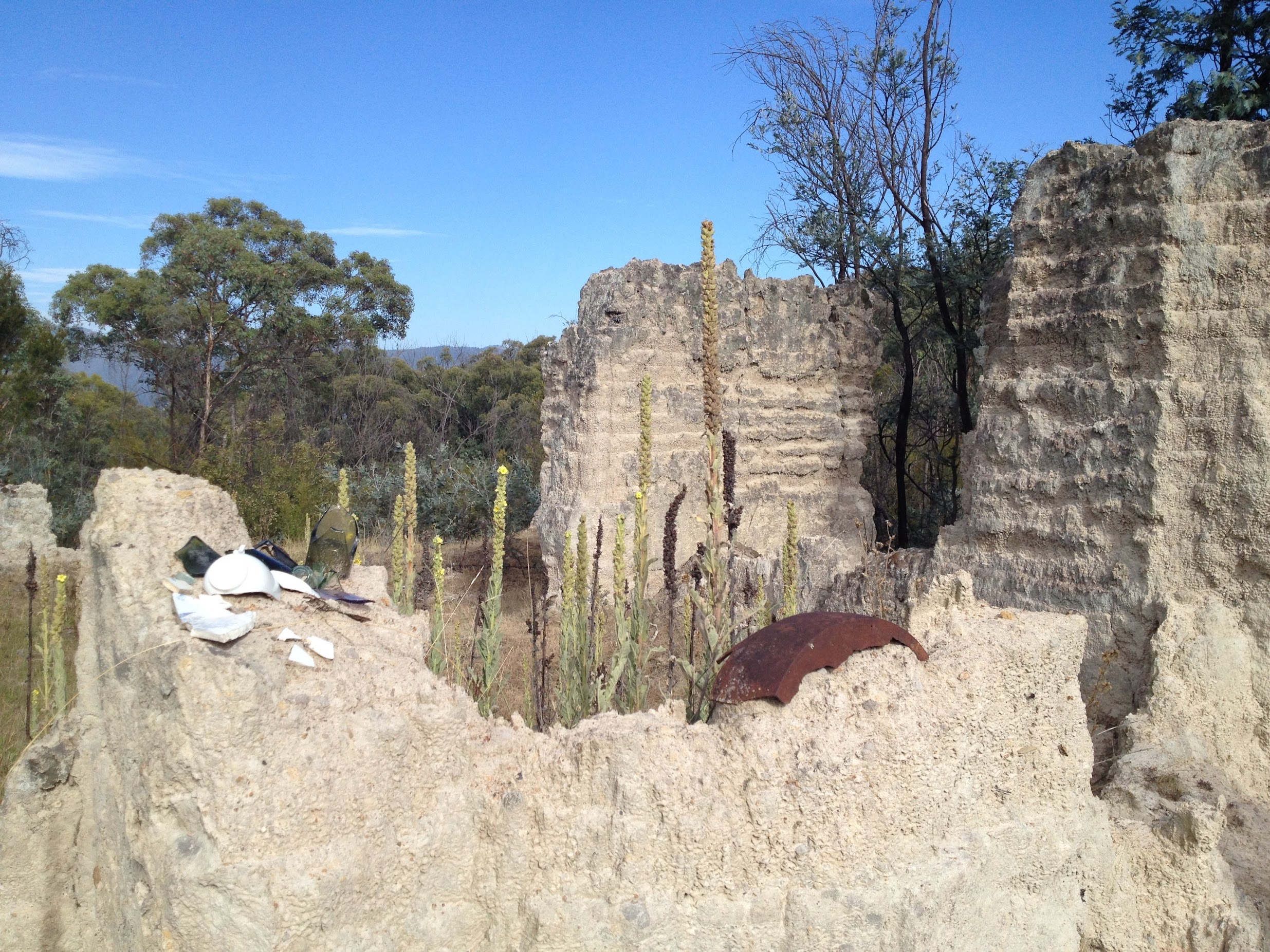
Climbed over the gate and walked up the old vehicle track. Took a left into the scrub too soon and had a slow walk through a couple of creek beds. A quick find of GC6XDQ2 Crumbling Calvary near the pisé ruin ‘Calvary’. Check out its history at Calvary. The daughter of a good mate, Angela B, did a conservation assessment of the site as her undergraduate project at UC a couple of years ago.
A good and short exit back to the vehicle track, via the nearby fruit tree. Wandered up the track past a black feral pig down in the creek line to the crest and joined the end of the Bullen Range Fire Trail. A few hundred metres south to a quick find of GC6XDQH Fallen Fencepost.
Returned, tib-min so a little detour, to the bike and rode home. A nice morning trip. 27.8km ride + 4.3km walk.
Track Maps


Party
just me.