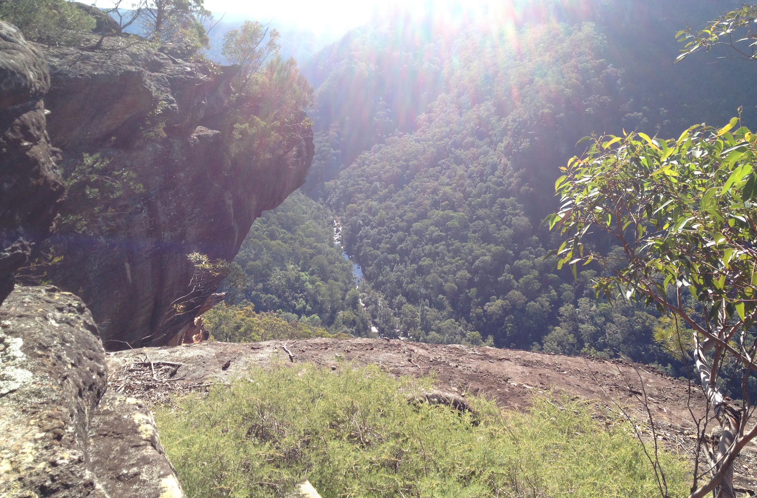
Looking down into Bundanoon Creek
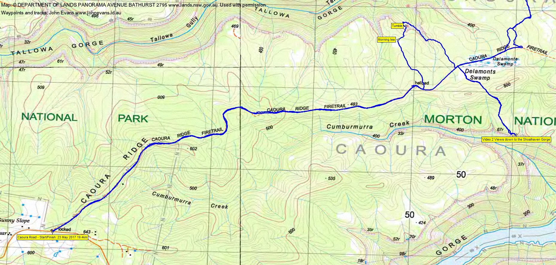
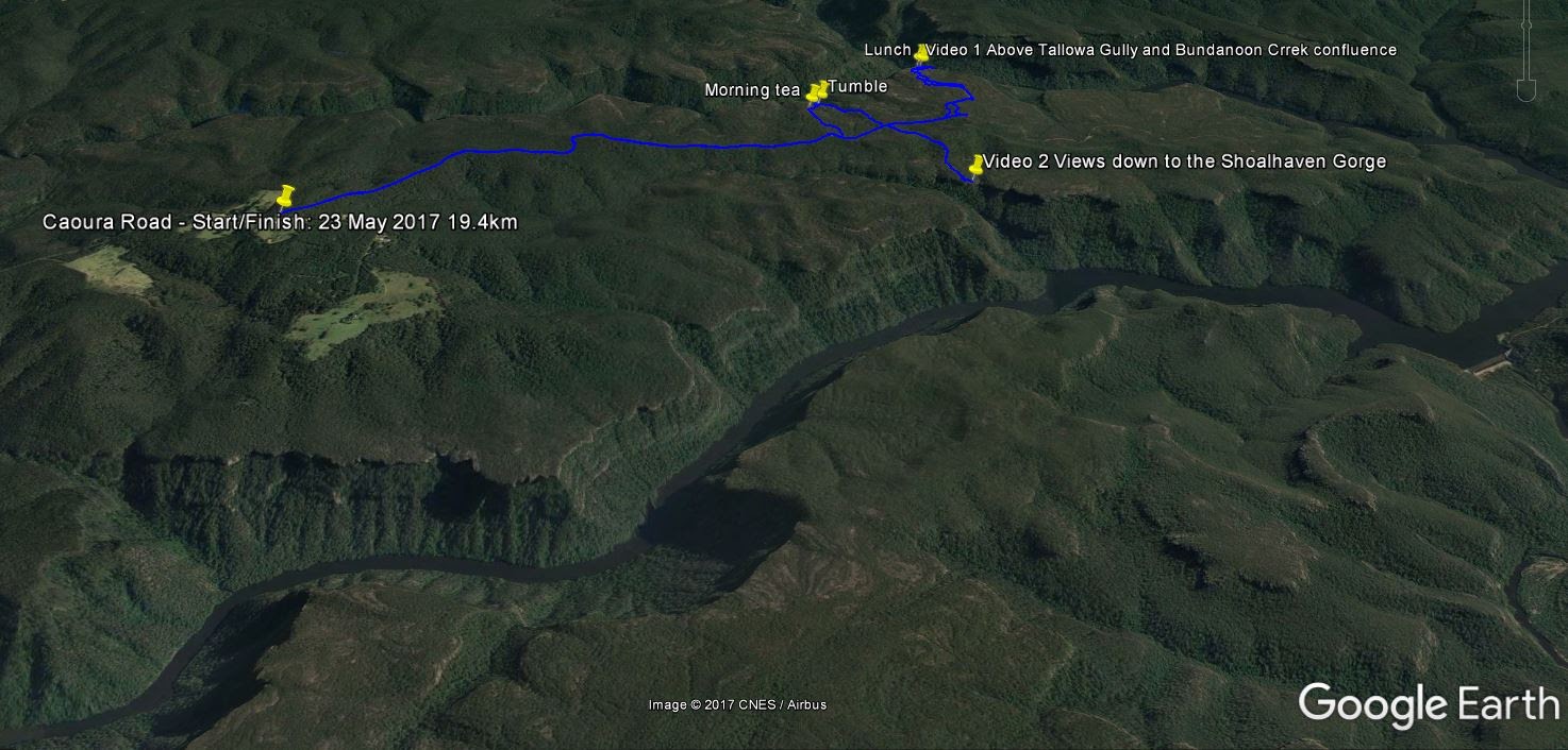
Tuesday 23 May: Caoura Ridge, Morton National Park – L/R,X. The walk starts on the Caoura Road, 21 km southeast of Marulan. We’ll follow fire-trails for 5 km, then investigate the base of the upper cliff-line above Tallowa Gorge. If feasible, we’ll follow the base of the cliffs for a few hours, then head back to the fire-trail. If time allows, we shall also visit the cliff tops above the Shoalhaven Gorge. The off-track walking may involve difficult scrambling in steep, rocky, and scrubby terrain. There is approximately 6 km off-track and 11.5 km of fire-trail. There is a 2 hour 10 minute drive each way. Minimum distance: 17.5 km with 600 metres of ascent. Maps: Bundanoon, Burrier, Caoura. Leader: Ian W. Transport: 332 km return Limit: 8.
Summary
Distance: 19.4km | Climb: 575m | Time: 8.50am – 3.40pm (6hrs 50mins), including 50 mins of breaks | Grading: L/M-R; H(12)
Photographs
Photographs are available, where you can start a large sized slideshow. Pardon my pics. My good camera (which partially compensates for my poor technique) is currently in hospital. There are 2 beaut shots from Ian included.
Videos
Waypoint and Track Files
Download the .gpx file. (Right click, Save Link As…, Save – if you want to use it.)
To use in Google Earth, do File, Open… and select Gps or All files as the File Type.
Track Notes
We were reminded today of the possible cost of our great off-track walking. One of the party took a 4-5m tumble down a chute in a little cliffette. For the others, it seemed like an eon before the call “I’m OK” was heard. Our walk leader handled the situation very well and the tumblee was absolutely huge in their response and recovery. With constant checking, the party continued on a modified route and enjoyed some spectacular views from the cliff tops.
A bit over 2 hours for the drive from the Woden area (through thick fog for a lot of the Federal and Hume Highways), turning onto the Highland Way just past Marulan, then onto the Caoura Road at Tallong.
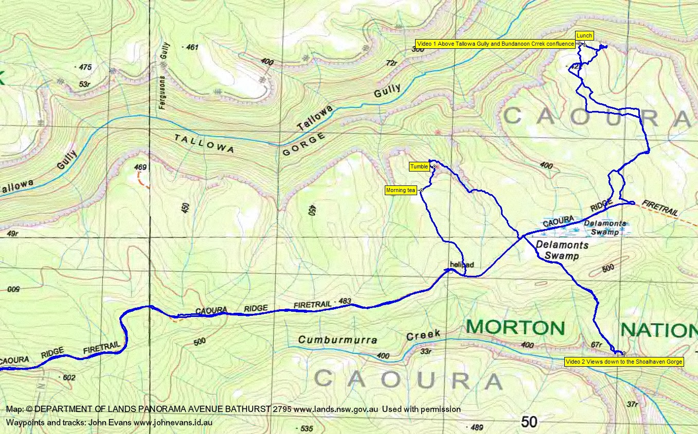
We inserted 4.8km in along the Caoura Ridge Fire Trail in 55mins to just past the map-marked helipad. Here Ian had spied an old fire trail alignment heading north-ish towards the top of Tallowa Gorge. We followed it to morning tea. A mild day, perfect walking weather.
After our break we headed down to the top cliff line. Here, as we descended a little chute in a cliffette, the tumble occurred. After the recovery, our modified route took us SE back up a drainage line to the tops, then back to the fire trail.
Further assessments were made and options offered. We all agreed to continue along the Caoura Ridge Fire Trail and then off-track via a series of old fire trail alignments and sandstone tops clearings to lunch above the confluence of Tallowa Gully and Bundanoon Creek. Magnificent views! Check out the video clip.
After lunch we returned to the main fire trail and walked back through the map-marked Delamonts Swamp area (didn’t notice anything particular). Using another decommissioned fire trail, we headed SE down to the 67m cliff tops above Cumburmurra Creek for more wonderful views to the Shoalhaven Gorge. Another video clip to watch.
Returning up to the main fire trail, we walked out.
Some late colour in the heathland and bush. Large red and small yellow grevilleas, late creamy wattle, Native Iris or Purple Flag (Patersonia occidentalis) (quickly identified tonight by my go to person for flowers, Barrie R) and, on the side of the Caoura Ridge Fire Trail about 3km from the car, a fruiting cycad.
A great trip to a new area for me.
Track Maps


Party
4 walkers – Meredith H, Chris R, Ian W (leader), me.