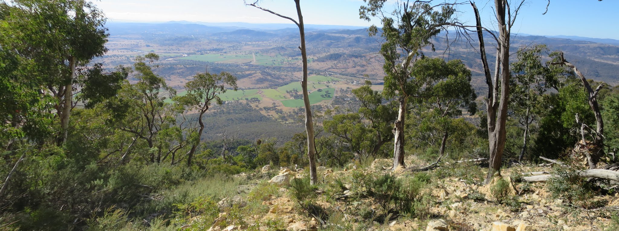
View down from the top of the Mt Tennent scar
Tuesday 24 May: Mt Tennent scar again – final GZ of ‘Up the Scar’ – L/E,R. A search on the Mt Tennent scar for the final GZ of geocache GC55GNQ Up the Scar.
2 of us drove and parked on the side of the Naas Rd where the AAWT crosses.
Summary
Distance: 13.6km | Climb: 950m | Time: 10.25am-3.15pm (4hrs 50mins), including 1hr of searching + lunch | Grading: L/E,R; H(12)
Photographs
Photographs are available, where you can start a large sized slideshow.
Video
Download the .gpx file. (Right click, Save Link As…, Save – if you want to use it.)
To use in Google Earth, do File, Open… and select Gps or All files as the File Type.
Track Notes
Last week we came down the scar and visited the first stage of the multi GC55GNQ Up the Scar. Even without working out the final GZ at the time, the cache name said it all. We returned today to bag the cache.
But being wise (or lazy), we took the AAWT/Mt Tennent Walking Track up to join the Mt Tennent Fire Trail and headed nearly up to the top. I have a waypoint or two which mark the drop-off point to the top of the scar, so we got there easily.
The caching was a comedy if errors. Both of us had printed the spoiler pic and both of us had left it at home. We searched for a while, tried to get the spoiler pic on our phones via a web browser (the geocaching app wouldn’t help, as this was a multi). Eventually I rang my (non) geo-wife and she emailed the spoiler to me (that exercise was a testament to the ease of use of www.geocaching.com). Some more searching revealed the cache!
Of course the track has been doctored so as to not reveal the final GZ of the cache.
A puff back up the hill and a return via the track.
Some nice views on a lovely day.
Track Map
Track

Profile

Party
2 walkers – Roger E (Marmaduke Rothschild), me (JohnnyBoyACT).