Spinnaker Rock

Tuesday 26 July: Spinnaker Rock (by special request) – S/M. A relatively short walk commencing from the intersection of Apollo and Booroomba Rocks Roads. From Sundial Rock we head SSE down the valley to the grasslands and then head NE up the ridge to Spinnaker Rock, having a look at some interesting boulders on the way up. Overall, pleasant walking, great views from Spinnaker Rock, and a large overhang type rock on the way down. Partly on and partly off track. Some thick scrub. Perhaps wet feet. Some rock scrambling. The descent from Spinnaker Rock back to Sundial Rock is steep, scrubby and loose underfoot. You should be fit, and be comfortable walking off track. We will meet at Kambah Village Shops and leave there at 9.00 am. Leader: Barrie R. Cars: We will car pool from Kambah Shops. About $10 p.p. Numbers are limited. Forecast for Tuesday in Canberra : partly cloudy, 40% chance of rain, 0-1 mm, temp range : 2-9ºC. Map: Corin Dam. Please book in with the leader no later than midday Monday 25 July, giving your name, address and emergency phone number.
6 of us met, 5 in Kambah and I was picked up from the deep south on the way.
Summary
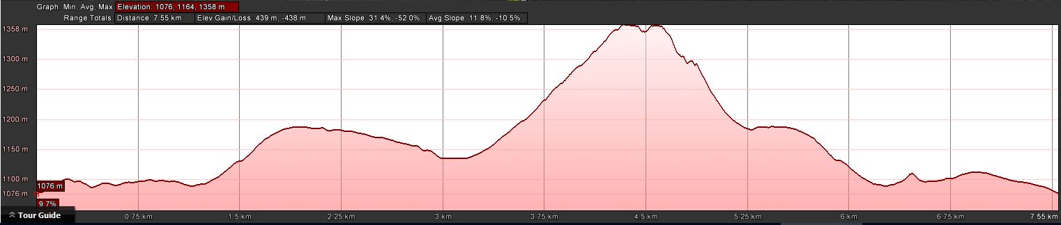
Distance: 7.6km | Climb: 430m | Time: 9.50am – 2.30pm (4hrs 40mins), including 45 mins of breaks | Grading: S/M; M(10)
Photographs
Photographs are available, where you can start a large sized slideshow.
Videos
Waypoint and Track Files
Download the .gpx file. (Right click, Save Link As…, Save – if you want to use it.)
To use in Google Earth, do File, Open… and select Gps or All files as the File Type.
Track Notes
What a beaut little walk! Huge thanks Barrie for putting it on at my request and through an area that I hadn’t visited. A cameo which now makes my usual there and back to The Spinnaker into a lollypop round.
We carped the diem. The pretty ordinary weather forecast didn’t eventuate and it was a blue-sky day, a little snow underfoot at the higher points and not too windy.
I had done a little preparation and was armed with the details for geocache GC6D6RA Weird Weir XXV – Honeysuckle – TE’s Forgotten Weir. So was most pleased when we parked near the intersection of Apollo Rd and the road to Booroomba Rocks car park. A little difficult to pick up the footpad which runs from near there and around the knoll of the Honeysuckle Creek tracking station site, due to a controlled burn. However, Barrie soon picked it up and we were on our way to the Honeysuckle Creek weir.
A quick stop at the weir to pick up the details for the single leg multi-cache. I had great bolt counting from Max but, after missing the final GZ and throwing myself on the mercy of the cache owner when I returned, I now know I cannot distinguish between a circle, rectangle and triangle.
We followed the creek to the fire trail, turned left up it and walked to the point where the footpad to ‘sundial rock’ saddle takes off. Difficult to recognise with the burning off, but Barrie had it well under control. Along the footpad to the saddle. I’d always thought that Barrie had named ‘sundial rock’ but he said no. I got a snap of him at it anyway. Morning tea nearby on a dry rock in the sun.
Our next leg was the unknown territory for me. Very pleasant, down through light scrub to an open grassed area where we crossed the drainage line. (One could go further south to views down into the Gudgenby River gorge, or west back up to join the AAWT Link Track.)
Today we headed north-west up to The Spinnaker. A lovely spur, gentle at first. A little snow increased the visual beauty of the bush. Some nice tors and slot squeezes as we pushed higher. A pace appreciated by all to allow enjoyment of the scenery and the opportunity to photograph it. Lovely granite with green mosses and white snow on this south-east facing slope.
This time we went to a new area of The Spinnaker, in fact right on the map-marked *. We braved the wind for lunch so we could catch the huge 180º views. Check out the photos and videos. A wedge-tailed eagle soared nearby.
The standard exit back down to the saddle via the huge overhang. Thank goodness there is a route to follow, as the scrub is tight on either side.
Back down, we headed back to the weir. I’d made my calculations at morning tea but, because I don’t know my basic shape, conducted a futile search. “I’ll be back”.
From a track intersection near the weir, we headed up a vehicle track which took us to the tracking station site. An area not often visited by me and some others in the party. A short direct walk down through the beautiful camping areas and a short tromp back along the road.
A ripper, thank you Barrie and all. And I’ll never be seduced by Pokemon Go.
Track Map
Track

Profile
Party
6 walkers – Kim H, Barry K, Barrie R (leader), Max S, Phillip S, me.
Barrie R
26 July , 2016 8:49 pmHi John
As you say, a great day and a great party. Also, a great write up with a huge number of super photos. Well done. Barrie