Buckenbowra River at lunch

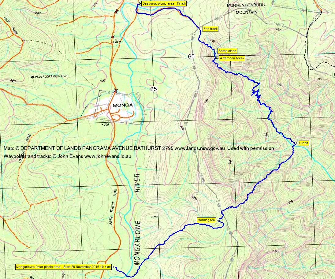
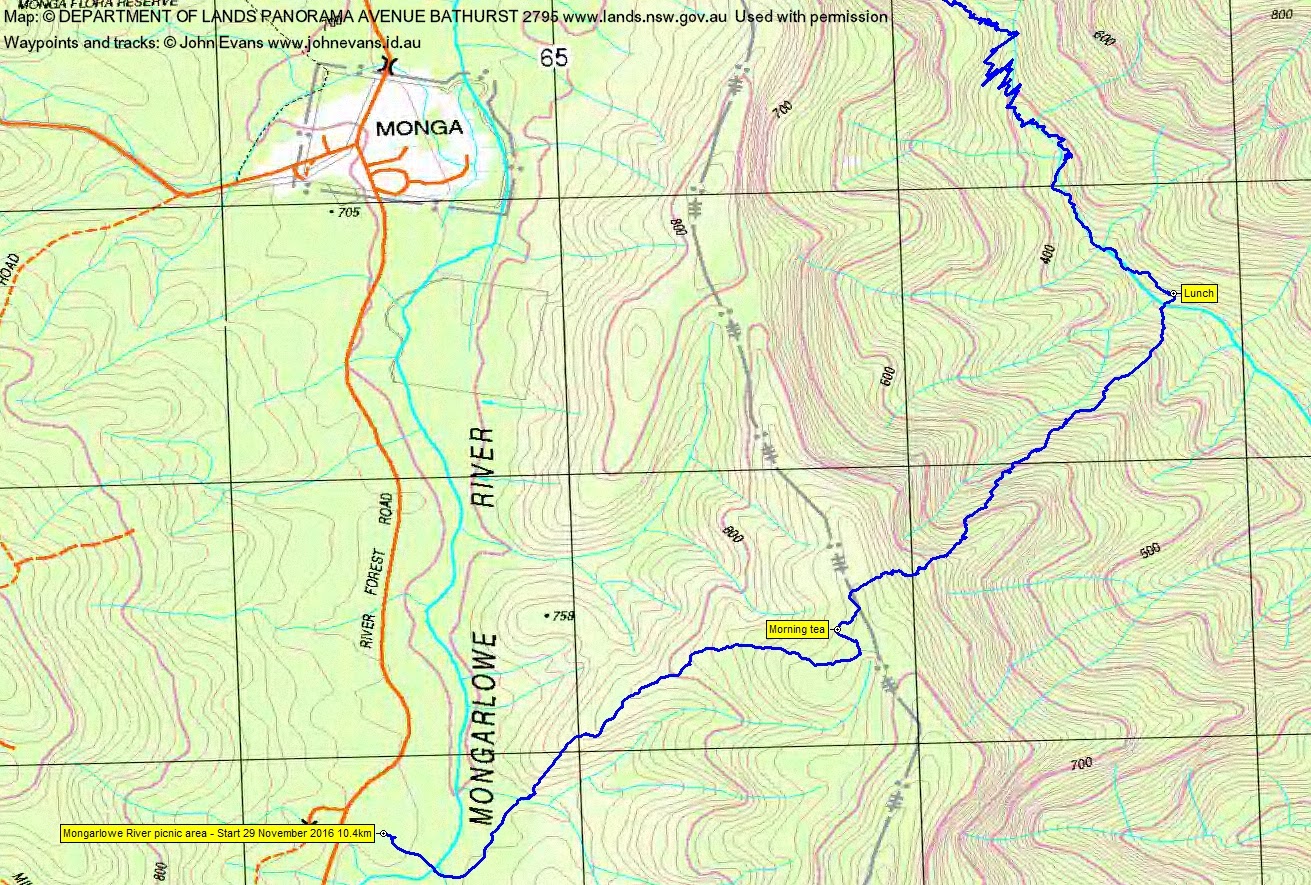
Tuesday 29 November: Upper Buckenbowra River – M/R,W. A plan B trip due to trees down. From the Mongarlowe River picnic area on River Forest Road, cross the Mongarlowe and follow a spur to the eastern watershed. Descend to the Buckenbowra River and walk upstream to its headwaters. Climb out to join the Corn Trail link to the Dasyurus picnic area. Car shuttle required. Leader: Linda G.
8 of us met.
Summary
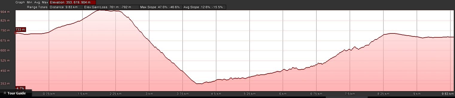
Distance: 10.4km | Climb: 760m | Time: 9.20am – 5.00pm (7hrs 40mins), including 60 mins of breaks | Grading: M/R; H(12)
Photographs
Photographs are available, where you can start a large sized slideshow.
Videos
Waypoint and Track Files
Download the .gpx file. (Right click, Save Link As…, Save – if you want to use it.)
To use in Google Earth, do File, Open… and select Gps or All files as the File Type.
Track Notes
Another huge trip led by Linda G in an awesome area. It had all the dramatic elements – river crossings, grass trees, Christmas bushes and bells (how seasonal is that), escarpment cloud and mist, tree ferns, seemingly near vertical 500m descent (although Google Earth can’t lie – max 47% slope), stinging trees, rain forest trees and vines, rock hopping up the upper Buckenbowra River, waterfalls, a couple of breaks (one maybe only a sprain), precarious traverses, torrid ascents and an afternoon booming thunderstorm. Rain forest fauna too – I even brought a leech home between my toes to show my dear wife. Couldn’t have been better.
To sum up with one of the great phrases from the film The Castle, “It’s the vibe“. The photos and videos tell it better than any words.
A lovely flat and sunny Aussie walk for our Swedish visitor. And another from The Castle “Get your hand off it…!“.
A hugely fabulous day, thanks Linda and all.
Track Maps

Party
8 walkers – Crister E, Eric G, Karl G, Linda G (leader), Kim H, Jenny H, Ian W, me.