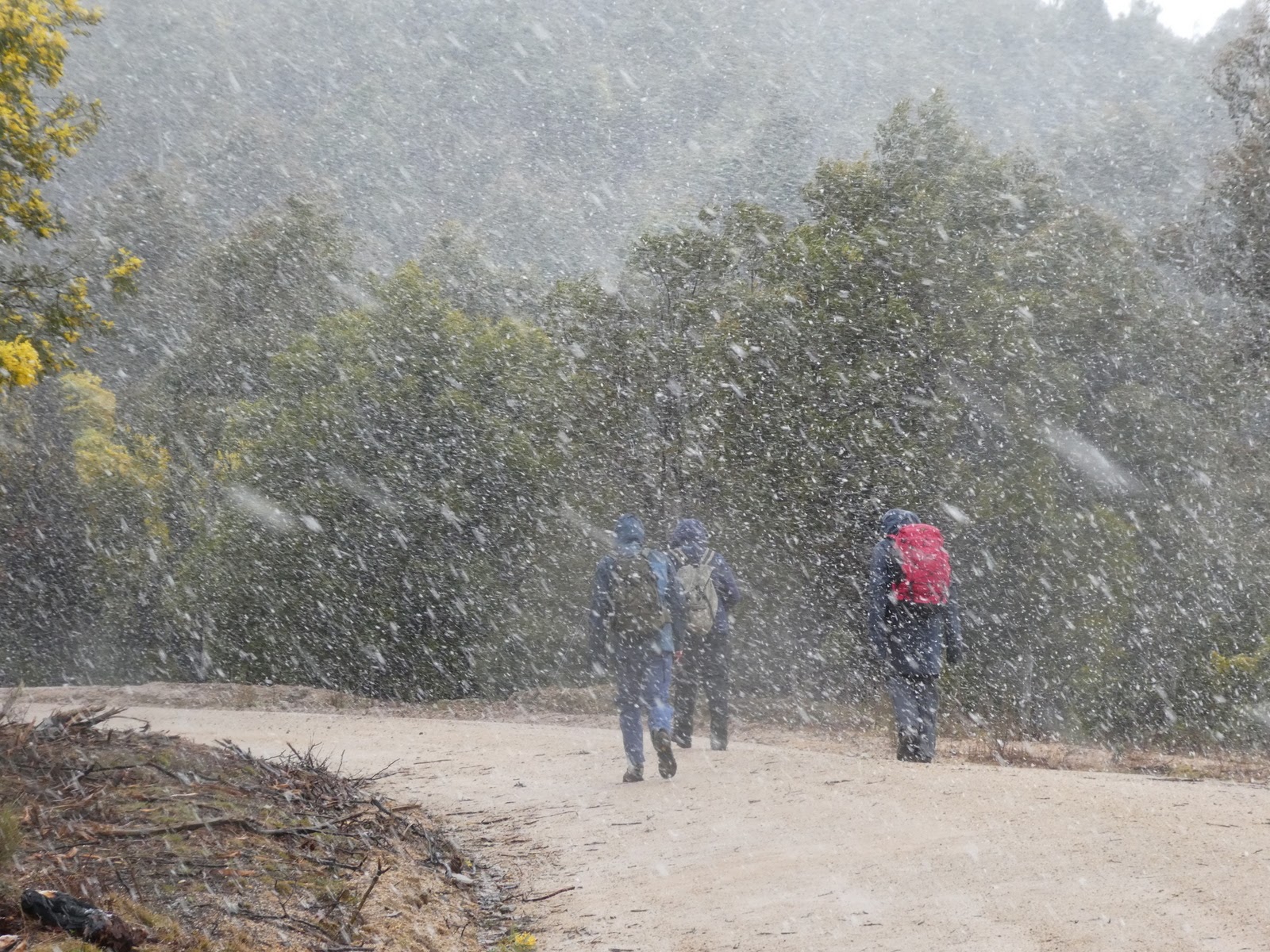
A snow shower on the way to Nil Desperandum | photo Mike B
Nil Desperandum and beyond – L/M. A through walk from Tidbinbilla Nature Reserve to Paddys River Road, near (not over) Black Hill. Car shuffle involved. If you are not into geocaches (GC78F5N, GC78F5V, GC79CZH, GC7BBHR, GC7B279, GC79CZZ, GC79D09, GC765YE, GC765YV, GC765YM,) then you will probably be bored! About 18km walk and a few undulations. Map: Tidbinbilla. Leader: Roger E. Transport: $20.00. per car. Limit: 8.
Summary
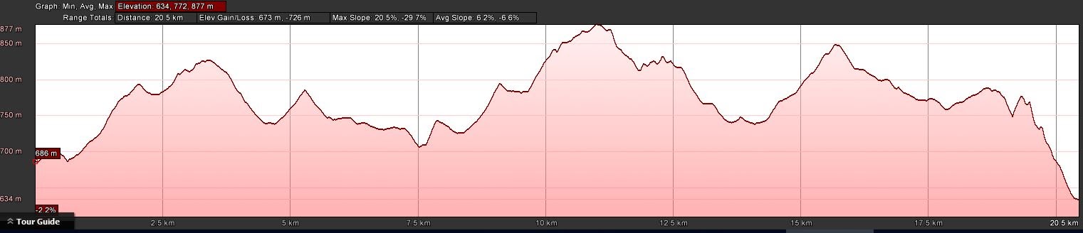
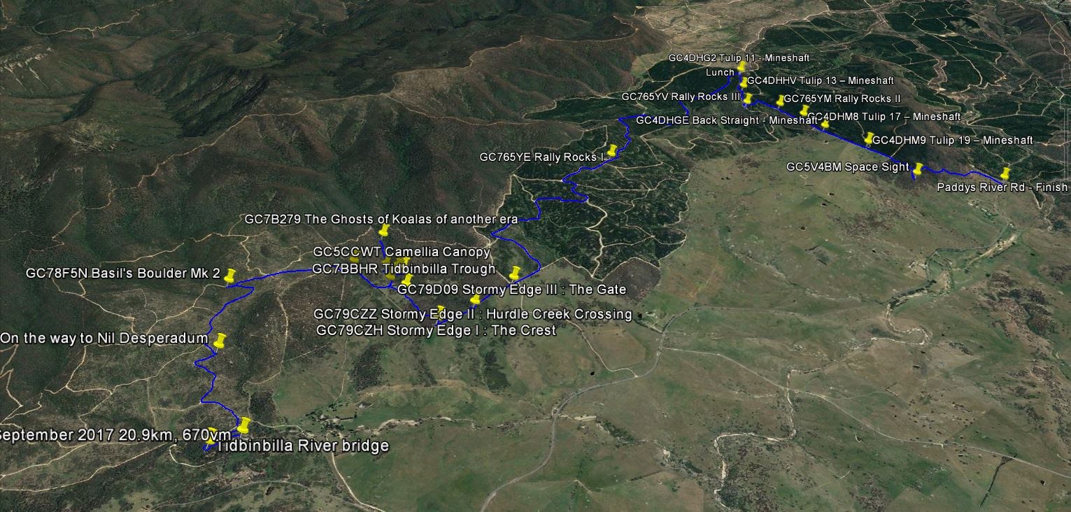
Distance: 20.9km | Climb: 670m | Time: 7.40am – 2.10pm (6hrs 30mins), including 40 mins of breaks and some caching time | Grading: L/E-M; M(10)
Photographs
Photographs are available, where you can start a large sized slideshow.
Waypoint and Track Files
Download the .gpx file. (Right click, Save Link As…, Save – if you want to use it.)
To use in Google Earth, do File, Open… and select Gps or All files as the File Type.
Track Notes
We dropped a car up Paddys River Rd under Black Hill, then returned to Tidbinbilla Nature Reserve, The gates were open at 7.20am and we drove via the play area to the picnic areas down along Tidbinbilla River.
Rain coats on straight away. We followed the path down to the river, then up the true right bank to the bridge. As we crossed, it started to snow! Down the pad on the true left side and across the fire trail. First time I’ve ever been to Nil Desperandum by the new route, which follows a more gentle gradient to the SW of SH865. As we tromped, the snow showers flurried stronger and the flakes started to settle on the ground and whiten it.
This was no gentle wander, dear reader, but a serious geocaching event 😆 . I had a list of 19, some of which our trusty leader had previously logged and therefore (being a cacher with few morals) hoped for a quick find.
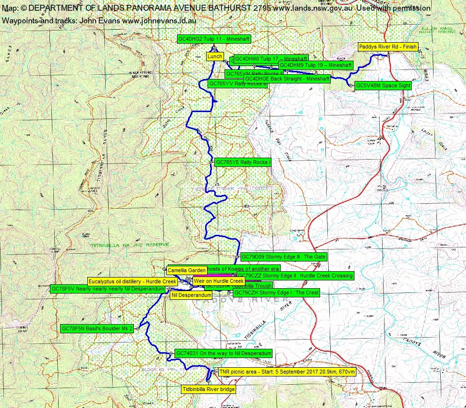
The first to reveal its secrets was GC74031 On the way to Nil Desperadum followed by, as we walked the snowy fire trail, GC78F5N Basil’s Boulder Mk 2. A kilometre or so across the NW side of SH865, we joined the fire trail I’d previously taken towards Nils and logged GC78F5V Nearly nearly nearly Nil Desperandum.
We rounded Nils and headed up the fire trail paralleling Hurdle Creek. Our next easy find was GC7B279 The Ghosts of Koalas of another era. I’ve found remnants of the old koala enclosure around 100m further up the fire trail and in along the creek line. About turn and a visit to the eucalyptus distillery site on the way back, then across the road to the camellia enclosure. A fail for the day on a difficulty = 1 cache – we could not find GC5CCWT Camellia Canopy 😳 . A quick look at the swimming pool weir on Hurdle Creek. Back to Nils for morning tea.
We next headed east from Nils to log GC7BBHR Tidbinbilla Trough. Further east, we hit the TNR border fence and logged GC79CZH Stormy Edge I. A nice grass tree nearby. Up the fence to log GC79CZZ Stormy Edge II and GC79D09 Stormy Edge III. Mike took a lovely zoom to a Robin, then some 13 pigs and piglets over the fence on Brindabella Station. I snapped a nearby gruesome alien heading to a gate.
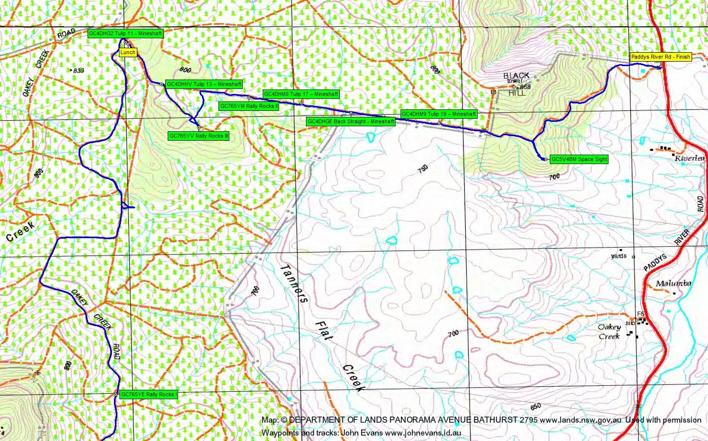
Into the Pierces Creek Pine Forest area and a long and winding (and windy) tromp up Oakey Creek Road. Found GC765YE Rally Rocks I. A little to-ing and fro-ing and to-ing further north as we couldn’t find a map-marked fire trail. So a bonus log of GC4DHG2 Tulip 11 – Mineshaft and lunch nearby.
A southerly dip to log GC4DHHV Tulip 13 – Mineshaft and GC765YV Rally Rocks III. Derek dared us to brave the blackberries and we took a pine forest shortcut to GC765YM Rally Rocks II.
A loong, straaaight fire trail heading towards the car yielded GC4DHM8 Tulip 17 – Mineshaft, GC4DHGE Back Straight – Mineshaft and GC4DHM9 Tulip 19 – Mineshaft. No rally cars today. A little off-track section got us GC5V4BM Space Sight, plus better views to the Tidbinbilla Space Tracking dishes. A final stroll to the car.
A good haul and a fun snowy start. Thanks Roger and all.
Track Maps


Party
4 walkers – Mike B, Roger E (leader), Derek S, me.