Typical open going NW of lunch

Tuesday 6 June: Nadgigomar Nature Reserve – L/M. With the weather a bit iffy locally, Ian chose to take us back to Nadgigomar Nature Reserve, located 25 kilometres southeast of Tarago. The area contains largely unmodified open woodlands with old trees and some interesting swamps.
Further Information
Previous trips to this NR 12 Aug 14, 9 Sep 14 and 3 Mar 15.
Summary
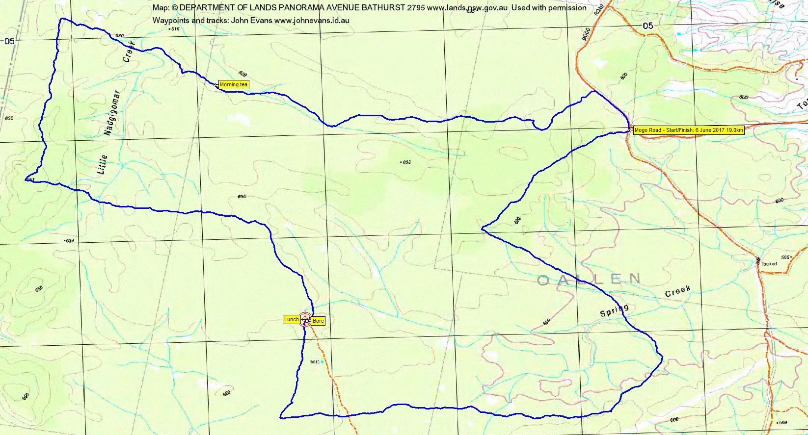
Distance: 19.0km | Climb: 150m | Time: 8.30am – 3.10pm (6hrs 40mins), including 50 mins of breaks | Grading: L/M; M(9)
Photographs
Photographs are available, where you can start a large sized slideshow.
Waypoint and Track Files
Download the .gpx file. (Right click, Save Link As…, Save – if you want to use it.)
To use in Google Earth, do File, Open… and select Gps or All files as the File Type.
Track Notes
A less than 2 hour drive from Woden, via Queanbeyan, Bungendore, Tarago, Lumley Rd, Cullulla Rd, Sandy Point Rd, Oallen Ford Rd and Mogo Rd. I slept the whole way.
This part of Nadgigomar NR is quite topographically featureless. Dry, sandy soil is dotted with termite mounds and closely pocked with tiny anthills.A couple of interesting dry swamps and open woodland. The understory consists of grass trees, banksia and some bands of teatree. Very easy walking, although I was a bit tired today.
We inscribed a route across the flat area that included parts not previously seen, visiting the slight rises to the west. A gentle shower caught us during the afternoon. Although the sun shone intermittently during the morning, it was not warm. Gloves and beanie on most of the day.
Thanks Ian. A far better alternative to the possible wet and dangerous granite of the Tinderrys.
Track Map
Party
4 walkers – Meredith H, Ian H, Ian W (leader), me.