MacArthur Park

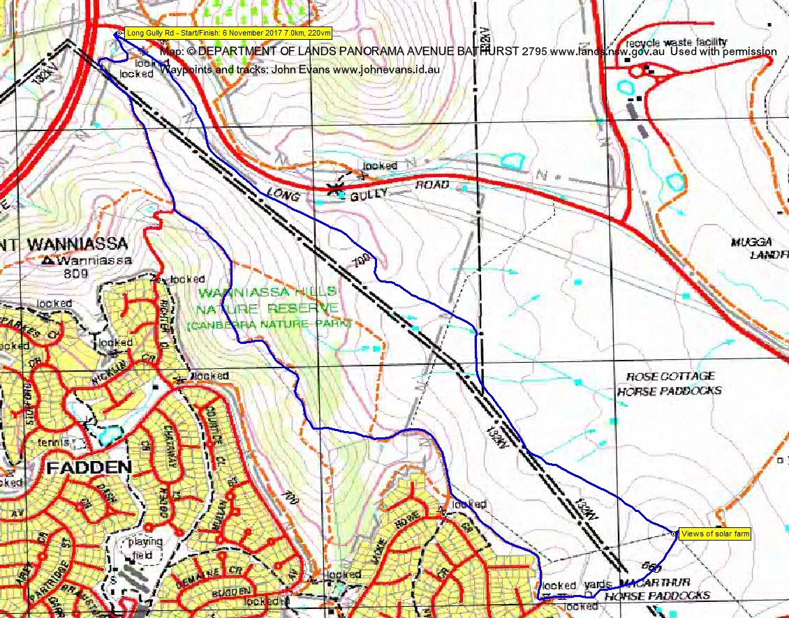
Monday evening 6 November: Southside Stroll in daylight savings – MacArthur (Horse) Park is melting in the dark … – S/E. A stroll along the flanks of Mt Wanniassa south-east through the grasslands of the Nature Reserve and Rose Cottage horse paddocks. From a prominent knoll, wonderful views to the Mugga Lane tip, the Hume solar farm and Tralee Hills. Return through MacArthur (Horse) Park “… I don’t think that I can take it …” and the edge of suburban MacArthur and Fadden. Around 6km and 240m climb. Map: Tuggeranong. Leader: John Evans 0417 436 877 john@johnevans.id.au . Transport: Drive yourself to meet at the reservoirs at the corner of Yamba-Erindale Drive and Long Gully Road, for a 6.30pm departure. No need to book.
Summary
Distance: 7.0km | Climb: 220m | Time: 6.30 – 7.50pm (1hrs 20mins) | Grading: S/E-M; E(6)
Photographs
Photographs are available, where you can start a large sized slideshow.
Waypoint and Track Files
Download the .gpx file. (Right click, Save Link As…, Save – if you want to use it.)
To use in Google Earth, do File, Open… and select Gps or All files as the File Type.
Track Notes
I was the slowest and oldest member in the party – of 2. Hopefully it was the weather (30ml of rain since 2am in Tuggers), not the leader, that put additional walkers off. But carpe diem and we didn’t get wet at all.
First time I’ve walked with Richard and he must have thought me a little strange, as he didn’t know of the epic song MacArthur Park (Richard Harris, 1968, 7mins 30secs of it!). He accepted my explanation of the walk description.
Always nice to stroll and chat. We viewed the advertised Mugga Lane tip, Hume industrial area, Tralee Hills and solar farm.
The sun came out at times and the roos grazed. We only crossed around 20 fences.
Thanks for coming Richard.
Track Map
Party
2 walkers – Richard H, me.