North Mundoonen Nature Reserve
Tuesday 7 April: North Mundoonen Nature Reserve – M/M. Change of plan with wet weather forecast. Leader: Jenny H.
5 of us drove in 2 cars to Sheldricks Lane, just off the Hume Highway. Around a 45min drive from our meet point on the Barton Highway near Hall.
Further Information
With a wet day including thunderstorms forecast, Ian W helped Jenny select a walk through woodland and more suited to the weather. Map: Gunning 1:50000; Jerrawa 1:25000.
The Mundoonen Nature Reserve Plan of Management is here.
Summary
Distance: 11.6km | Climb: 435m | Time: 8.50am-1.50pm (5hrs), with 55 mins of breaks | Grading: M/M; M(9)
Track Map
Track

Profile

Photographs
Photographs are available, where you can start a large sized slideshow.
gpx File
Download the .gpx file here. (Right click, Save Link As…, Save – if you want to use it.)
kml File
Download the .kml file here.
Track Notes
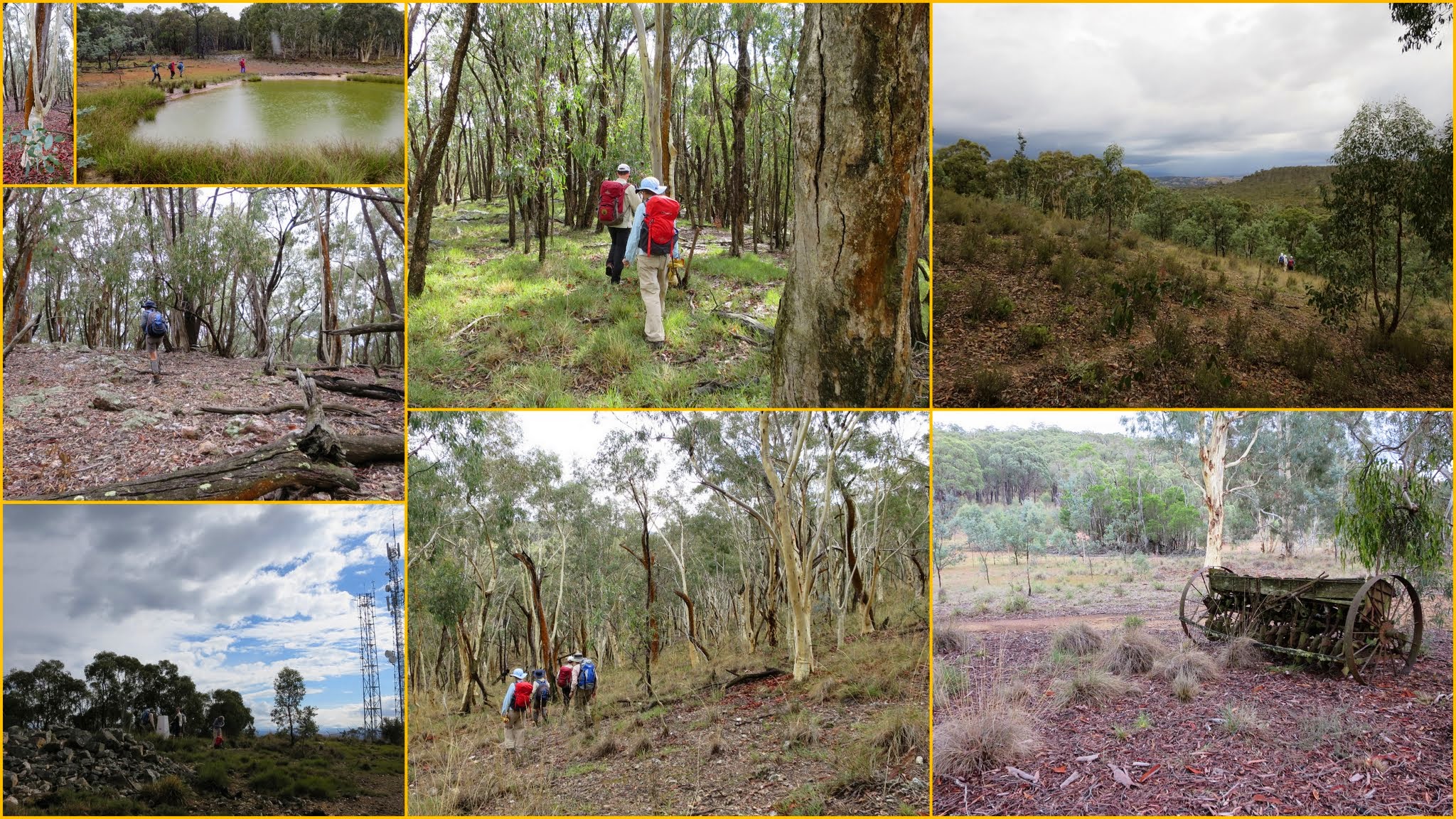
Patches of blue sky as we drove north, but with the forecast percentage chance of rain at 90%, we knew we’d get damp at some stage.
We climbed the Highway Trail service road to the communication towers on Mt Mundoonen. Quite an array of them, including (I presume) the main Sydney-Melbourne microwave link. A fancy NSW trig – white concrete column with a recycled marker on the top at about chest height.
Off-track from here, generally N-ish down a gentle spur clothed in eucalypt woodland. We drifted off the crest (a planned move!) down to the western edge of the southern portion of this area. A few grass trees about. N-ish along the fence line to a corner with a lovely view over open grazing land, then W-ish to the western edge of the NR. A little further N from this corner we found morning tea.
Ominous, loud and long rumblings as we walked N then NE over some higher ground and down to buildings marked on the OZraster Jerrawa 1:25000 map which Ian and I have. A substantial house and associated sheds. Very well watered – 3 large dams nearby and several tanks. Wonder what it was/is/is used for? No mention of it in the Management Plan. However, we made very good use of the verandah as we sheltered for 15 minutes from a savage thunderstorm that rolled over. Always nice to have digital connection on a walk (those huge towers on Mt Mundoonen!), so we could see its extent on the BOM radar. It did go away, but drizzle to rain for the rest of the day.
A bit of a Tasmanian-shaped route followed, N to the NW extent of the walk, SE to a dam then afterwards NE to the NE extent of the walk. Nice view over the surrounding cleared grazing land. Then generally S to lunch on wet logs at about ‘Hobart’.
Our wet weather gear was getting a good workout as we looped over to the west and back, just for the fun of it. Then back onto the Mundoonen Range. Another beautiful group of grass trees. Came off the crest and headed more directly back to the cars.
Great choice for a wet day and a part of Mundoonen Nature Reserve that we hadn’t visited before. Thanks Jen, and Ian for the idea.
Party
5 walkers – Chris F, Eric G, Jenny H (leader), Ian W, me.
Next Tuesday Walk
Tuesday 14 April: Yankee Hat Slabs and Bogong Creek – L/R,ptX. Starting from the Yankee Hat carpark we will ascend to the crest of the Yankee Hat Ridge from near the rock art site. There are excellent granite tors and extensive views at the top. We will then find a route down to Bogong Creek through the extensive slabs on the southwest flank of the ridge. We will then follow Bogong Creek back to the cars. This is a difficult, off-track, exploratory walk. There is thick scrub for most of the day and steep rocky slopes to negotiate. Minimum distance: 16 km with 700 metres of ascent Maps: Rendezvous Creek, Yaouk Leader: Ian W. Transport: 110 km return. Limit: 6.
Tuesday 14 April – no walking for me