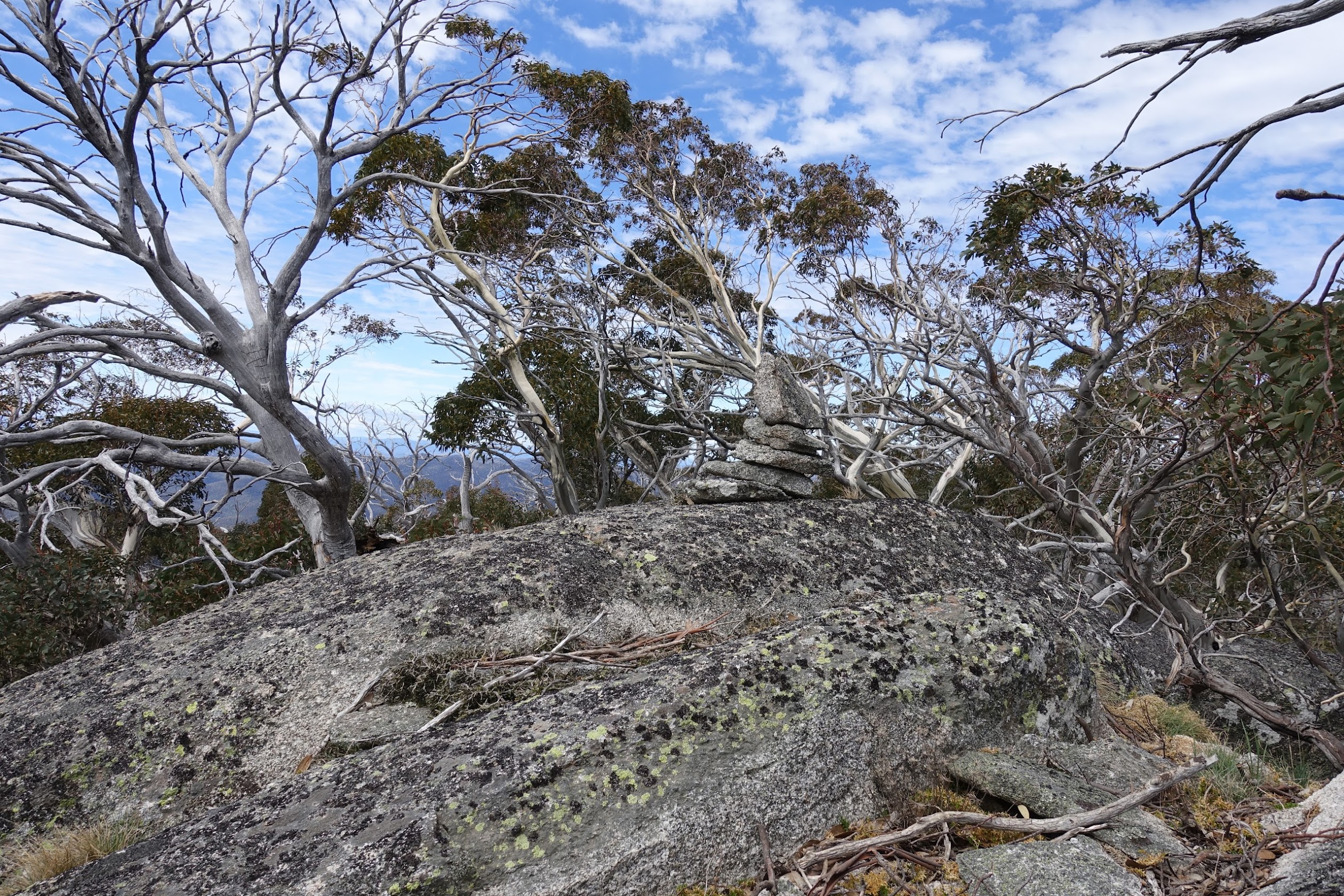
‘Ginger Ale’ with ACT border marker F59 on top
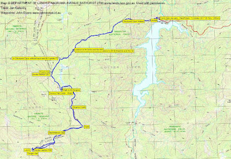
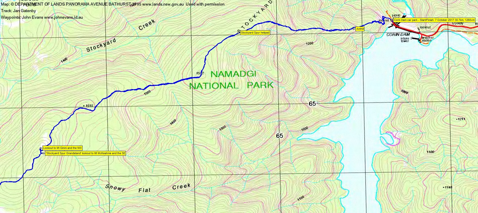
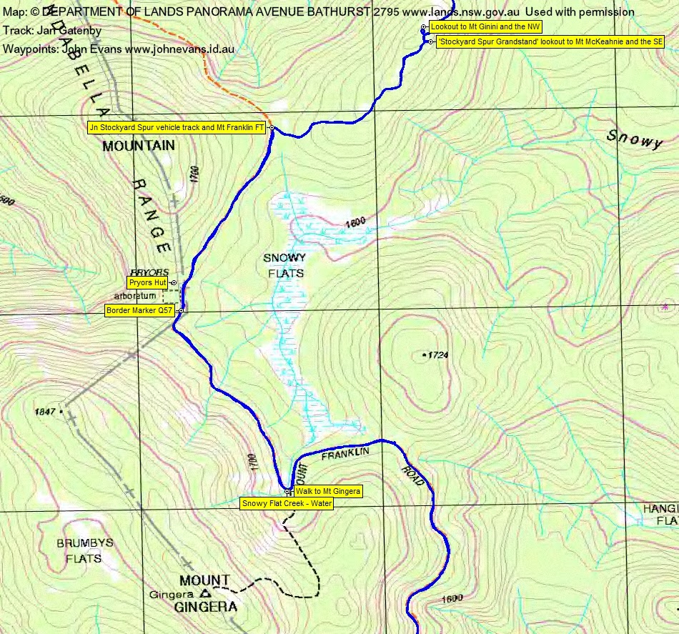
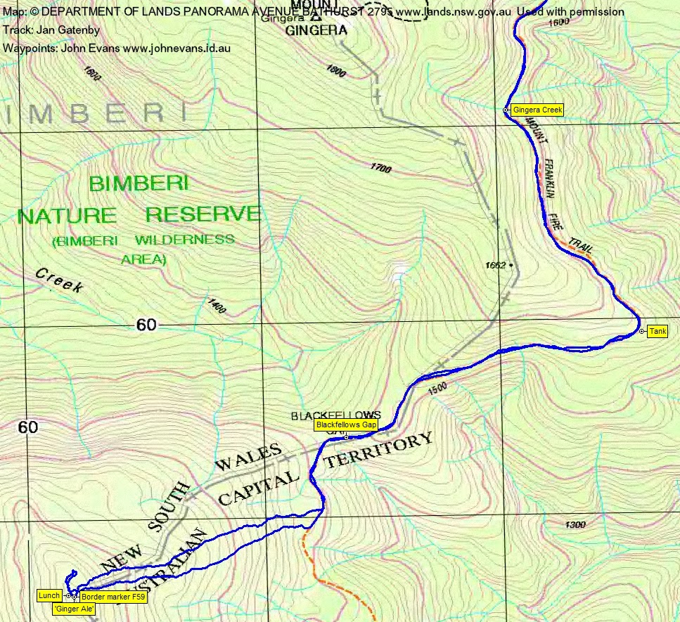
Saturday 7 October: Ginger Ale – L/M. From Corin Dam we have a long ascent to Stockyard Spur and then along the ridge to join the Mount Franklin Road beneath Little Ginini Mountain. We follow the road south, passing Priors Hut and Gingera, and continue to the top of the 1700m prominence on the ACT border southwest of Blackfellows Gap (often called Ginger Ale). Return via the same route. 27km and about 1100m climb. Map: Corin Dam. Leader: Mac K. Transport: $10 per person.
Further Information
Last times here were 11 May 10 and 27 Oct 12.
Summary
Distance: 31.0km | Climb: 1260m | Time: 8.30am – 6.05pm (9hrs 35mins), including 70 mins of breaks | Grading: L/M; H(14)
Photographs
Photographs are available, where you can start a large sized slideshow.
Waypoint and Track Files
Download the .gpx file. (Right click, Save Link As…, Save – if you want to use it.)
To use in Google Earth, do File, Open… and select Gps or All files as the File Type.
Track Notes
The 5th time in a row my GPSr has failed to record the correct track. I now have little confidence in it. A call in to Garmin technical support. Thankfully, Jan was recording both on an Etrex30 and via Back Country Navigator on her phone. Thanks to her for today’s track and something to send to Garmin to compare.
A training walk for some for Mac’s trip on the AAWT, starting in November. A straightforward trip, but a long day and most on the stony Mt Franklin Fire Trail. Great walking weather – not too hot, wispy cloud about. Met a couple of other groups on our return who had been up Mt Gingera.
Corin Dam-helipad: 2.3km, 57mins
Helipad-Mt Franklin Rd: 4.4km, 1hr 15mins including 11mins break
Mt Franklin Rd-leave to climb hill: 7.4km, 1hr 35mins including 5min break
Climb Ginger Ale: 1.4km, 55mins
Descend Ginger Ale: 1.2km, 30mins
Return to cars: 14.1km, 3hrs 25mins including 20mins of breaks.
Thanks Mac and all. A solid day.
I need to get the new camera under control. Set on extra fine, each photo is coming out at 15-20MB for 5472X3648. That’s a bit big.
Track Maps
Party
8 walkers – Cynthia B, Anita D, Jan and Phillip G, Mac K (leader), Ming L, Trevor L, me.
Next Saturday
Next Saturday is the Worn Boot Bash to Mt Clear. Around 30km and 1200vm, so pretty similar to today. So we should be able to knock it off in ∼10hrs.
Anita Davis
14 October , 2017 7:45 pmThanks for the photos John 🙂