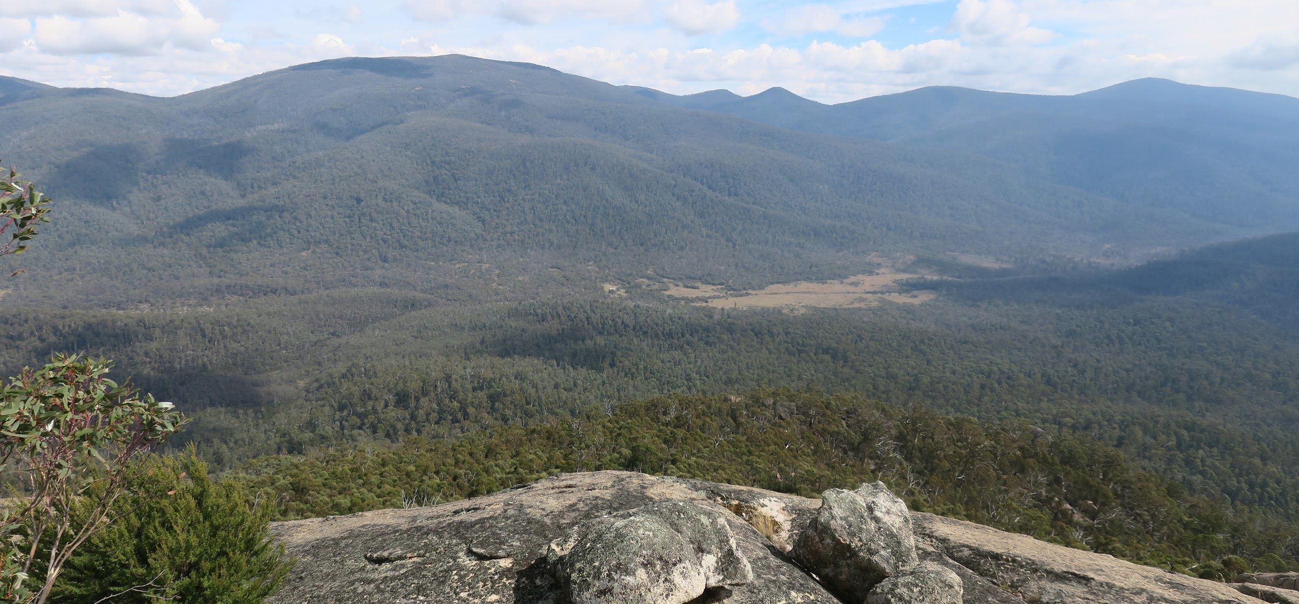
Bimberi Peak and Cotter Flats from Coronet Peak
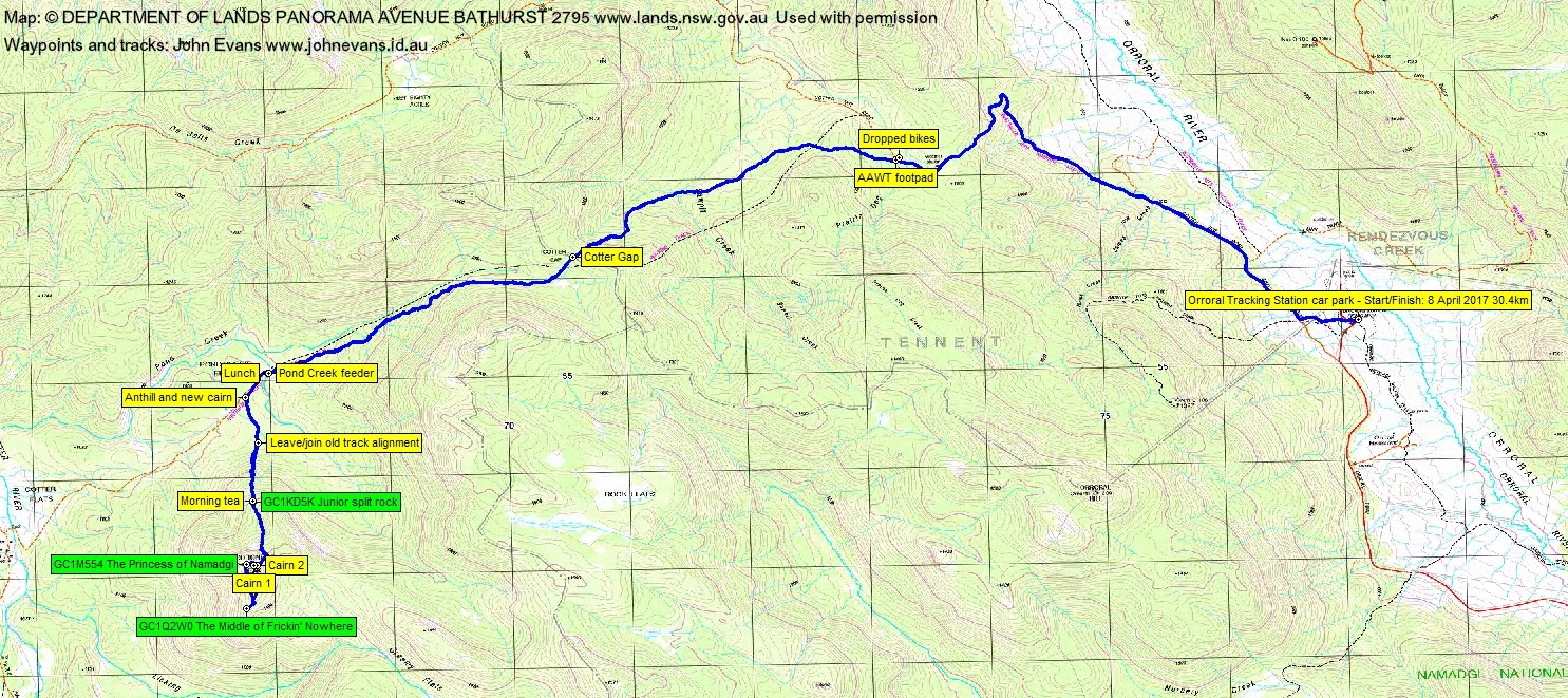
Saturday 8 April: Geocaches on Coronet Peak – L/R,ptX. Ride Cotter Hut Road to the Australian Alps Walking Track footpad. Walk the AAWT over Cotter Gap to below Coronet Peak. From near the Pond Creek crossing ascend to the south, picking up GC1KD5K Junior split rock. Further south along the ridge is GC1Q2W0 The Middle of Frickin’ Nowhere. Back around to the west of the granite crown, scrambling for GC1M554 The Princess of Namadgi. If time and energy allow, climb Coronet Peak. Around 32km and 1300m climb. Leave Canberra at 5.30am. Maps: Rendezvous Creek and Corin Dam. Leader: John Evans 0417 436 877 john@johnevans.id.au. Transport: You need your own mountain bike and transport. Book by Thursday 6pm. Limit: 8.
Further Information
This was my 8th trip to Coronet Peak, others on 25 Jul 15, 21 Oct 14, 19 Nov 13, 22 Feb 11, 11 Aug 09, 30 Oct 07, 6 Nov 05.
An expensive trip, with a car bashed by a kangaroo (in town!) and my new trifocals lost. But great logs and views too.
Summary
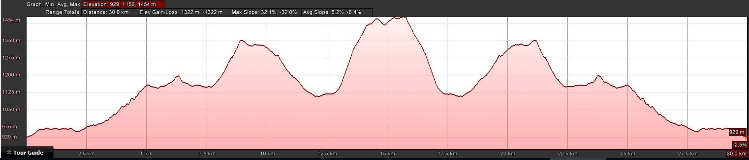
Distance: 30.4km (11.4km ride + 19km walk) | Climb: 1320m | Time: 6.20am – 3.10pm (8hrs 50mins), including 30 mins of breaks | Grading: L/R; H(14)
Photographs
Photographs are available, where you can start a large sized slideshow.
Videos
Waypoint and Track Files
Download the .gpx file. (Right click, Save Link As…, Save – if you want to use it.)
To use in Google Earth, do File, Open… and select Gps or All files as the File Type.
Track Notes
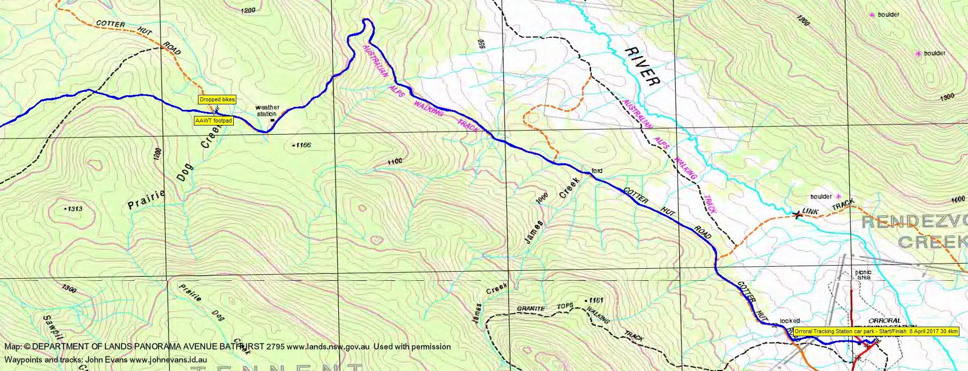
One of the advantages of beginning this walk with a ride to the edge of the Bimberi Wilderness is that you make the 5.7km to where the AAWT footpad leaves the Cotter Hut Road in quick time, even with a bit of a walk and push up the hill. Today, in the early morning light, it took 50 minutes. Of course, bikes have a few disadvantages, in that more transport is required and walkers without bikes and vehicles are excluded.
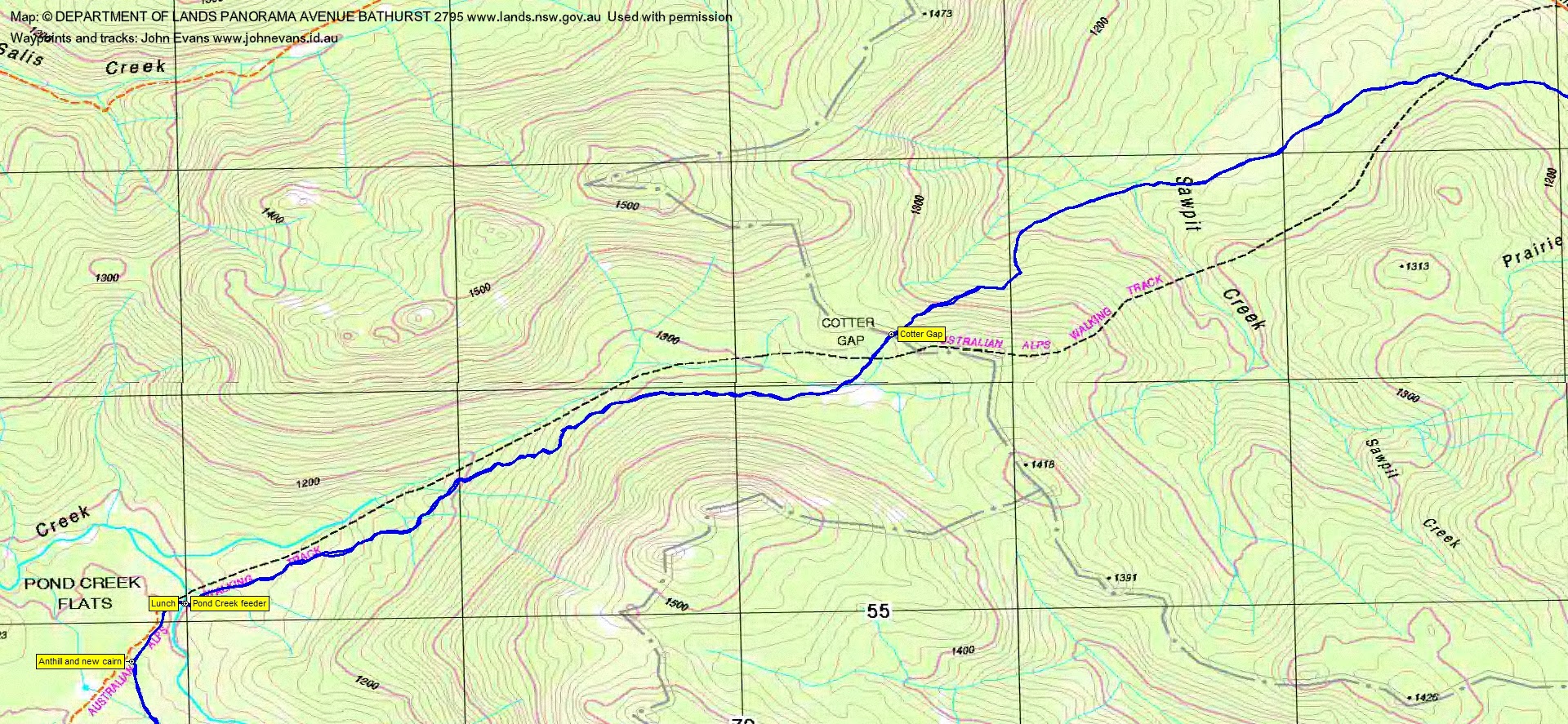
We dropped our bikes in the bush opposite the AAWT junction and set off along the track. Quick times today with a lad 50 years younger snapping at my heels. 3.3km to Cotter Gap in 45mins with Split Rock majestically above, like a freshly wiped butt. 3.2km from Cotter Gap to cross the Pond Creek feeder in 37mins. Some yellow-tailed black cockatoos and lyrebirds coming down the Pond Creek Cut. Only 8.40am so too early for a break.
The AAWT is in good nick, with the large fallen trees climbing to Cotter Gap sawn through and off the track and pronounced track-side clearing. Very pleasant walking.
300m further SW along the AAWT we came to the ant hill on the right and tiny group of stones on the left that marks the turnoff onto the old vehicle track (marked on the first edition Rendezvous Creek 1:25000 topo map) that make a somewhat vague route over into Little Creamy Flats. We followed the pad, then gap in the trees for a while, then turned towards the spur leading up towards Coronet Peak. The going wasn’t too bad (relatively speaking) and we made the 1.2km climb to the first geocache from the AAWT in 30mins. Found GC1KD5K Junior split rock which I’d logged on 21 Oct 14. Now 9.35am, so a bite of morning tea.
Our next leg took us 1.3km in 52mins south along the east side of Coronet Peak (giving it a good skirt) to find GC1Q2W0 The Middle of Frickin’ Nowhere. Again, I’d been here on 21 Oct 14. Great views to the west to Bimberi Peak and other Bimberi/Brindabella Ranges tops and down to the Cotter Flats and Cotter Hut. Realised I’d lost my new trifocals 😐 .
Having amused my companions with these two finds, it was now time for my goal of the day. We tracked north back along the spur towards Coronet Peak and, at a spot used on an abortive attempt to find the Princess on 25 Jul 15 and with advice from the cache owner to dip down low, we headed down and around the SW side of the granite flanking the dome. Easy when you know how and with a bit of scrub and very little scrambling, we were at the location shown in the spoiler photos. Cankid made the find of GC1M554 The Princess of Namadgi. Hooray! Again we enjoyed the views.
We’d heard of someone climbing to the top from this west side, so Cankid went that way. ‘One slip would not have been pretty’ was his comment when we met him at the top, so I’d not recommend this route.
The three of us climbed a little, then headed round to the north. An ah-ha moment as I passed a cliff-face, remembered from my first visit to Coronet Peak on 6 Nov 05. A very easy and short route round to Cairn 2, marking the usual way up to the top. So, basically, we circumnavigated Coronet Peak.
The usual excellent and uninterrupted views from the top. Longing gazes to the Namadgi bulb above Little Creamy Flats, where I hope to be caching next weekend.
We left at 11.45am. In the vain hope of finding my glasses, we tracked across to our inward route and followed it back to the first cache, but no joy. We continued on down to the AAWT, the 2km leg taking 1hr 10mins. Lunch at the Pond Creek feeder crossing.
We left at 1.15pm and trudged up the Pond Creek cut to Cotter Gap, down the other side and across to the Cotter Hut Road and our bikes. 6.5km in 1hr 30mins.
Now the fun of a quick trip down the hill. 5.7km in 25mins beats walking!
A bonus at the end with a cool down short walk and nab of GC70KD7 Space Stream-sucker.
Track Maps

Party
4 walkers – Hugh C (Cankid), Roger E (Marmaduke Rothschild), Martin E (TikvaNZ), me (JohnnyBoyACT).