Sphagnum moss stores and releases Canberra’s water
Tuesday 9 January: A Geocaching Journey in the Brindabellas – more driving than walking – S/M-R,ptX. For a hot day, this could be a good option. Drive the Mt Franklin Road as far as possible, to the Mt Ginini car park. Walk east down to Ginini Creek, then south along an old vehicle alignment and footpad through Morass Flats to the site of the Stockyard arboretum. Geocache GC6JBAP ‘Pining for you, Still’ is in the area. Exit across a feeder to Stockyard Creek and Cheyenne Flats. Around 5km and 220m climb. Drive to Bendora Dam for geocaches GC6JAY7 Bendora Bolt and GC6JAY3 Weird weir XXVII – Bendora, with access via tracks. Around 2km and 100m climb. Drive back along the Brindabella Road, then in Warks Road. Walk around 5km and 200m climb on fire trails to geocache GC7FPAZ Lightning Ridge. Some nice locations, even if you’re not into geocaching. Maps: Corin Dam, Tidbinbilla, Cotter Dam. Leader: John Evans 0417 436 877 john@johnevans.id.au . Limit: 8. Transport: ∼$18 per person.
Summary
Distance: 7.3km | Climb: 270m | Time: 8.00am – 1.55pm (5hrs 55mins), including breaks and driving between walks | Grading: S/M-R,ptX; M(8)
Photographs
Photographs are available, where you can start a large sized slideshow.
Waypoint and Track Files
Download the .gpx file. (Right click, Save Link As…, Save – if you want to use it.)
To use in Google Earth, do File, Open… and select Gps or All files as the File Type.
Track Notes
Yup, 170km of driving and 7km of walking! Huge thanks to Mike B who drove the 5 of us in his big 4WD, rather than taking 2 SUVs. The weather forecast for the day was not encouraging but, in the end, we only experienced one short shower as we walked up from Cheyenne Flats and were back in Canberra before the thunderstorms started. The March flies were not too welcome.
Walk 1
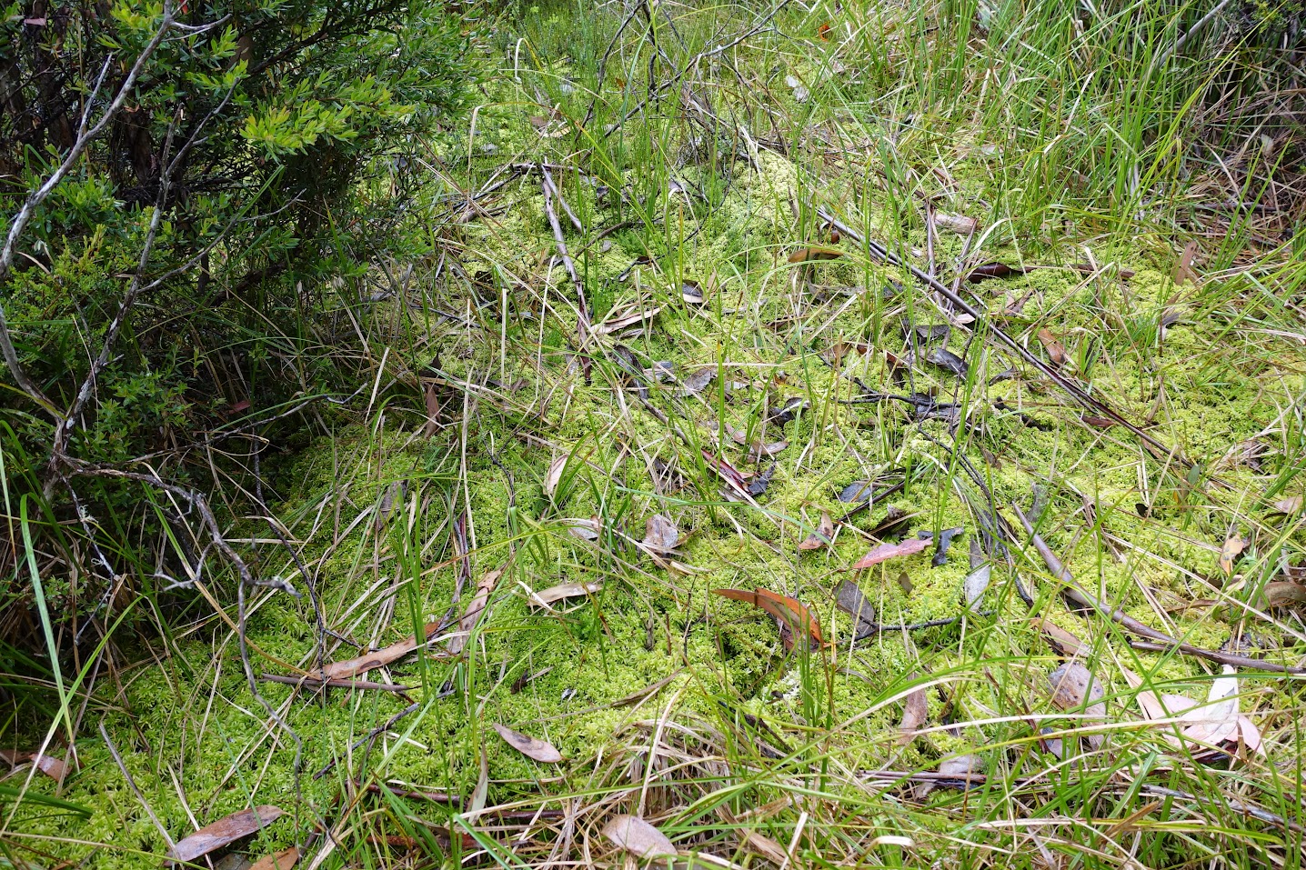
This area below Mt Ginini is a lovely spot – the Namadgi Bog consists of Morass Flats and Cheyenne Flats. Ginini Creek flows north from the area and a feeder to Stockyard Creek to the south. Alas, the old vehicle track alignment is no more, just vestigial signs and a footpad in some places. The Namadi Bog Restoration signs now lean against a tree. We found where the 4WD track crosses the creek. On to pass an old insulator on a tree and pick up the broken phone line which went to the Stockyard Arboretum Hut. Only two huge fir trees remain at the Stockyard Arboretum site. Armed with information collected on the way, in the area we found the final GZ of geocache GC6JBAP Pining for you, Still and logged it. (The published track has been altered so as to not give away the location.) A direct NW exit across the lower part of Cheyenne Flats to rejoin the Mt Franklin Road. Some lovely sphagnum in places. Morning tea.
Walk 2
Back at the Bulls Head picnic area, it’s a 28km return trip into Bendora Dam. The huge boulder within 1km of turning down looks better as the years go by, now accompanied by nice tree ferns. A quick find of GC6JAY7 Bendora Bolt. Man, that is a big bolt and nut! We then wandered down the track to below the dam for another quick find of GC6JAY3 Weird weir XXVII – Bendora, followed by a leisurely look around the dam wall. Huge views up to the Cow Flats Creek cliffs – might I dare to venture back there after 10 years? Lunch at a picnic table in the shade.
Walk 3
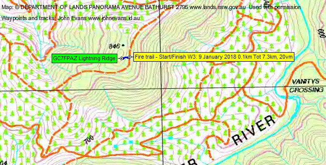
We then drove back down Brindabella Rd and in Warks Rd to the locked gate near the intersection with Yellow Rabbit Rd. From here I’d planned a 5km return fire trail walk for the final cache of the day. But, in keeping with the ‘more driving, less walking’ theme, Mike kindly wheeled us up the fire trail to within 50m of geocache GC7FPAZ Lightning Ridge. Views to the enlarged Cotter Dam. We strolled up through the light bush to log it.
A soft day, but some locations I hadn’t visited for a while. Thanks again for driving, Mike.
Track Maps
W1

W2

W3
Party
5 walkers – Mark B, Mike B, Roger E, Neil W, me.