Leaving the Shoalhaven River

Tuesday 9th September: Nadgigomar Nature Reserve South – L/M. This is a long off-track walk in the southern section of Nadgigomar Nature Reserve, 15 km north of Braidwood. From the Euradux Road entrance we will follow a maze of spurs and gullies with many short, steep, ascents for 11 km to the northern boundary of the reserve on the Shoalhaven River. The return route is through undulating country in the east of the reserve. The going is either quite open in dry sclerophyll woodlands, or slower going through Casuarina forests. Minimum distance: 23 km with ~ 800 metres of ascent Map: Durran Durra. Leader: Ian W. Transport: 200 km return. Limit: 8.
8 of us drove in 2 cars via Braidwood (well, Dawsons Lane) to park at the NR entrance on Euradux Road.
Summary
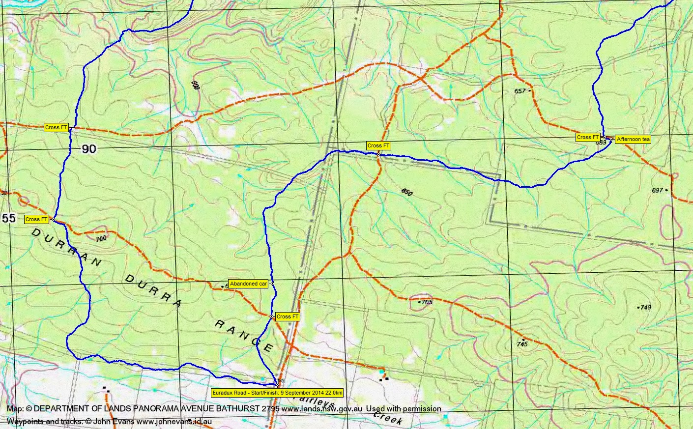
Distance: 22.0km | Climb: 550m | Time: 8.40am-4.15pm (7hrs 35mins), with 45 mins of breaks | Grading: L/M; H(12)
Track Maps
Track overview

Track 1
Track 2
Track 3
Photographs
Photographs are available, where you can start a large sized slide show.
Google Earth
Download the Google Earth .kmz file here.
Track Notes
Another interesting day following our last trip in this Nature Reserve on 12 August.
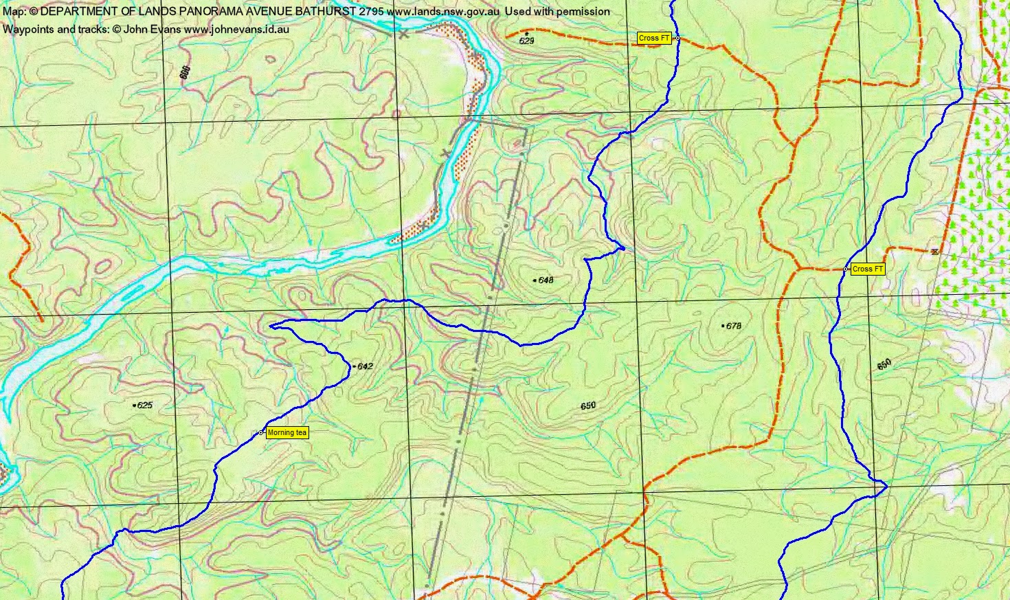
Ian took us on a well planned walk up spurs, along ridges and down gullies, through a variety of vegetation communities. Mainly open woodland going, eucalypt and she-oak, with some heath areas and fields of Dianella. Fire trails were definitely out today – we crossed 9 of them.
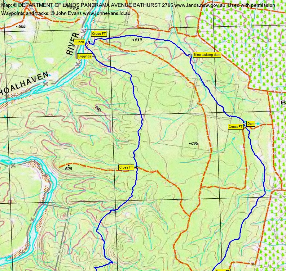
A great digging site up above the Shoalhaven and a lovely river sand bar for lunch. A sluicing dam east of the diggings with faint traces of an aqueduct leading away from it.
A good distance, but easy walking.
Party
8 walkers – Peter C, Cynthia C, Chris F, Linda G, David and Meredith H, Ian W (leader), me.
Next Tuesday Walk
Tuesday 16 September: Gillindich Nature Reserve – L/R/X. This is an exploratory walk 25 km north of Crookwell. The Reserve is rugged country of about 4 km x 3 km, with steep gullies and ridges covered in dry grassy woodlands. The walk is mainly off-track with numerous steep ascents and descents. Emergency contact details must be registered/provided to book. Minimum distance: 17 km with ~ 750 metres of ascent. There is a 2 hour drive each way. Map: Bigga 1:50,000 Leader: Ian W. Transport: 320 km return. Limit: 8.