Tallaganda NP – dirt bike trail | boulders | feeder creek | Mulloon Creek flats | ferny feeder creek | creek confluence
Tuesday 13 May: Tallaganda National Park – M/M. A walk around the western side of the Tallaganda National Park. Mixture of off track, fire trail, and foot pads through generally open forest and along Mulloon Creek for a bit. Visit a nice bouldering boulder (not Serenity Rocks) with hopefully good views to the west, and an abandoned mine shaft. Map: Bombay 1:25,000. Leader Roger E. Transport estimated. $50.00 per car. Limit 8.

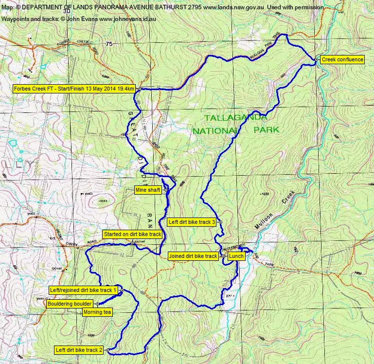
8 of us drove from Canberra via Queanbeyan, Captains Flat Rd, Briars Sharrow Rd, Plains Rd, Hoskinstown Rd, Forbes Creek Rd to the junction of Forbes Creek Rd, Mulloon Fire Trail and North Black Range Fire Trail.
Summary
Distance: 19.4km | Climb: 710m | Time: 8.20am – 3.30pm (7hrs 10 mins), with 50mins of breaks | Grading: L/M; H(12)
Track Maps
Track overview
Track 1
Track 2

Photographs
Photographs are available, where you can start a large sized slide show.
Google Earth
Download the Google Earth .kmz file here.
Track Notes
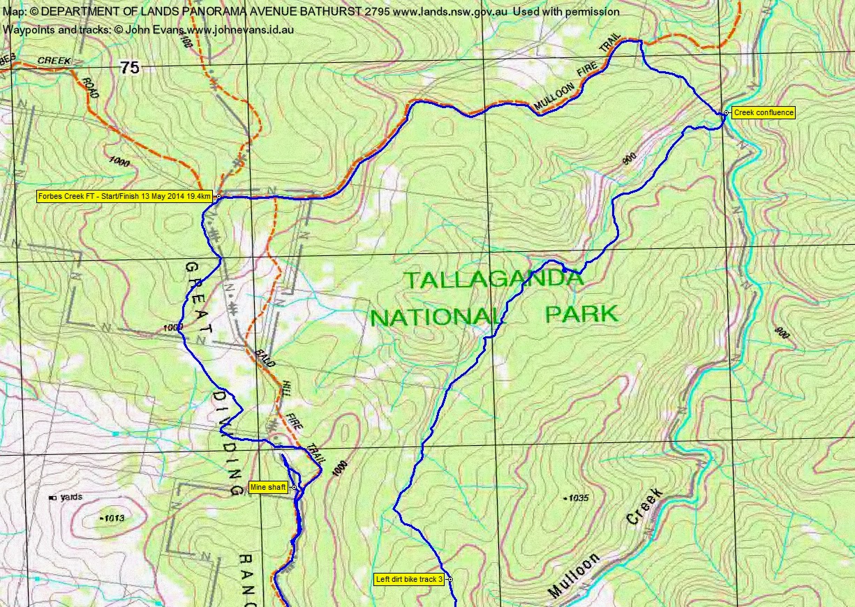
Only 35km from Queanbeyan via Hoskinstown. S from the start, paralleling the Bald Hill FT but sooo much nicer. Lovely open forest. Onto the fire trail for a bit, then a back track. Roger was working from a rogaining map (as well as carrying 1:25000 topo maps and GPSr) which referenced an area containing a mine shaft. Some searching, then David came up with the goods. A small, vertical shaft (who knows how deep – we could see water at around 10?m down). It must have been hard to work.
Back to the Bald Hill FT and along it for ~1km. We then turned onto a dirt motor bike track which paralleled the Galvins Creek FT in a W direction. We stepped aside as 2 bikes roared past us. Easy walking through open brown barrel forest. The track wiggled S then E till we left it and headed 500m SW to Roger’s next POI – a group of boulders which are used for bouldering. Last visited by Roger on a rogain. A couple of wire brushes strapped to long poles – for grooming the rock surfaces prior to activity? Nice views to the open valley to the NW where Rossi is situated. After a look about we had morning tea.
Back on the dirt bike track, we walked it a further 1.2km, then turned E up the hill to rejoin the Bald Hill FT on the crest. 830m N on this, then generally E down to Mulloon Creek. Some lovely areas as we descended via a drainage line to the edge of the creek flats.
Here, in error, we may have strayed a few metres onto private land. We could see a lovely clearing and building across the creek flats and you can see the marked off blocks on the map segment. We returned to the edge of the NP as soon as we could. A kilometer took us N to the Jinglemoney Fire Trail, a quick view of the ford of Mulloon Creek, then an ascent up a new alignment of the fire trail to a junction. Lunch on a log in the sun.
Our afternoon leg took us first via a section of dirt bike track, then off-track down to a feeder creek to the main Mulloon Creek. We ambled down the creek line for 3km through generally open forest, crossing the creek on a couple of occasions. We ended up at the confluence of the feeder creek and Mulloon Creek, approximately 800m S of the Mulloon Creek ford where the Mt Palerang walk starts.
NW across a gentle spur, then back up the Mulloon Fire Trail to the cars.
A great round with a couple of points of interest and lovely open forest walking.
Party
8 walkers – Paul C, Roger E (leader), Jenny H, Stewart J, Phillip S, David P, Ian W, me.