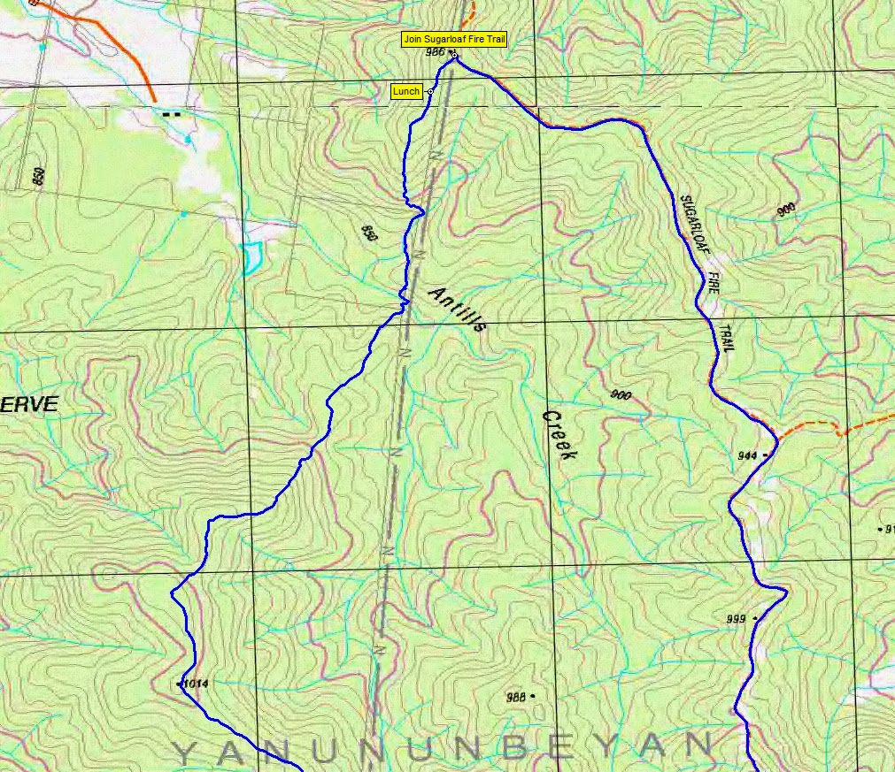
Climbing North out of Antills Creek through dry sclerophyll woodland
Tuesday 29 April: Yanununbeyan National Park – L/R,ptX. The walk starts about 8 km northwest of Captains Flat at the junction of Woolcara Lane and Spring Creek Fire trail (GR 138606). We will head northeast, mainly off-track, for a few hours through the Yanununbeyan State Conservation area and also the Yanununbeyan National Park. Most of the area is new to the leader and how far we get depends on the type of forest and scrub we encounter. Our return route is mainly on fire-trails via Mount Foxlow. Minimum distance: 20 km with ∼600 metres of ascent. Maps: Captains Flat, Hoskinstown. Leader: Ian W. Transport: ∼115 km return. Limit: 8.

4 of us drove from Canberra via Queanbeyan, Captains Flat Rd, Woolcara Lane.
Summary
Distance: 24.5km | Climb: 920m | Time: 8.15am-4.10pm (7hrs 55mins), with 40 mins of breaks | Grading: L/M; H(14-)
Track Maps
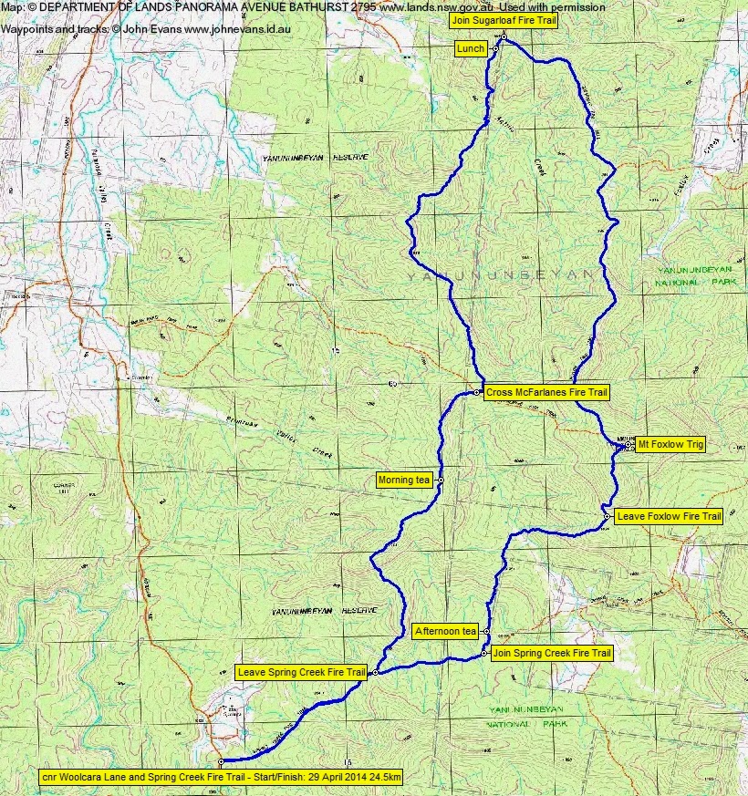
Track overview
Track 1
Track 2

Track 3
Photographs
Photographs are available, where you can start a large sized slide show.
Google Earth
Download the Google Earth .kmz file here.
Track Notes
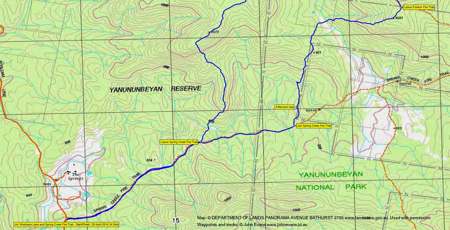
Ian had a solid route planned. We headed up the Spring Creek Fire Trail for a while, then struck off N-ish through the Yanununbeyan Reserve. Fortunately, we found the going to be open, dry sclerophyll woodland for all the day when off-track. I was sporting a recovering twisted knee and it took a bit of a bashing particularly going down hill. A kill or cure walk.
Morning tea above the headwaters of Primrose Valley Creek, the open valley of which we initially drove in to turn down Woolcara Lane is emerald green.On to cross McFarlanes Fire Trail. We continued N along the undulating crest of the ridges. Easy walking.
Crossed Antills Creek – some magnificent Manna Gum (Eucalyptus viminalis) there. Lunch just shy of the Sugarloaf Fire Trail. Ian was happy that we’d reached his N-most objective an hour ahead of schedule; I was happy that I could still walk.
Joining the Sugarloaf Fire Trail (and after gazing at the amazing house built high up on it), we turned S and tromped along it to meet the Foxlow Fire Trail. This took us up to Mt Foxlow. Not much of a view, even from the top of the fire spotters tower pole, but they sure built magnificent cairns in those days. We were in the Yanununbeyan National Park.
About 1km S of Foxlow trig we left the fire trail to give our feet a rest and skirted a private block. Back onto the Spring Creek Fire Trail and so to the car.
Although I’ve been to Mt Foxlow on 14 Apr 12, we covered a whole lot of new ground for me today. And I could still (just) walk when we got back to the car.
12.3km of the 24.5km was on fire trail.
Party
4 walkers – Eric G, Jenny H, Ian W (leader), me.