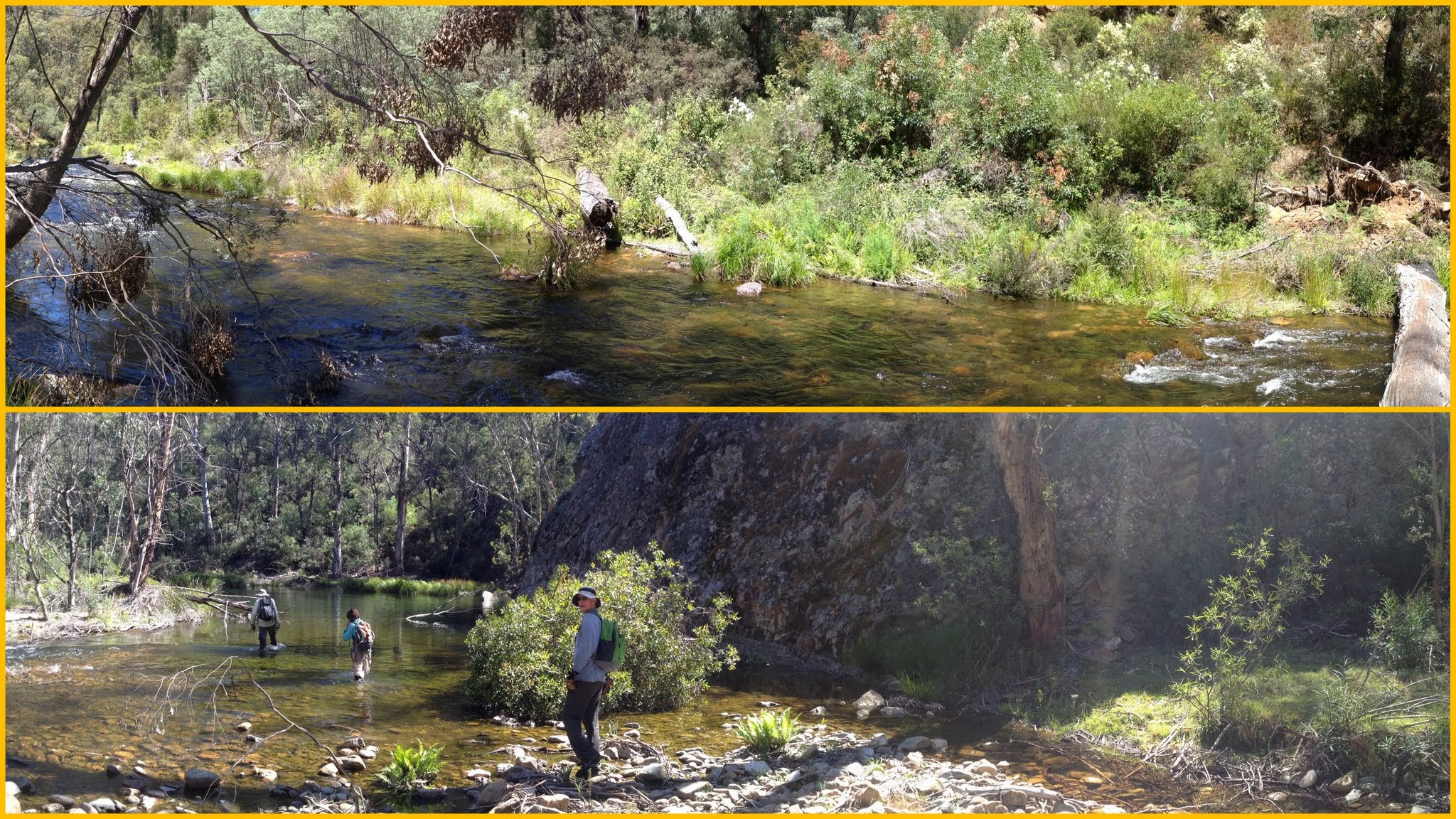
Cotter River at lunch | Last crossing of the Cotter River around 500m downstream of Corin Dam
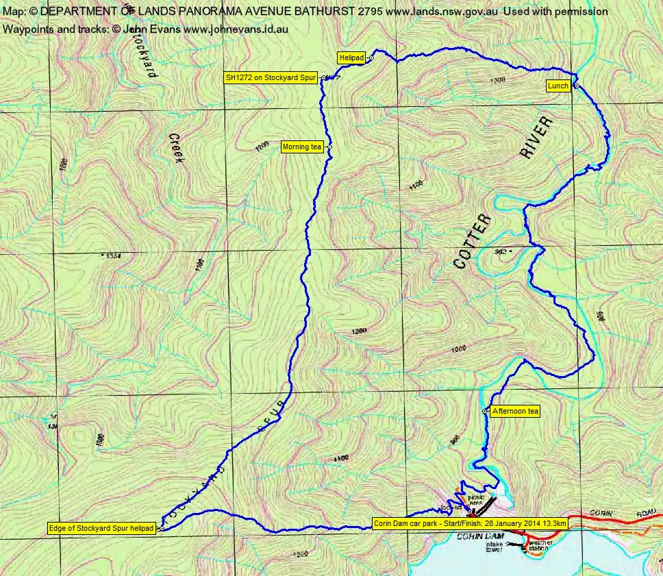
Tuesday 28 January: Stockyard Spur and Cotter River – L/R,WX. Ascend Stockyard Spur track from Corin Dam to helicopter pad then NNE along crest of Spur as far as practicable in time available before descending to Cotter River for lunch. Return via river bed to start. Expect scrub along crest with some recently burnt-off areas, much rock scrambling and probable wet feet on return leg. Exploratory for leader. 18 km and 700m height gain. Map: Corin Dam. Leader: Eric G. Transport: $60 per car. Limit: 8.
6 of us drove from Canberra to Corin Dam.
Further Information
My last trip in this area was on 15 May 07.
Summary
Distance: 13.3km | Climb: 825m | Time: 7.30am-4.05pm (8hrs 35mins), with 45mins of breaks | Grading: L/R,W; H(13)
Track Maps
Track overview
Track 1
Track 2
Photographs
Photographs are available, where you can start a large sized slide show.
Video
Google Earth
Download the Google Earth .kmz file here.
Track Notes
It was actually cool as we began, but bodies soon warmed past walking temperature as we climbed to the heli pad on Stockyard Spur. The regulation 1hr for the 2.2km and 500m climb. Here 2 of our party departed company as one was suffering malaise. They wandered on a bit, then returned to wait the day for us.
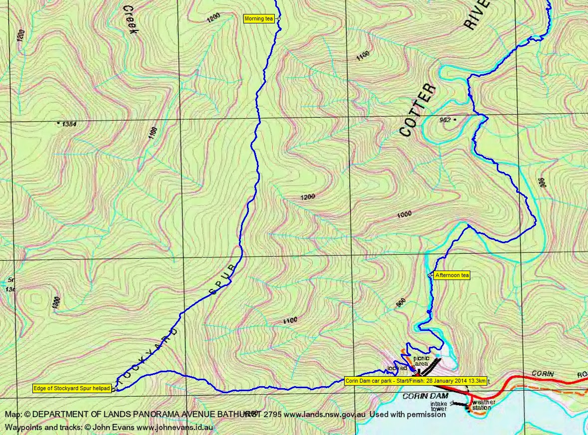
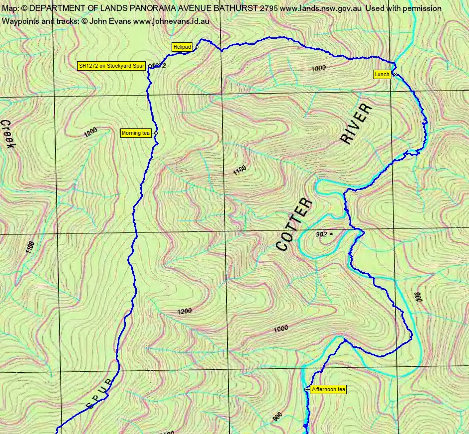
We turned down to the right, following the Stockyard Spur crest generally N and generally along the old vehicle track (see my Namadgi Footpads, Stockyard Spur track – down). Initially open going through a recent controlled burn, relatively easy going on the old vehicle track alignment, pea and wattle regrowth when not. Including a 15min morning tea, we covered the 3.7km to SH1272 in 1hr 45mins.
Here we bent away to the NE via another cleared helipad (missing the top of the spur for a while) and crashed down to the Cotter River. Some medium scrub in patches at the top, but very thick as we dropped towards the river. Eric set a substantial pace – and I won’t say how many more years older than me he is. The descent took 1hr 25mins over 2km and a drop of 400m.
Glad I was to see the Cotter River and a substantial fallen tree to bridge us across to the E side. Very soon lunch was called.
It wasn’t long after lunch that we were in the river. There was a considerable flow of water, releasing from Corin Dam to feed Bendora Dam and so gravity feed to Canberra. We alternated sides – crossing the Cotter several times; water and river bank. Dense patches of scrub in places, particularly as we negotiated up and over spurs to cut out large bends in the river. The water was soothing in the heat of the day and, refilling our water bottles, pure as the driven snow. A brief afternoon tea was called just within sight of the Corin Dam wall, but still with 750m of crow flying to go. From lunch to arvo tea took 3hrs to cover the 4.1km.
Continuing upstream, we crossed the Cotter to the W bank for the last time, headed for the bottom of the spillway, trudged up the access zig-zag road and spotted 2 friends hanging around the toilet block (it was shaded and cool – on the outside). This last 1.3km took 45mins.
I’m not aware of anyone covering this territory since Max and my trip on 15 May 07. We now know why.
Party
6 walkers – Peter C, Vin F, Eric G (leader), Linda G, Ian W, me.