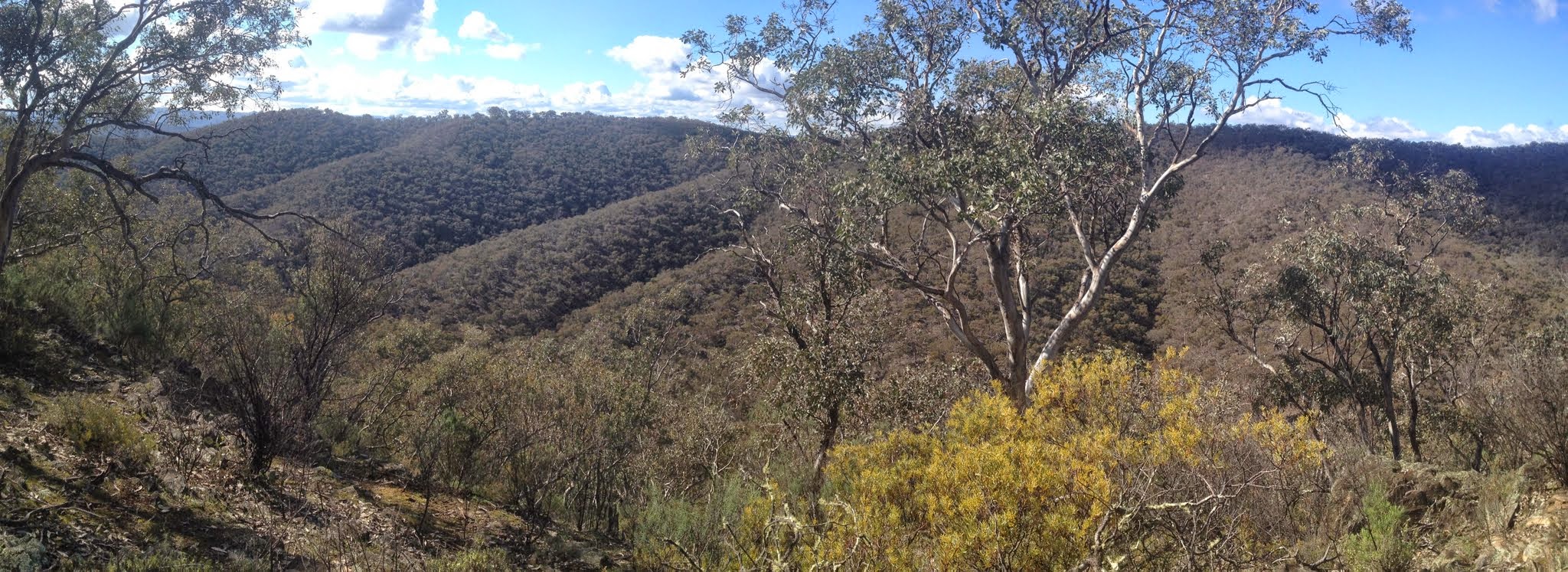
View to the ridges and spurs between Tuena Creek and Bears Gully
Tuesday 22 July: Nuggetty State Conservation Area – L/M/X. This is an exploratory walk 40 km north of Crookwell. The Nuggetty SCA is rugged country of about 6 km x 3 km, with numerous steep gullies and ridges covered by dry grassy woodlands. Emergency contact details must be registered/provided to book. Minimum distance: 4 km of fire trail and 15 km off-track, with ∼900 metres of ascent. There is a 2h 20 minute drive each way. Map: Bigga 1:50,000 Leader: Ian W. Transport: 380 km return. $140 per car. Limit: 8.
6 of us drove in 2 cars from Canberra via Sutton, Gundaroo, picking up a 7th in Gunning, through Crookwell to park off the side of Junction Point Road at an entrance to the Nuggetty SCA. Around 2.5hrs each way.
Further Information
If time and leader allow, look for geocache GC2NAY4 Crookwell Racecourse.
Summary
Distance: 16.6km | Climb: 880m | Time: 9.10am-5.10pm (8hrs), with 30 mins of breaks | Grading: L/R; H(12-)
Track Maps
GC2NAY4 Crookwell Racecourse

Track

Photographs
Photographs are available, where you can start a large sized slide show.
Google Earth
Download the Google Earth .kmz file here.
Track Notes
I believe I am being drawn to the dark side because, as soon as I’d checked out the planned route from Ian, I checked to see if there were any nearby geocaches. GC2NAY4 Crookwell Racecourse was available, the description saying that the Crookwell races are conducted on the farm ‘Funny Hill’. Jokes abounded about the funny farm. Ian graciously allowed me a minute to recover and log it, a quick and easy find.
I’d dressed for Canberra cold. When we got out of the cars it was cool, but not cold and the thermal pants came off. I had a beanie with me – did I have a hat? No worries, as Linda had presented me with a presso from Feral Kaza, the Kimberley bat girl – and it was a mighty fine one too. Immediately useful. Thanks Karen!
We immediately got a view of what was to come – the spurs, ridges and knolls of the Nuggetty SCA rose in front of us, lightly timbered in dry Sclerophyll woodland and crossed by some fine flowing streams. Ian had a loop planned for us that looked pretty flat on the maps until, of course, we reminded ourselves that it was 1:50,000 so the contour interval was 20m. We headed generally NE, stopping for a brief morning tea before crossing Nuggetty Creek.
A climb of an open spur, a bit of crest, then down into Tuena Creek. A couple of digging sites as we crossed, then re-crossed the Creek. We found no gold, so thought a better name would be Un-Nuggetty SCA.
Then a long climb of another spur to the crest near the N-S fire trail on the eastern side of the SCA. The day was quite mild and layers of clothing were shed. The party was a bit slower than expected, so we got all of 15mins for lunch and Ian slightly modified his plans.
An un-marked fire trail took us steeply down to cross Tuena Creek again. From here, generally NW off-track across a series of spurs to descend to Bears Gully.
Here a delightful side creek provided our exit route and we climbed up it for as long as time allowed. A nice mini-cascade.
More twists and turns and ups and downs returned us to the cars pretty much on sun set. We could not have delayed much more. An interesting track profile.
A 14 hour day, door to door, and a long day of concentration for our drivers. Thank you Ian and Stewart. But well worth the effort to walk in a new area. Thanks Ian for the planning and leadership.
Party
7 walkers – Chris F, Eric G, Linda G, Nathan H, Stewart J, Ian W (leader), me.
Next Tuesday Walk
Tuesday 29th July: Tinderry Nature Reserve Northern Section – L/R/X. This is an exploratory walk to investigate some large granite slabs and tors in the northern section of the nature reserve. Starting on the Burra Road, we will follow the West Keewong Fire Trail for 6 km to the crest of the Tinderry Range then spend the rest of the day off-track in steep spur and gully country. This is a hard walk with steep rock scrambles and possibly thick scrub in places. Emergency contact details must be registered/provided to book. Minimum distance: 13 km off-track plus 7 km of fire trail. ~ 800 metres of ascent. Maps: Williamsdale, Michelago, Tinderry Leader: Ian W. Transport: 110 km return. Limit: 8.