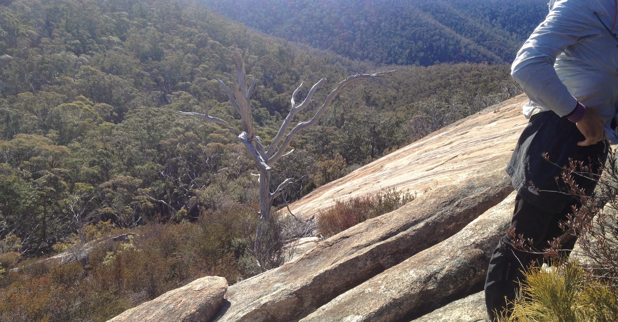
Top of the slab of North Tinderry Bluff (aka seldom seen slabs)
Tuesday 29 July: Tinderry Nature Reserve Northern Section – L/R,X. This is an exploratory walk to investigate some large granite slabs and tors in the northern section of the nature reserve. Starting on the Burra Road, we will follow the West Keewong Fire Trail for 6 km to the crest of the Tinderry Range then spend the rest of the day off-track in steep spur and gully country. This is a hard walk with steep rock scrambles and possibly thick scrub in places. Emergency contact details must be registered/provided to book. Minimum distance: 13 km off-track plus 7 km of fire trail. ∼800 metres of ascent. Maps: Williamsdale, Michelago, Tinderry. Leader: Ian W. Transport: 110 km return. Limit: 8.
8 of us drove in 2 cars via the Monaro Highway, Williamsdale Rd and Burra Rd to an entrance to the Tinderry Nature Reserve near the West Keewong Fire Trail.
Further Information
If possible, look for geocache GC176TV Last Stop Michelago.
Summary
Distance: 16.6km | Climb: 765m | Time: 7.55am-3.30pm (7hrs 35mins), with 55 mins of breaks | Grading: L/R; H(13)
Track Maps
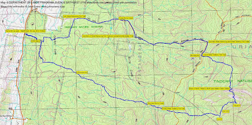
Track overview
Track 1
Track 2
Photographs
Photographs are available, where you can start a large sized slide show.
Video
Google Earth
Download the Google Earth .kmz file here.
Track Notes
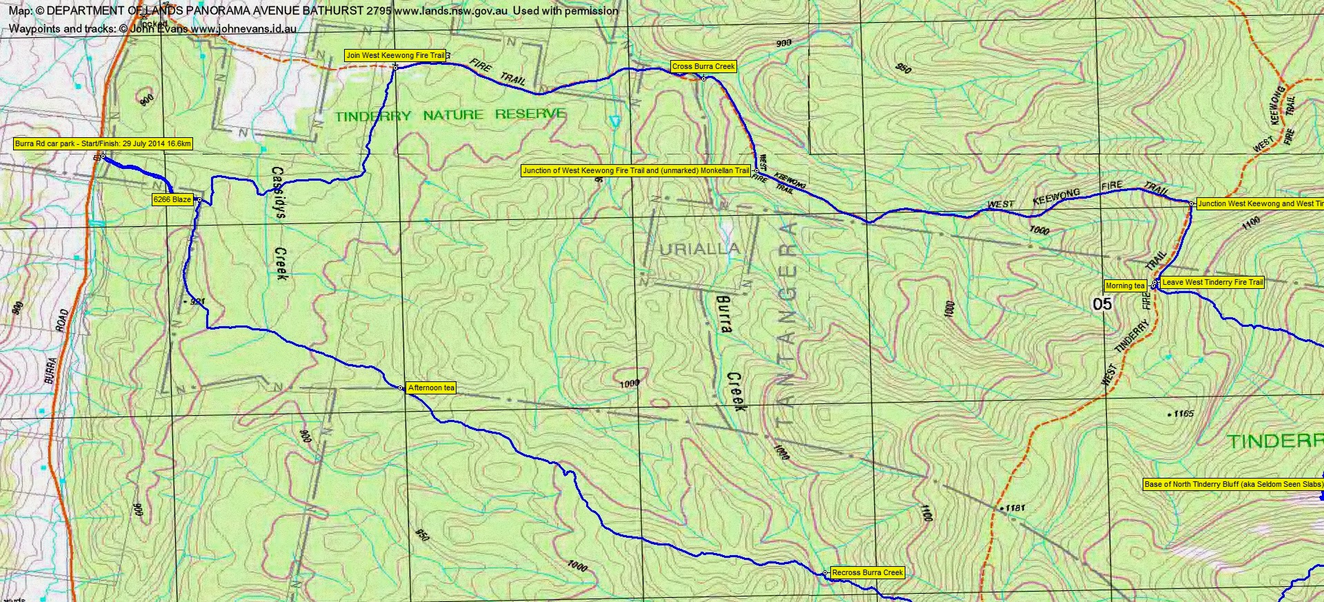
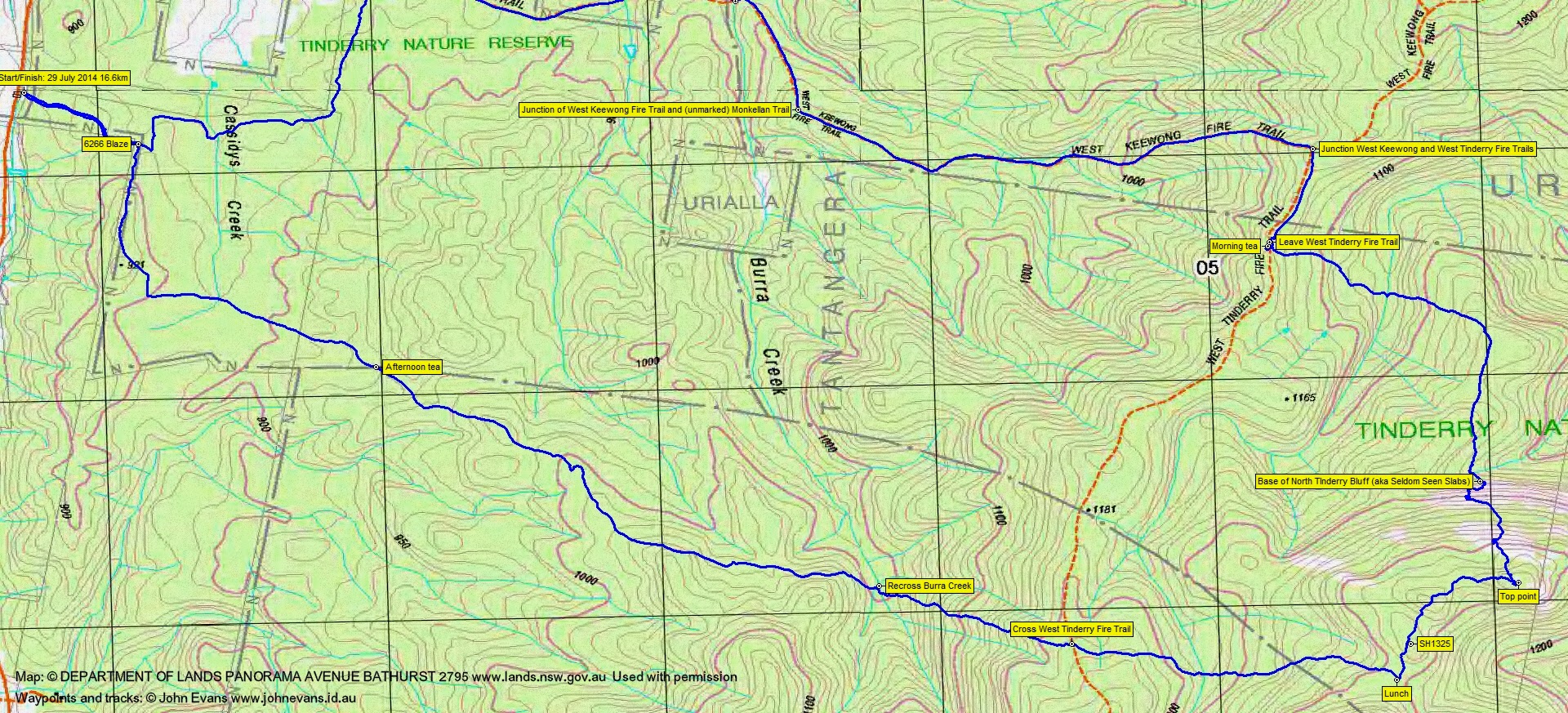
Ian lulled us into a false sense of security as we followed an un-map marked fire trail from the NR entrance generally east over Cassidys Creek, then north to join the West Keewong Fire Trail. There was even some down as we crossed Burra Creek. But we knew a climb would eventually start and there was a gentle up after crossing Burra Creek to climb to the intersection of the West Keewong Fire Trail and the un-map marked Monkellan Trail. From here there was a further 200m climb to the West Tinderry Fire Trail, including one section to trudge that rises 100m over 50mm across the ground. From the cars to the West Tinderry Fire Trail was 6.1km in 1hr 25mins.
We turned south and after 500m slipped into the bush on the side of the fire trail for morning tea. The wind made us cool.
Back on the fire trail on the crest, we headed down the eastern side to cross a fast flowing feeder of Tinderry Creek, climbed, then turned south to arrive at the base of a granite slab structure that we named North Tinderry Bluff (aka Seldom Seen Slabs).
Now it’s been some time since I’ve lain on my stomach and huffed and puffed. Whilst the others monkeyed up the slab (not a great distance, but as steep as the Gudgenby slabs), I got stuck and expended quite a deal of energy getting nowhere. Don’t know why, but it was a real effort for me to make the top.
From the top of the main slab, our route continued to rise relentlessly, another 150m over 400m on the ground. At last we reached the top point. From base to top was 760m across the ground in 60 minutes, climbing 200m.
Great views from the top, especially west to the snow-capped Brindabella Range.
We followed the bouldery top generally SW through SH1325 and a little further on found lunch.
The return leg from here was mostly through open dry sclerophyll woodland and forest, but we still had a way to go. Down and up to cross the West Tinderry Fire Trail, down to recross Burra Creek, then a bit of up and sidling and down to 1000m. We crossed another couple of un-map marked fire trails. From here the going opened up. A pause for afternoon tea, then a quick walk to the NR boundary fence, north along it to join our entry fire trail (a nice 6266 survey blaze on a tree) and so back to the cars. The leg back from lunch was 6.7km in 2hrs 50mins.
Yet another great trip planned and led by Ian. Creeks, granite slabs, spurs and ridges I’d not seen before.
We drove home via Michelago and there was time to stop and find the cache at the beautiful Michelago Railway Station.
Party
8 walkers – Peter C, Eric G, Linda G, Meredith H, Stewart J, Trevor L, Ian W (leader), me.
Next Tuesday Walk
Tuesday 5 August: Kybeyan Ridges and River – M/R,ptX. A circuit in the Kybeyan SCA, to explore the ridges and river upstream of the April walk in this interesting area. Start ~ 121 E, 868 N, then via saddle at 129 E 857N (Numeralla map), south then east down to a winding section of the Kybeyan River which has, according to Google Earth, bluffs and sandy beaches at 142E, 845 N (Kybeyan map), return by a different ridge. 1 hour 40 minute drive via Numeralla. Around 13 km, main height changes are: up 250 metres, down 350 metres before lunch, reverse in the afternoon. The drive crosses private property for which we have permission. Maps: Numeralla, Kybeyan. Leader: Linda G. Transport: $100 per car. Limit: 10.