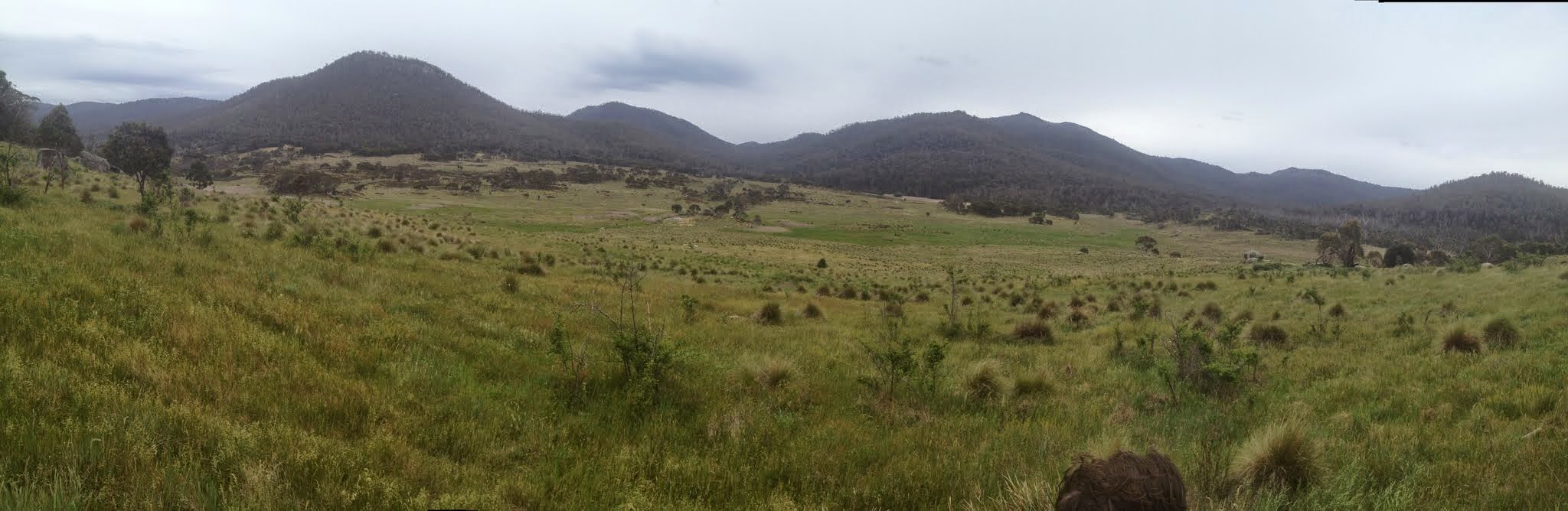
View from lunch over the Orroral River to the hills beyond
Saturday 15 November: A circuit of the upper Orroral Valley – L/E-M-R,ptX. Enjoy an amble up the Orroral Valley grasslands on footpad from the Tracking Station car park to join Smokers Trail. Continue north along the fire trail to cross the Orroral River and to the saddle between SH1164 and SH1157. Off-track to the east and down to Booroomba Creek (this 500m leg will be scrubby). Follow the creek (wet feet?) back down to the open valley (unknown to me). Here a geocache in a cave has previously eluded me. Return via the east side of the Orroral River (off-track but open going). Around 20km and 500m climb. Maps: Corin Dam and Rendezvous Creek. Leader: John Evans 0417 436 877 john@johnevans.id.au. Transport: ∼$12 per person. Late bookings considered.
3 of us drove to the Orroral Tracking Station car park.
Further Information
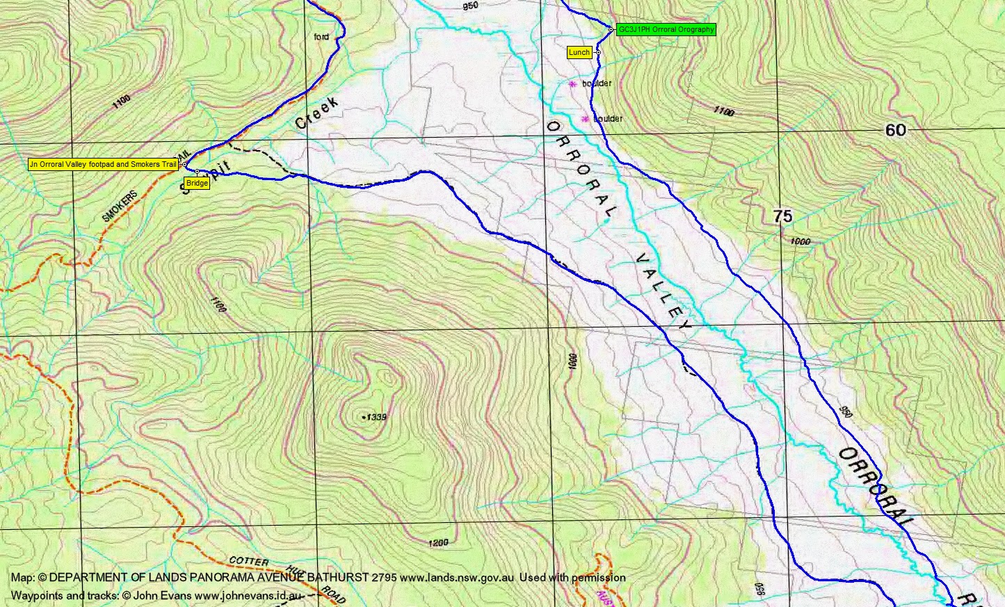
Look for geocache GC3J1PH Orroral Orography.
Summary
Distance: 21.5km | Climb: 380m | Time: 8.00am-2.50pm (6hrs 50mins), with 35 mins of breaks | Grading: L/E-M-R,ptX; H(12-)
Track Maps
Track overview

Track 1

Track 2
Track 3
Photographs
Photographs are available here, where you can start a large sized slideshow.
gpx File
Download the .gpx file here. (Do a File, Save Page As…, change Save as Type from Text Document to All Files, Save if you want to use it.)
Track Notes
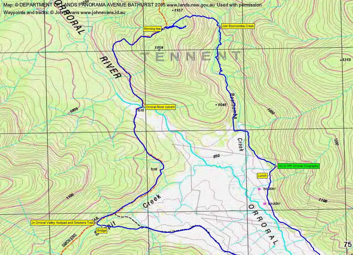
Up the valley and Smokers Trail to morning tea, same as 3 Jun 14.
A little to and fro in the bush, as we retrieved a lost water bottle. On the second attempt, around the north side of a little knoll then steeply down to Booroomba Creek.
Then a delightful trip down Booroomba Creek, sometimes in it, sometimes left and other times right bank. Shallow, but slow rock hopping and wading. We shared the creek with a brown snake at one stage. We skipped a few of the bends by staying high. Eventually out onto the flats, we crossed the creek for the last time and headed towards GC3J1PH Orroral Orography.
My technique is improving – by the time I’d faffed about getting my torch out, BlackLotusEater (aka Llewellyn) had retrieved the cache and was signing us in.
An easier exit from the cache than entry from the north and we were soon back out in the open and having lunch.
A straightforward trip down the true left side, except for a dance with another snake that I nearly trod on. We called in at the old footbridge site and finally at the boulder.
Across the Orroral River bridge and heading south around the swamp, we came across a concrete ‘thing’, out in the middle of nowhere, that I’d certainly like to know what it was used for.
A nice little trip and we beat the showers.
Party
3 walkers – Elliot H, Llewellyn S, me.