Murrumbidgee River

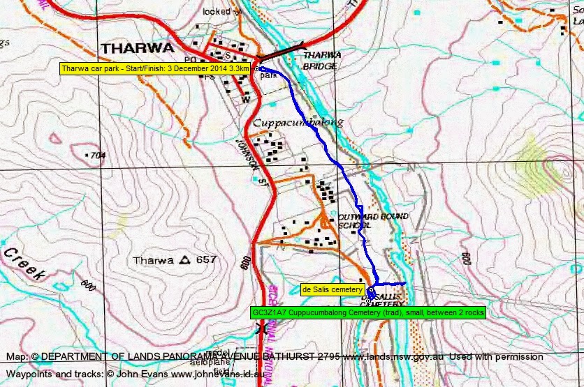
Wednesday evening 3 December 2014: Southside Stroll –The dead centre of Tharwa – S/E. Instead of digging down they raised the cemetery up! A 3km round trip through an avenue of poplars will get us to this unique place. The de Salis cemetery overlooks the confluence of the Gudgenby and Murrumbidgee Rivers. Meet in the parking area above the picnic toilets in Tharwa, just over the Murrumbidgee River bridge on the left, for a 6.30pm walk start. No need to book. Map: Williamsdale. Leader: John Evans 0417 436 877 john@johnevans.id.au . Transport: Drive yourself, but please contact me if you need a lift and I’ll try to assist.
7 of us met at Tharwa.
Further Information
Look for geocache GC3Z1A7 Cuppacumbalong Cemetery.
Summary
Distance: 3.3km | Climb: 20m | Time: 6.30-7.30pm (1hr) | Grading: S/E; VE(3)
Track Map
Track
Photographs
Photographs are available, where you can start a large sized slideshow.
gpx File
Download the .gpx file here. (Right click, Save Link As…, Save – if you want to use it.)
Track Notes
Up to 30mm of thunderstorm rain in the afternoon hours preceding 6.30pm at Tharwa, but no raincoats required for the stroll. Pity that only 6 others have faith in my heavenly connections (grin).
A gentle stroll through the avenue of poplars (they look great in Autumn), across the back of Cuppacumbalong and Outward Bound to the cemetery. It’s been beautifully restored over the last couple of years, with the stone walls all redone. A first time visit for my companions.
A bit of a poke about, then off to log GC3Z1A7 Cuppacumbalong Cemetery. Chifleygrrrl did the find.
A path down to the Murrumbidgee River had been mown, so we went down to the beach.
On returning to the Tharwa green, we had a little celebration for the birthday girl.
Party
7 walkers – John and Helen L, Lyndall M-B, Alison N, Zoe N, Ian W, me.