Last updated 22Sep24
18 Brindabella Weirs
Here’s a map (show in full screen for best results):
Here’s the gpx file of ACT Weirs.
1 Sunny Corner weir on Condor Creek
Late to take up bushwalking, I first visited one of the Brindabella weirs in 2008. The walk down Sunny Corner trail from Reids Pinch to the weir on Condor Creek is a popular Wednesday Walk. Not having been able to join them, I was given hints by Peter W from FBI and took a party there on 13 May 2008.
| Weir | Visited (click the link to access a map segment showing the weir’s location) |
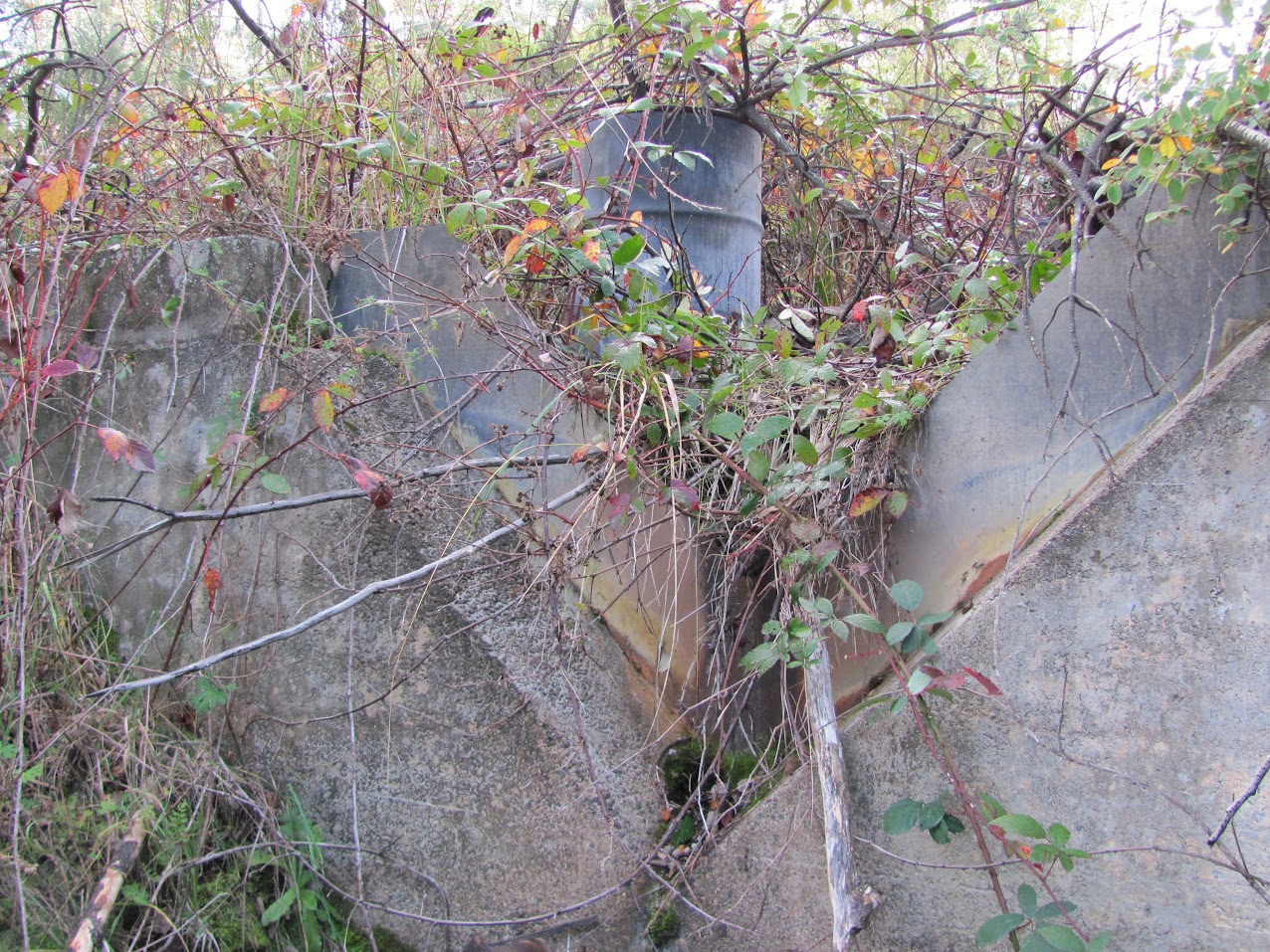
Location (MGA94) | Photo (click on the thumbnail for a larger image) |
| Sunny Corner on Condor Creek | 13 May 08* | UTM 55H 665279-6088269 Cotter Dam 1:25000 |
 |
2 Lees Creek weir
A private walk on 7 October 2008 included a visit to Lees Creek weir. It’s marked on the Cotter Dam 1;25000 topographic map, a few hundred metres north of the intersection of Blundells Creek Road and Warks Road.
| Weir | Visited (click the link to access a map segment showing the weir’s location) |
Location (MGA94) | Photo (click on the thumbnail for a larger image) |
| Lees Creek (Blundells) |
22 Sep 24 25 Jun 16 16 Dec 17 6 Dec 11 7 Jun 11 16 Nov 10 7 Oct 08* |
UTM 55H 667289-6085673 Cotter Dam 1:25000 |
 |
3 Weir on Condor Creek between Blundells Flat and Shannons Flat
A CBC walk, based on a description in Beyond the Cotter by Allan J Mortlock and Klaus Hueneke ANU Press Canberra 1979, took us to a weir on Condor Creek, between Blundells Flat and Shannons Flat, on 9 June 2009. According to the annotation on Bent J’s Cotter 1:50000 map, this could be a ‘Department of Works’ weir.
| Weir | Visited (click the link to access a map segment showing the weir’s location) |
Location (MGA94) | Photo (click on the thumbnail for a larger image) |
| Weir on Condor Creek between Blundells Flat and Shannons Flat |
9 Jun 09* | UTM 55H 667756-6090737 Cotter Dam 1:25000 |
 |
Access to Kosciuszko Huts Association Data
In mid-2010 I was fortunate enough to be contacted by Graham S of KHA, who knew of my interest in Namadgi National Park. As well as their immense database of Kosciuszko National Park places of interest, KHA have a substantial holding of NNP locations and they asked if I would ground-truth them. Included were a number of weirs on the eastern flanks of the Brindabella Range:
|
Weir |
Location (MGA94) |
My Comment |
|
|
Easting |
Northing |
||
|
WEIR |
665212 |
6088283 |
This is Condor Creek weir. |
|
WEIR (Piccadilly) |
664812 |
6085583 |
|
|
WEIR (Ferny) |
664812 |
6084483 |
|
|
WEIR (Warks) |
666512 |
6084483 |
|
|
WEIR (Lees Central) |
667312 |
6085683 |
This is Lees Creek weir. |
|
WEIR (Bushranger) |
664412 |
6079983 |
|
|
WEIR (Bulls Head) |
665012 |
6083683 |
|
|
WEIR (Pago) |
665912 |
6082983 |
|
4 Piccadilly weir, 5 Ferny weir, 6 Bulls Head weir and 7 Warks weir
Having an inveterate desire to tick off lists, this seemed too good an opportunity to miss and a ‘Weir-d day in the Brindabellas’ themed walk was executed on 16 November 2010. It proved to be somewhat successful, with the party finding and recording the locations of Piccadilly weir, Ferny weir, Bulls Head weir and Warks weir. We also visited Lees Creek weir. Ferny weir took a little time to locate, as it was some distance away from the given location. Late 2010 rain has really assisted with the revegetation of the area after the 2003 bushfires and long dry spells, so the creek lines are choked. The weir-hunting method which drew results consisted of walking along Old Mill Road and, at each occasion when the sound of running water increased, a foray into the creek to see what was causing the noise.
The location we had for Pago weir was up on a ridge line, but a search for it down a best guess, nearby creek line to the north proved fruitless.
| Weir | Visited (click the link to access a map segment showing the weir’s location) |
Location (MGA94) | Photo (click on the thumbnail for a larger image) |
| Piccadilly weir | 22 Sep 24 25 Jun 16 16 Nov 10* |
UTM 55H 664890-6085551 Cotter Dam 1:25000 |
 |
| Ferny weir | 22 Sep 24 25 Jun 16 4 Jan 11 16 Nov 10* |
UTM 55H 665089-6084582 Cotter Dam 1:25000 |
 |
| Bulls Head weir | 22 Sep 24 25 Jun 16 4 Jan 11 16 Nov 10* |
UTM 55H 665068-6083627 Cotter Dam 1:25000 |
 |
| Warks weir | 22 Sep 24 25 Jun 16 16 Dec 17 16 Nov 10* |
UTM 55H 666415-6084472 Cotter Dam 1:25000 |
 |
The search for Pago weir
Unwilling to give up, a chain of contacts (Peter H and Bill S of Kisters, Ross K and Tony F of ACTEW) led me to Norm M, the Manager of Water Sciences at ALS Laboratory Group. A ‘bingo’, with Norm providing:
‘The Pago site area is indicated as one of 19 water sampling sites in a paper by Talsma, T., and Hallum, P.M., “Stream Water Quality of Forest Catchments in the Cotter Valley, ACT”, The First national Symposium on Forest Hydrology, 1982, Melbourne, 11-13 May.
The paper indicates that instrumented catchments were established between 1964 and 1972 (Division of Forest Research, CSIRO) to assess water quantity and quality impacts (mainly 1974-1977) of fire and forestry management operations in native forests. Of the 19 water sampling sites, 16 were also stream gauging sites.’
Matthew H was interested.
In addition, Norm kindly provided an electronic copy of the paper. A further request from me resulted in the supply of the locations of 15 of the sites.
The CSIRO location for Pago weir was not helpful, so a further search was mounted on 4 Jan 11, visiting rugged creek lines to the south of the area previously covered. Again, no joy. At the end of the walk we ran into the local ranger, Christian W. He had a map, but it also contained locations of sensitive sites and he was not able to share it with me.
In January 2011, Barbara M (whom I’d assisted with site locations after she contacted me via my blog) emailed me material from books by Ian Fraser and Margaret McJannett which mentioned walks on Pago Break. It didn’t help me find Pago weir, but I did contact Margaret and borrow the four books she co-authored. I also managed to buy 3 of them at a second hand bookstore, again thanks to Barbara’s assistance. To complete the quadrella, Barbara found the 4th book for me at the Namadgi Visitors Centre, tucked away in a back room.
In early February 2011, I asked Alex P at ACTPLA if he knew of Pago weir. He didn’t but sent me a map segment from the ACT 1:10000 map series, which shows the area around and below Bulls Head in greater detail.
At about the same time, I contacted Tim the Yowie Man, who authors a 2 page spread in the Panorama magazine of the Canberra Times each Saturday on interesting things. I asked him if he’d ask if anyone knew where Pago weir was, which he did in his Canberra Times Panorama magazine article on 26 Feb 11 – see here. I also put the request on the front page of my blog in the News section, offering either a large box of chocolates or a fine bottle of red to the person who can get me there.
In mid February 2011, Barbara (who is fast turning into my fairy godmother of information supply) was walking on Urambi Hills and got talking to Bent J, who retired from the CSIRO Division of Forestry Research. I called to see Bent and he gave me a 1:50000 map of the area with weirs marked. He also referred me to Peter S, whom I rang. Peter gave me the contact for John B, who was the technical officer responsible for building the weirs.
I rang John and he jumped at the chance to revisit the area and take me there, on 28 Feb 11. Tim the Yowie Man rounded off the search with a report in his 2 page spread in the Panorama magazine of the Canberra Times on Saturday 12 Mar – see here.
8 Pago weir
It took John Burns, the CSIRO project officer responsible for building Pago weir in 1968, to get me to Pago weir.
| Weir | Visited (click the link to access a map segment showing the weir’s location) |
Location (MGA94) | Photo (click on the thumbnail for a larger image) |
| Pago weir | 22 Sep 24 22 Apr 17 18 May 13 6 Dec 11 28 Mar 11 28 Feb 11* |
UTM 55H 665408-6082421 Tidbinbilla 1:25000 |
 |
9 Bushranger weir
I organised a private trip to take John Burns to Pago weir. We went on and found Bushranger weir.
| Weir | Visited (click the link to access a map segment showing the weir’s location) |
Location (MGA94) | Photo (click on the thumbnail for a larger image) |
| Bushranger weir | 22 Apr 17 18 May 13 29 Mar 11 28 Mar 11* |
UTM 55H 664356-6079895 Tidbinbilla 1:25000 |
 |
10 Blundells (Tinkers Creek) weir
I hadn’t got round to further investigating the locations of the additional CSIRO weirs. But just checking the proposed route for Stan M’s Pig Hill walk on 9 Apr 11, I saw a weir marked on Tinkers Creek on the 1st edition Umburra 1:25000 map (nothing marked on the 2nd edn map). Stan was flexible and kind enough to allow me and some of his party to visit the weir.
| Weir | Visited (click the link to access a map segment showing the weir’s location) |
Location (MGA94) | Photo (click on the thumbnail for a larger image) |
| Blundells (Tinkers Creek) weir | 9 Apr 11* | UTM 55H 671555-6102227 Umburra 1:25000 |
 |
More weirs
Poring over Bent J’s map and a schematic from the CSIRO, I took a best guess at locations for Cpt 97, Blue Range, Greens, Uriarra and Marshalls weirs. Combining driving, mountain biking and walking to the several locations on 19 Apr 11, a day when no one else would walk with me, revealed 4 of these 5.
11 Blue Range weir
| Weir | Visited (click the link to access a map segment showing the weir’s location) |
Location (MGA94) | Photo (click on the thumbnail for a larger image) |
| Blue Range weir | 5 Apr 16 19 Apr 11* |
UTM 55H 670468-6090796 Cotter Dam 1:25000 |
 |
12 Greens weir
| Weir | Visited (click the link to access a map segment showing the weir’s location) |
Location (MGA94) | Photo (click on the thumbnail for a larger image) |
| Greens weir | 16 Dec 17 19 Apr 11* |
UTM 55H 669825-6087810 Cotter Dam 1:25000 |
 |
13 Uriarra weir
| Weir | Visited (click the link to access a map segment showing the weir’s location) |
Location (MGA94) | Photo (click on the thumbnail for a larger image) |
| Uriarra weir | 4 Sep 24 31 Aug 2311 Sep 22 5 Apr 16 30 Mar 13 19 Apr 11* |
UTM 55H 672376-6094855 Cotter Dam 1:25000 |
 |
14 Marshalls weir
| Weir | Visited (click the link to access a map segment showing the weir’s location) |
Location (MGA94) | Photo (click on the thumbnail for a larger image) |
| Marshalls weir | 13 Sep 16 18 Jun 11 19 Apr 11* |
UTM 55H 668602-6090012 Cotter Dam 1:25000 |
 |
More weirs
So, from the CSIRO paper I have, it seems like the following weirs are still to be hunted: Howells, Cpt 99 and Cpt 97. Use the map supplied by Bent J.
I think I know where Howells weir is and will have a look on 7 Jun 11.
A contact that John B gave me was Ross M. Ross and Jean only had the same Cotter 1:50,000 map, labelled “Watershed Research Instrument 1966 Network”, that Bent had given me.
When all else fails, ring Canberra Connect! They put me in touch with Neil C, the Manager Fire, Forest and Roads, ACT Parks and Conservation Service, who kindly chatted with me and sent me an old forestry map, which shows a site ‘V-notch Weir’ marked (with an X, why not a V (grin)?) on the Cotter River and annotated MGA94 672300 6088085. It also showed forestry compartments which gave me an idea of where to look for Cpt 97 and Cpt 99.
Visited the area on 7 May 11 and found Cpt 99.
15 Forestry Compartment 99 (Cpt 99) weir
| Weir | Visited (click the link to access a map segment showing the weir’s location) |
Location (MGA94) | Photo (click on the thumbnail for a larger image) |
| Cpt 99 weir | 7 May 11* | UTM 55H 672357-6088089 Cotter Dam 1:25000 |
 |
More weirs …
Norm M from Actew confirmed that there is no weir on the Cotter River ~2km downstream from Vanitys Crossing, at UTM 55H 672300-6088085 (MGA94) . Go back to look for Cpt 97. Look for Howells. Visited the areas on 21 May 11 – found Cpt 97 weir, but could not find Howells weir.
16 Forestry Compartment 97 (Cpt 97) weir
| Weir | Visited (click the link to access a map segment showing the weir’s location) |
Location (MGA94) | Photo (click on the thumbnail for a larger image) |
| Cpt 97 weir | 6 Sep 16 21 May 11* |
UTM 55H 671922-6088341 Cotter Dam 1:25000 |
 |
17 Howells weir … the last weir
| Weir | Visited (click the link to access a map segment showing the weir’s location) |
Location (MGA94) | Photo (click on the thumbnail for a larger image) |
| Howells weir | 13 Sep 16 11 Oct 11* |
UTM 55H 667910-6087155 Cotter Dam 1:25000 |
 |
18 (… not quite a Brindabella weir, but …) Honeysuckle Creek weir
| Weir | Visited (click the link to access a map segment showing the weir’s location) |
Location (MGA94) | Photo (click on the thumbnail for a larger image) |
| Honeysuckle Creek weir | 24 Aug 13* | UTM 55H 679171-6060215 Corin Dam 1:25000 |
 |
Leave a Comment