This walk was organised and led by Max S as a private walk, as only 2 of us turned up:
(Starting at Mt Franklin carpark, climb to Trig before descending down a spur to Stockyard Creek. Along Ginini Creek to view Ginini Falls, probably without water. Return southwards to above Little Ginini Falls and back to Mt Franklin Road Carpark. Expect rough going, particularly on descent. Meet at Kambah ***7.00 am ***. 15 km, 870 m, Hard (13) allow 8 hours, hence late finish likely).
Drove via Uriarra Crossing and Piccadilly Circus to the Mt Franklin carpark.
Away by 8.15am. Interesting to find the gate open and, as we walked through the fog and mist, to be assailed by loud pop music. A bus, concrete mixer, marquee and 20+ Adelaide Uni students came into view, toiling away at the Mt Franklin ski hut site building a new information centre. Quite surreal! On up towards the trig with the cloud clearing into a lovely day (see pic 1) - the rustic bench at this viewing point has been broken. Passed the trig point and followed the old vehicle track round and down in an E direction.
Gaiters on and headed off the track as it curved to the S and soon hit robust regrowth. At 9.20am and around the 1400m contour we crossed a faint vehicle track - the same as the one coming off the top? - worth an explore sometime. Generally E and S (I'm sure Max was on an exact bearing) to find a brief morning tea at around 10am at a quite unique granite rock pile in the middle of the bush. Continued thick regrowth.
By 10.30am we were around the 1070m contour, heading down a steep drop. Ginini Falls were 500m to our S. We could see the rocky top of the face. Continued SE to hit Ginini Creek at the 910m contour at 10.40am. A drop of 735m from the top of Mt Franklin. Surprised to find a plaque in memory of Joseph Kendall-Torry fixed to a large rock face by the creek.
We spent the next 35mins rock-hopping/crawling back up the creek to the base of the Falls. A spectacular view, even with minimal water (see pic 2). A second mini morning tea was enjoyed.
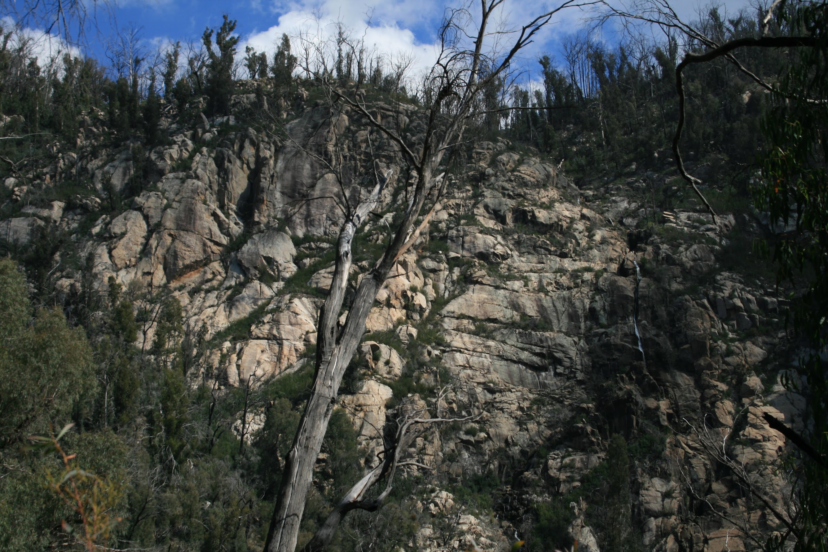
Away back down the creek for a couple of hundred metres until, at around 11.45am, the S cliff line had opened up enough for us to start climbing. A steep ascent, the regrowth here being an advantage as it gave us something to cling on to. A parting shot of Ginini Falls from the climb out (see pic 3).
By 12.30pm the sharp ridge had begun to flatten (relatively speaking), so we found a granite throne which gave us a bit of a view through the trees to the E and enjoyed a bite of lunch.
Following the ascending ridge, we headed a bit S of W onto the Corin Dam map, then SW. By 2.10pm we were at an open area 500m NE of Upper Ginini Falls (GR61916862 (GDA94)) which afforded views across to Mt Franklin. We skirted the top of the Upper Ginini Falls, crossing Ginini Creek at 2.30pm.
We headed W-ish across the unnamed creek running in. Plenty of sphagnum fed water flowing. Back into the tree line so the walking was a little easier, up the gentle ridge with a lyrebird fluttering across our track, tripped over a border marker and headed into NSW and so down to the Mt Franklin Road at 3.15pm.
2.8km along the road (excellently selected by Max to be gently sloping down) to reach the car at 3.40pm.
A great little loop, Max. As with last time to the top of Ginini Falls, clockwise was the wise way to go!
Distance: 13.8km Climb: 950m. Time: 8.15am - 3.40pm (call it 7.5hrs), with 40mins of breaks.
Grading: L/R,X; H(13)