This walk was organised and led by me as an irregular CBC Tuesday walk:
Tuesday 19 May - Border Markers between Mt Gingera and Blackfellows Gap - L/R,ptX. Climb Stockyard Spur from Corin Dam, past Pryors Hut to Mt Gingera. Follow the border south to Blackfellows Gap, looking for border markers. Return via the Mt Franklin fire trail/road. Around 25km + 1500m climb. Map: Corin Dam 1:25000. Limit of 8. Leader: John Evans – jevans@pcug.org.au, (h) 6288 7235. Transport: ~$10. Further details at http://jevans.pcug.org.au.
5 of us drove in 1 car to Corin Dam. Thanks folks, I really appreciate everyone being so punctual.
Civil twilight: 0627 - 1733. This gives 11 hours of 'just see' time.
Match a comment to a party member:
(a) "I'll bring my PLB also so that it can be carried at the rear of the group in case the group spread is too great"
(b) "Late finish expected as I will drag the chain"
(c) "we’ll go hard and fast to Mt Gingera"
(d) "I have been able to get out of a meeting that had been scheduled for tomorrow"
(e) "I too expect to be hanging on to the chain - will someone be pulling?"
Walk Track
Mine was (c) and guess who was last up to the Stockyard Spur cairns. I tried to window dress it as concern for the tail of the party but I was puffing and I was the tail. Karen was today's queen of the Spur. Thanks to punctual companions we were walking by 7.45am and covered the 2km and 520m climb to the cairns in 55mins. It was a very cool and a bit of a drizzly day. I see the maximum temperature at nearby Mt Ginini between 8am and 5pm was 5.1°C with a maximum apparent temperature of 0.4°C. That explains why our stops were few; one very quickly got chilled. 3 lyrebirds fluttered from the side of the Stockyard Spur track.
Morning tea at Pryors Hut where a party member (not me - I haven't lost anything for a couple of weeks!) realised a mobile phone was missing. So we skipped back to the Stockyard Spur marker post to try to find it. No joy, also none on our return leg. Back to the hut, passing pig baits and infrared cameras on the track. We ran into the guys from the feral pig research centre setting them up between Pryors and the turn off to Mt Gingera. We asked them why we see no pigs. They said they are about - the cameras had recently photographed walkers going by and, within 2 minutes, huge pigs were back down at the baits and camera. We've certainly noticed the Pryors Hut area progressively getting worse over our several visits within the last couple of months. Had a quick look at border markers Q57 and 21 Mile just S of Pryors, just so they could contribute to today's tally.
Made Mt Gingera (the real one, border marker W57) at 11.10am and spent a good 10mins looking for the described '1" Gaspipe driven into cleft of Boulder'. No joy and this is the second time consuming search for W57. Does anyone have a metal detector?!! Down to X57 (previously spotted) just near the guyed pole about 100m S and, at last, ready to start the day's hunting for new border markers.
A little less bitter down out of the wind but still raincoat drizzly and wet boot damp in the mountain grasses. And if one is not fuelled by the warming passion of border marker hunting, the process can be a little slow and uninteresting. Still, we all joined in the spirit of the day and worked well as a team. Except for me who, after finding Y57, led the party on a confusing loop to the N of E, instead of steadily to the SE, until I got my bearings.
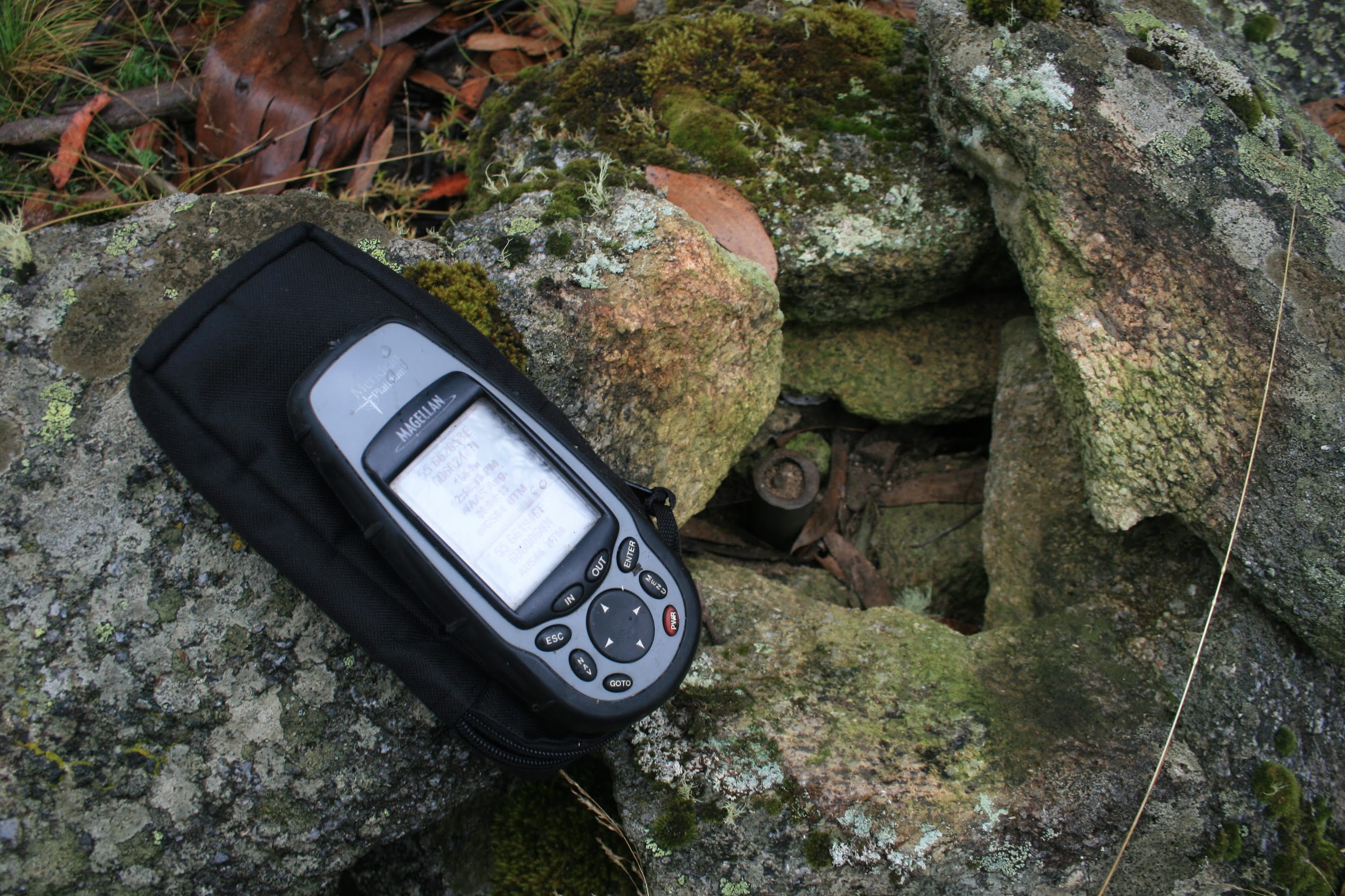
Same drill as last time. Set the GOTO in the GPS, approach to around 30m, slow down so the GPS positioning has a chance to catch up and, more usually than not, slowly circle in on the prey. Photograph the kill with the GPS location showing (I now realise that some of my locations are a bit out on the ACT-NSW Border Markers and Lockspits page because, once found, we don't waste time to let the GPS finally settle), photograph the kill with the GPS waypoint id showing (these 2 pics are for my records, and to prove that I'm not making these up!), then photograph it in its glory. Then onto the next one. One party member has an archaeological interest and will often expose the usual '1" Pipe sunk flush to the ground' to prove that we're not just visiting piles of granite. Of course we meticulously restore the cairn or lockspit. Another bagger (yes, I got that 'a' correct) was initially unsure and reckoned a probability should be assigned to each. But I have good data from Alex P at ACTPLA, we form a good search team once we settle into the routine and we're getting pretty good at spotting them (practise makes perfect). Some were hard to find today and the percentage probability was to the forefront as we searched for the 23 Mile mark. I wasn't happy with a couple of possibilities so we moved on - only to find the real thing within 10m. A couple of tiny patches of snow left over from a week or so ago.
Prior to that little episode, and having found all of Y57, Z57, A58, B58, C58, D58, E58, F58 and G58 (see pic 1), we found an excellent rock overhang for lunch. Most pleasant.
Back to work, H58, I58, 23 Mile, J58, K58, L58, M58 and N58 (see pic 2 - see the exposed typical 1" pipe sunk flush) were all bagged.
By this time it was 2pm and this was the turnaround time I'd set if we were at Blackfellows Gap. There was obviously not enough time to get to there, so we struck down to the NE (see pic 3) and soon found ourselves on the Mt Franklin fire trail at 2.10pm.
All that remained was to return to the car. The return leg of 10.8km took 2hrs25mins (allowing for the extra 10mins spent searching for the phone). So that's good to know - because we will come back to finish these off - that we can exit from this point in 2 and a half hours.
The details of the border markers found are on my ACT-NSW Border Markers and Lockspits page. Adding in the previously bagged Q57, 21 Mile and X57, we did 20 border makers today.
Thanks for excellent hunting and support - Eric, Karen, Max and Mike. I promise not to go back for at least a couple of weeks.
Distance: 23.8km Climb: 1200m. Time: 7.45am - 4.45pm (9hrs), including 35mins of stops and 40mins of searching for personal effects.
Grading: L/M-R,ptX; H(14)
KMZ file for Google Earth/Maps: Border Markers on the SE Spur of Mt Gingera