

1-4 October 2010 Kiandra to Orroral Valley on the AAWT
Maps: Ravine, Tantangara, Rules Point, Rendezvous Creek and Corin Dam 1:25000
Getting There
This walk was organised and led by me as a CBC walk:
Friday arvo - Monday 1-4 October (long weekend) - Kiandra to Orroral Valley via the AAWT- L/M,X. Friday - drive Canberra to Kiandra and walk to Witzes Hut 12km and 300m climb; Saturday - Witzes to Hainsworth Hut 23km and 350m climb; Sunday - Hainsworth to Oldfields Hut 22km and 200m climb; Monday - Oldfields Hut to Orroral Valley 27km and 300m climb. Maps: Ravine, Tantangara, Rules Point, Rendezvous Creek and Corin Dam. Leader: John Evans - jevans@pcug.org.au, (h) 6288 7235. Transport: TBA.
4 of us gathered at my place early Friday afternoon and taxi Maxi took us to Kiandra. We were picked up from Orroral by Mike, who also brought a yummy welcome back arvo tea. This walk would not have happened without the assistance of these two friends, who put themselves out considerably.
Further Information
Here are some maps segments of the alternate major river crossings:
|
|
| Alternative route across Eucumbene River | Alternative route across Murrumbidgee River |
The 'bible' for the AAWT is Australian Alps Walking Track by John Chapman, Monica Chapman and John Siseman. This walk is covered in section 8 - Kiandra to Tharwa.
Photographs
Access all primary pics here. All thumbnails in the walk report are active - click for a larger picture.
Walk
Day 1 - Kiandra to Witzes Hut
 |
 |
 |
 |
| Track overview Kiandra to Witzes Hut | Track 1 Kiandra to Witzes Hut | Track 2 Kiandra to Witzes Hut | Track 3 Kiandra to Witzes Hut |
We were a little late leaving town and arrived at Kiandra around 3.10pm. Away soon after and Max wandered the 400m down to the river to check that we could get across. In various river-crossing footwear (Lyn had a very colourful pair of crocs) we waded across first the Bullocks Head Creek and then the Eucumbene River, above knee level. The ski stocks I'd brought just in case were tossed back to Max and we were on our own. Into dry socks and boots, we walked briskly up the Nungar Creek Fire Trail with uninterrupted views back to Kiandra.
 |
 |
| That's Bullocks Head Creek and the Eucumbene River crossed | Looking back to Kiandra from the Nungar Creek Fire Trail |
3.8km along we came to Chance Creek, now with a culvert crossing. There are lots of photos of such crossings, for 2 reasons - to document the current state of this section of the AAWT and, because I don't like water, each such crossing was a bonus. Very pleasant views on a sunny Friday arvo to the open, rolling plains. A further 4.4km in 55mins (so we were motoring along the easy walking and soft fire trail) had us at the junction with the Alpine Creek Fire Trail. We turned NW, our fire trail paralleling Tantangara Creek and providing great views through to Tantangara Plain.
 |
 |
| Chance Creek now has a bridge | Nungar Creek ft paralleling Tantangara Creek |
1.4km later we were at Tantangara Creek - my digital 1:25000 map marked ford replaced by another little bridge.
 |
 |
 |
| Nungar Creek ft approaching Tantangara Creek bridge | Old log Tantangara Creek bridge | Tantangara Creek bridge |
A further 2.2km on we arrived at Witzes Hut, making it in at 6.05pm with the sun down. Max had been more than willing to loan me his SPOT PLB, so I sent off an OK message. This was a well timed wander in - we were fresh and had not been on the AAWT for 50+ days, nor were we carrying a week's supplies. I have the location of the hut a little different to the 1:25000 Tantangara map - not that I took a waypoint, but where the day's track ended. I have it at UTM 55H 643055-6035784 (GDA94) - but don't necessarily trust me.
(I'd set my GPS to record a track point every 10 metres and had it running all the time. So the track on the map segments is real.)
 |
| Witzes Hut |
AAWT - 1 Kiandra to Witzes Hut, 340m climb 12.4km 4½ hours
Distance: 12.2km Climb: 340m. Time: 3.17 - 6.05pm (2hrs 48mins).
Day 2 - Witzes Hut to Hainsworth Hut
 |
 |
 |
 |
| Track overview 1 Witzes Hut to Hainsworth Hut | Track overview 2 Witzes Hut to Hainsworth Hut | Track 1 Witzes Hut to Hainsworth Hut | Track 2 Witzes Hut to Hainsworth Hut |
 |
 |
 |
 |
| Track 3 Witzes Hut to Hainsworth Hut | Track 4 Witzes Hut to Hainsworth Hut | Track 5 Witzes Hut to Hainsworth Hut | Track 6 Witzes Hut to Hainsworth Hut |
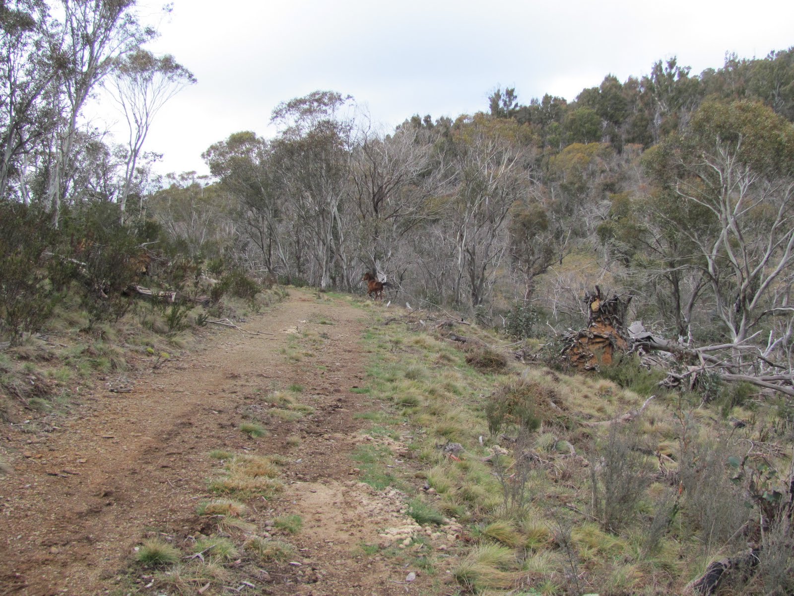
We rose around 6am to a cloudy day and left at around 7.30am. 450m along the track we turned NW onto Bullocks Hill Fire Trail. Lightly timbered on our right, with grey burnt stands. Open flats to the left. Another culvert over Blanket Creek! Easy and pleasant walking for 8.8km 1hr 45mins along Bullocks Hill Fire Trail to the second crossing of Tantangara Creek. We'd seen a couple of brumbies yesterday arfternoon, but here a mob of 9 or 10 crossed in front of us. Quite a sight (I haven't seen many before) - I suppose we would have seen a couple of hundred on the walk, in mobs up to 25.
<
 |
 |
 |
 |
| Grey burnt trees beside the Bullocks Hill Fire Trail | Approaching the bridge over Blanket Creek | Bullocks Hill Fire Trail between Hains Hut Trail and Tantangara Creek | Brumbies from Bullocks Hill Fire Trail |
An open descent to Tantangara Creek, where we could see a 4WD on the other side. Pretty quick off the mark, as the gates were only opened after winter at 8am this morning. No bridge this time, but a simple knee-level wade.
1.6km up then down to the Murrumbidgee River, the girls ahead of we boys finding the best place to cross. We had morning tea around 10am on the N bank of the river.
 |
 |
 |
| Descending to cross Tantangara Creek | Kerrie and Lyn crossing Tantangara Creek | Looking for a place to cross the Murrumbidgee River |
You wouldn't think that navigation could be muffed, with maps, compass, guide book and GPS in this open country on a mild Spring day - but I can do anything. Picking up the footpad (which the guide book indicated the next section deteriorated to) going N from the Murrumbidgee, we followed it to a saddle. But instead of following the AAWT, it was decided to use the guide book marked (but not map marked) old fire trail to go direct to Millers Hut. I picked up wheel tracks (which must have crossed the old fire trail) which took us nearly due E and we followed them until I decided to do a location check. The map segments Track 3 Witzes Hut to Hainsworth Hut and Track 4 Witzes Hut to Hainsworth Hut above tell the nasty story and the correction. As it turned out, however, it was very pleasant and relatively lightly treed country, a nice change to the open plains and fire trail. We eventually snuck up on the back of Millers Hut, having covered 6.1km in 1hr 30mins since leaving the Murrumbidgee River.
 |
 |
| Footpad 400m N of Murrumbidgee River crossing | Millers Hut |
A footpad left Millers Hut and took us 1.2km down to and across Bally Creek and onto the Port Phillip Fire trail, joining it NE of the Bally Creek bridge. Quite a major road. A 4WD towing a tinny went past from E to W. 1.7km along we came to the Ghost Gully Camping Ground at the intersection of the Port Phillip Fire Trail and Mosquito Creek Fire Trail, a great looking set up for campers and horse rides. There were 2 vehicles with horse floats there.
 |
| Approaching Ghost Gully Camping Ground on the Port Phillip Fire Trail |
It was 12.40pm, but it was only 3.4km to Hainsworth Hut and the weather looked a little threatening, so we trotted there in 40mins and had lunch.
 |
| Hainsworth Hut |
By the time we'd lunched, set up tents, collected water, gathered firewood, the day was still young. Two horsemen arrived, looking quite the part, especially when it began to shower and the Drizabones came out. All they needed was a rifle in a scabbard beside the saddle and they'd be archetypal. A sad tale - one of them had lost 2 horses (complete with saddles and bridles) a month ago, so had spent much time since looking for them). They left in the rain to return to Ghost Gully - they owned the utes and floats we'd seen.
 |
 |
 |
| Riders at Hainsworth Hut | Mountain horseman | Mountain horseman |
The weather cleared for a while, so we set off for a little 2.8km wander out towards McPhersons Creek with views over Long Plain (spoilt a little by the 330kV transmission lines and towers). We sat for some time watching a mob of brumbies. A lone interloper tried to make off with some of the girls; the stallions had a chat; then a fickle mare and foal decided to join the intruder. The boss pulled them into line. Such is brumby life on the plains.
 |
| Brumby drama at McPhersons Creek |
Dip Creek was not 20 metres from the door of Hainsworth Hut.
 |
| Dip Creek at Hainsworth Hut |
AAWT - 2 Witzes Hut to Murrumbidgee River, 135m climb 10.5km 3 hours; 3 Murrumbidgee River to Ghost Gully, 230m climb 8.5km 3½ hours; 4 Ghost Gully to Hainsworth Hut Junction, 35m climb 3.2km 1 hour
Distance: 26.2km Climb: 400m. Time: 7.30am - 1.20pm; 3.30 - 4.40pm.
Day 3 - Hainsworth Hut to Murrays Gap
 |
 |
 |
 |
| Track overview 1 Hainsworth Hut to Murrays Gap | Track overview 2 Hainsworth Hut to Murrays Gap | Track 1 Hainsworth Hut to Murrays Gap | Track 2 Hainsworth Hut to Murrays Gap |
 |
 |
 |
| Track 3 Hainsworth Hut to Murrays Gap | Track 4 Hainsworth Hut to Murrays Gap | Track 5 Hainsworth Hut to Murrays Gap |
More options for side trips on this day, so were keen to get going. Away before 7.30am and a pleasant 7.3km in 1hr 25mins on the Mosquito Creek Fire Trail to the sign posted turn off just before Morris Creek. An overcast day.
 |
 |
| Mosquito Creek Fire Trail | Brumby on Mosquito Creek Fire Trail just SE of Harrys Gap |
A 3.8km return trip into Old Currango Homestead. Plenty of water lying about the track. A truly delightful place, wonderful restoration underway, reminders of a bygone era. Views SE across the vast Currango Plain to the exotic trees of Currango Station. The mountains to the E had their heads in the clouds.
 |
 |
 |
 |
 |
| Brumbies on the track to Old Currango Homestead near Charlies Creek | Old Currango Homestead | Wallpaper inside Old Currango Homestead | 1942 papering inside Old Currango Homestead | View across Currango Plain |
4.5km via Blue Waterhole Saddle in the Gurrangorambla Range and a side trip to Bill Jones Hut. A bite of morning tea.
 |
 |
| Mosquito Creek ft on the flanks of the Gurrangorambla Range | Bill Jones Hut |
Then 2.2km on the Harris Hut Track across Cooleman Plain to the intersection with Blue Waterholes Fire Trail. The weather was coming in showers from the E and I must have put my coat on and taken it off a dozen or more times during the rest of the day. A very large mob - maybe 25 - of brumbies up above the intersection.
That was the last of the new territory for me, as I'd been through the area ahead on 17-19 Mar 07 and 12-14 Sep 06. But that was a long time ago.
4.7km in 55mins on Blue Waterholes Fire Trail across Seventeen Flat. We saw our last brumbies - there must be a 'no entry' sign for them at the ACT border. A side trip to Pockets Hut for lunch. Showers continued.
 |
| Pockets Hut |
Our next leg took us 3km in 37mins from Pockets Hut over to join the Leura Gap Trail, back onto Blue Waterholes Fire Trail, past the valve house and to the junction of Pockets Saddle Road and the Murray Gap Fire Trail.
Turning E, we climbed 160m and over to Oldfields Hut, 2km in 34mins. Met two blokes coming down the hill as we were going up - they were heading to Rules Point.
 |
| Wattle on the Murray Gap ft W of Oldfields Hut |
Oldfields Hut is a delightful place. I'd love to see it in the snow, as per the pic on the door.
 |
 |
 |
 |
| Kerrie at Oldfields Hut | Oldfields Hut sign | Photo on Oldfields Hut door | Peter leaving Oldfields Hut |
As it was only 4.15pm on the first day of daylight savings and with the guide book indicating a 26.5km 700m climb 10¼hr last day, we decided to go on to Murrays Gap. That would also give us the option of climbing Mt Murray. So that we did, doing the 4.4km in 1hr 13mins. Both the Goodradigbee River and Dunns Flat Creek had bridges. Surprised 2 pigs on the track below Murrays Gap. The ground very wet climbing to the Gap - in fact, I got my night's water from out of the wheel ruts (pura-tab treated).
 |
 |
 |
| Bimberi Wilderness signage | Goodradigbee River bridge | Approaching Murrays Gap |
Set up tents, collected water, worked hard to get a fire going (in NSW of course) with wet wood in the showers. As at every evening meal, Peter cooked up a storm.
 |
| Peter cooks up a gormet storm at Murrays Gap camp |
Very disappointing border marker hunting. The marked tree referred to in Mouat's field notebook has gone and the border markers each side of the Gap (H76 to the N and I76 to the S) - each a 1" Pipe - are not cairned, so are impossible to find. In fact, I slept within 6m of I76. I spent considerable time wandering around - possibly found J76.
 |
| Possible J76 by flash at 7.19pm first day of Australian Eastern Summer Time |
AAWT - 5 Hainsworth Hut Junction to Morris Creek, 105m climb 7.0km 2 hours; 6 Morris Creek to Seventeen Flat Creek, 60m climb 5.5km 1¾ hours; 7 Seventeen Flat Creek to Oldfields Hut, 270m climb 8.4km 3½ hours; 8 Oldfields Hut to Murray Gap, 245m climb 4.3km 1¾ hours
Distance: 32.7km Climb: 680m. Time: 7.20am - 5.30pm; some wandering around looking for border markers.
Day 4 - Murrays Gap to Orroral
 |
 |
 |
| Track overview 1 Murrays Gap to Orroral | Track overview 2 Murrays Gap to Orroral | Track 1 Murrays Gap to Orroral |
 |
 |
 |
| Track 2 Murrays Gap to Orroral | Track 3 Murrays Gap to Orroral | Track 4 Murrays Gap to Orroral |
A few showers and high wind during the night, but the camp site just S of the Gap in the trees kept the wind out. However, Mt Murray and Bimberi Peak were up in the clouds, so there was no point in climbing. Murrays Gap and the hills either side are Site of Significance in the ACT UC21. We had a quick, cold breakfast and headed off at 7.25am, with the promise of a cuppa at Cotter Hut.
 |
| Murrays Gap signage |
Plenty of water on the ground going down this side of Murrays Gap, too. A pleasant walk (because we were going 520m down not up) through some nice timbered sections. 6.6km in 2hrs 3mins.
 |
 |
 |
 |
| Pleasant forest on the Murray Gap Trail S of Little Bimberi | Walking the Murray Gap Trail SE of Little Bimberi | Wattle on the Murray Gap Trail SE of Little Bimberi | Moss covered branches on the Murray Gap Trail at Little Bimberi Creek |
Met a party of 3 at Cotter Hut who had camped nearby. We stopped for a cuppa, then I wandered on ahead and waded the Cotter River to have a poke around the Oldfields site. Coronet Peak was appearing and disappearing in the clouds.
 |
| Coronet Peak and Oldfields Homestead site |
The Oldfields Homestead site is ACT Site of Significance UC16 and identified in the KHA location list as #294 and #182. The pile of granite which would be the hearth is at UTM 55H 665941-6053501 (GDA94), the poplar tree at UTM 55H 665941-6053515 (GDA94) and the orchard just coming into bud at UTM 55H 665937-6053541 (GDA94). There is an additional pile of granite and some old bits and pieces of metal lying about nearby at UTM 55H 665974-6053517 (GDA94).
 |
 |
 |
 |
 |
| Oldfields Homestead site hearth | Oldfields Homestead site poplar tree | Oldfields Homestead site orchard | Extra site at Oldfields | SoS UC16 Cotter Flats |
We continued up the hill, hopped the fence and rejoined the AAWT. A few hundred metres along it an old vehicle track heads off to the E and the AAWT continues as a footpad to the NE. Walkers must have taken the wrong route, as the 'wilderness area' guidelines have been relaxed by placing an AAWT marker indicating the correct path.
Nice flowers by the track - must consult Barrie R, the plant guru as to what ... many thanks, Barrie. The first is Hovea linearis (Common Hovea) a slender shrub in the family Fabaceae, native to Australia. The upper leaves are narrow and long while the lower leaves are oval-shaped. Purple (or occasionally white) flowers are produced in the spring. The second is Epacris microphylla (Coral Heath), named for the size of its tiny leaves, 2-4mm, which are heart-shaped and pointed. They are held erect against the thin, wiry stem and sharply angular branches. The shrub grows to about 1m high, chiefly in damp rocky heath areas, but also open forests on sandy soils. The white tubular flowers of Epacris microphylla are arranged very neatly along the upper sections of the branches, often hiding the leaves. Where the shrubs grow densely they create a snowy effect.
 |
 |
| Common Hovea on the AAWT between Cotter River and Pond Creek | Coral Heath on the AAWT between Cotter River and Pond Creek |
Strange things are photographed, but I'll be back in to here on 19 Oct 10, so the anthill and newly placed small stone cairn mark the turn off onto the old Little Creamy Flats track.
 |
 |
| Anthill and new cairn opposite marking turnoff to Little Creamy Flats | New cairn opposite anthill marking turnoff to Little Creamy Flats |
Oldfields Homestead site to just over the brow of Cotter Gap was 5.9km in 1hr 40mins. Here, as prearranged, we set off the SPOT to summons a lift and had lunch. A few showers.
9.5km and 2hrs 20mins later we were back at Orroral, having met Mike a few hundred metres out from the car park. We'd been discussing what would be a nice little treat that morning - the girls opted for hot chocolate and me a beer. I won, thanks very much to Mike, who had a 6-pack of Cascade light, some fruit juice, Tim Tams and other goodies.
AAWT - 9 Murray Gap to Cotter Hut, 35m climb 6.6km 2½ hours; 10 Cotter Hut to Cotter Gap, 350m climb 6.3km 3 hours; 11 Cotter Gap to Orroral River, 70m climb 9.3km 3 hours
Distance: 22.7km Climb: 455m. Time: 7.25am - 2.25pm.
My overall impressions - great, open, rolling plains; brumbies; interesting huts; some nice timbered country in places. Much fire trail - I don't think I'd do the same section again. Maybe Kiandra S next year.
Many thanks for your company Kerrie T, Lyn F and Peter B. Great walkers, not one complaint!
Not a fairytale ending, finding that Gay had spent Saturday in hospital.
Distance: 93.8km Climb: 1875m. Time: 3½ days.
Grading: L/E-M,W,ptX; M(11)
KMZ file for Google Earth/Maps: Kiandra to Orroral Valley on the AAWT
Back to Walks Index
This page last updated 22Aug22