Looking over the top of the waterfall
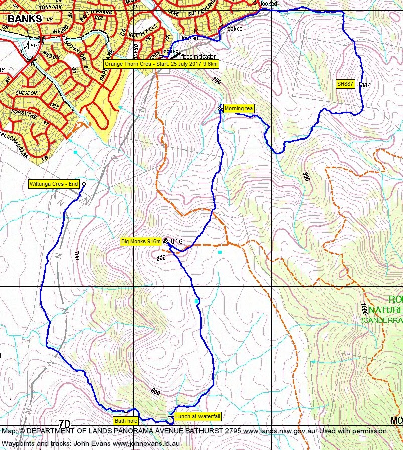
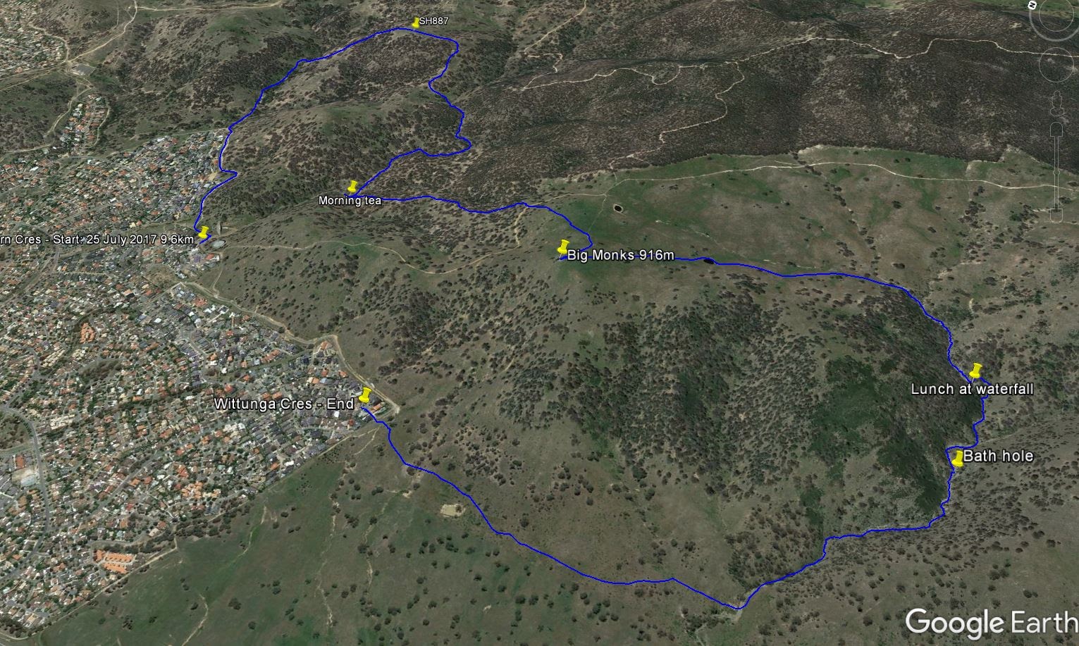
Tuesday 25 July: Three creeks of Rob Roy – M/R/part X. There is some interestingly rough country in the Rob Roy Nature Reserve if you avoid the fire trails! After a short car shuffle to Crespin Place, Banks, we’ll head south for 1.2 km to an un-named creek, then follow the creek as it rises 150 metres in 1.5 km through rocky terrain, past a waterfall (probably dry). Then north across country to another unnamed creek, previously explored and quite pretty. From this creek we’ll climb to a hilltop at 880 m that has 360 degree views. A steep, loose descent to a third creek, where we pick up a foot pad and head back to the shuffled car at the Big Monks carpark. About 10 km, with two main climbs of about 200 metres each. Map: Tuggeranong. Leader: Linda G. Transport: Drive yourself but let me know if you need or can offer a lift. Please book by previous Sunday.
Further Information
We did the walk in reverse.
Summary
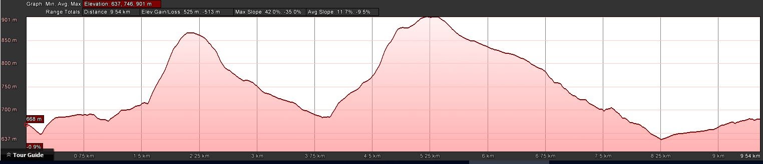
Distance: 9.6km | Climb: 525m | Time: 8.50am – 2.00pm (5hrs 10mins), including 60 mins of breaks | Grading: M/R; M(11).
Photographs
Photographs are available, where you can start a large sized slideshow.
Video
Waypoint and Track Files
Download the .gpx file. (Right click, Save Link As…, Save – if you want to use it.)
To use in Google Earth, do File, Open… and select Gps or All files as the File Type.
Track Notes
We popped a couple of cars in Wittunga Crescent, not shown on my topographic maps, so that indicates how old they are.
Back at Orange Thorn Cres, we crossed below the flood mitigation wall and were immediately into a breath-sapping climb. Heading NE, our leader took us into the first creek system. A gentle climb in the shadow of Callaghan Hill (where my wimpy walk via fire trail will go this coming Saturday). At an appropriate point, we turned up in a south-ish direction and climbed the nearly 200 vertical metres to SH887. Apart from the up, it was easy going through rocky soil (of which there was little) supporting very open woodland. Nice views from the open knoll over the southern suburbs and to the western hills.
From here we descended south, then west to a saddle, then SW down into creek 2. A bit more than 1 km down, we stopped at a creek junction for morning tea. Time to explore a tad further on. I’d been up through here on 12 Mar 16.
From morning tea we climbed south to Big Monks. Lovely views! Plenty of snow on the horizon, Mt Gingera I think.
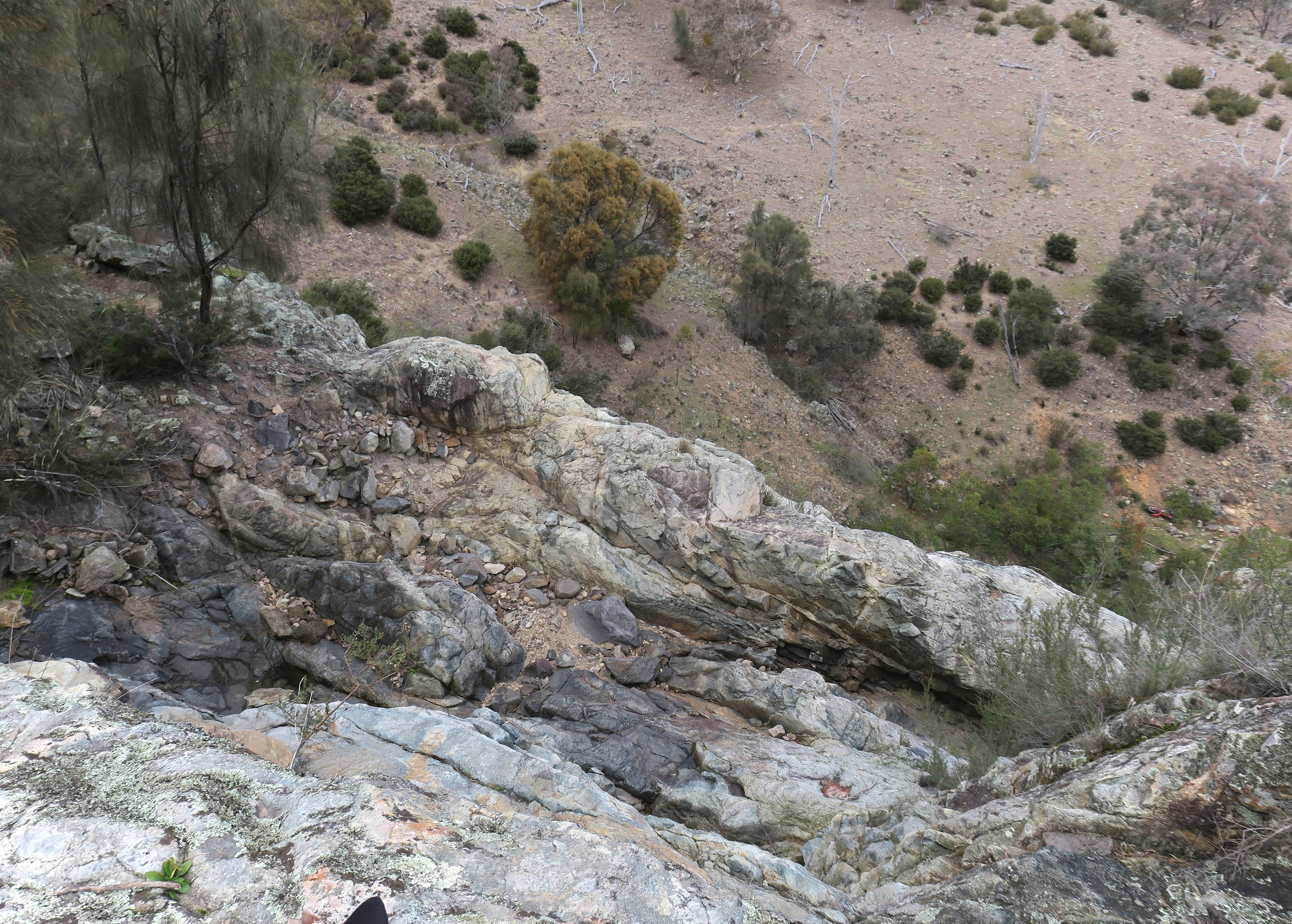
South from Big Monks, we entered the top of creek 3, which bent SW to the spot of the day. A lovely (dry) waterfall. Incredible to think that this is just 2km from Banks and only a few more from my humble abode. Lunch in the gods.
We skirted the rock face to the left, down to the pool at the bottom. This would be an impressive sight after rain, probably best accessed via nearby spurs.
Walk features were not yet exhausted, with more canyon-like gully walking. A ‘bath hole’ with quite a drop into it.
At last the steep gully petered out and the creek became an innocuous flat, dry watercourse.
We turned north and gained the cars at the SE corner of Banks.
This leader always comes up with the goods. Amazing – and in my backyard too. A lovely round, thank you Linda and all.
Track Maps
Party
7 walkers – Monika B, Peter C, Linda G (leader), Meredith H, Trevor L, Derek S, me.