This page last updated 8Feb12. Now at http://www.johnevans.id.au/wp/?page_id=3354
Many people have walked and documented the AAWT. Just Google it and see what you get!
Again, there would be many experts, but the Canberra based living legends that I'm aware of are Rob H (the face and voice of the AAWT presentation at the Namadgi Visitors Centre) and Karen Cody. Karen did the trip for a second time in March - April 2010. Check out the record of her triphere.
Her trip, from S to N, was divided into 6 stages:
This is just my little attempt to draw together resources that might one day assist me to cover the journey although, at the rate I've done a couple of little bits and pieces of it since I started walking, it will take a hundred years.
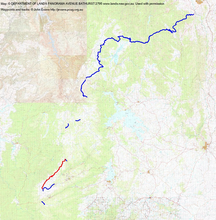
I've covered a few tens of kilometres in bits, as follows:
1 Cascade Trail from its crossing of the Thredbo River to Dead Horse Gap (2.5km): 26-29 Jan 06
2 Koscuiszko Walk from CootaPatamba Lookout to Rawsons Pass (1.2km): 26-28 Feb 10
3 Summit Walk from Rawsons Pass to Charlottes Pass (7.7km): 9-10 Apr 05
4 Munyang-Geehi Road from its N intersection with the Aquaduct Track to Whites River Hut turnoff (1.2km):
26-28 Feb 10
11 The Main Range unofficial route (as I understand it) departs from the official route at Rawsons Pass and goes via the Main Range Track to NE of Carruthers Peak, then via an old vehicle track passing very near Mt Tywnam, Mt Anton and Mt Anderson. The old vehicle track deteriorates into a footpad SE of Mt Anderson. The footpad continues to Consett Stephen Pass. An unmarked route through The Granite Peaks above The Rolling Ground and NE down to Whites River Hut. The official route is rejoined on the Munyang-Geehi Road (25.5km): 26-28 Feb 10
5 Grey Mare Fire Trail from the meteorological station N of Mt Jagungal to its intersection with Farm Ridge Fire Trail (4.8km): 1-2 Dec 09, 23-25 Mar 10
6 Grey
Mare Fire Trail where an unmarked track joins near a feeder creek to Doubtful Creek to Mackays Hut (2.4km) 23-25 Mar 10
7 Tabletop Mountain Fire Trail from its intersection with Four Mile Hut Fire Trail to its intersection with the Mt Selwyn Cross Country Ski Trail (6.7km): 2 Mar 10
8 Kiandra to Orroral Valley (82.0km) 1-4 Oct 10
9 Link Track from Orroral Valley to Honeysuckle Creek camping ground: several times (8.8km): incl 29 Jan 05
10 AAWT from Honeysuckle Creek camping ground to Namadgi Visitors Centre at Tharwa: several times (14.1km), incl 9 Sep 08, 1 Jan 08, 25 Mar 05
11
Orroral to Murrays Gap (Bimberi Peak) (21.4km) 4 Feb 12
12
Tabletop Mountain Fire Trail from Kiandra to the base of Tabletop Mountain (13.3km) 7 Feb 12.
Back to Walks Index