Walk
Day 11 - 13 July. Coles Bay to Cooks Hut over the Hazards
We were up around 7am (as every good hobo should), packed up quickly and drove to Coles Bay. We took some early light photos, then had breakfast at a local reserve and repacked for our next adventure. We were on the way by 9.15am, checked in at the National Parks office for any relevant information and were walking by 10.05am.
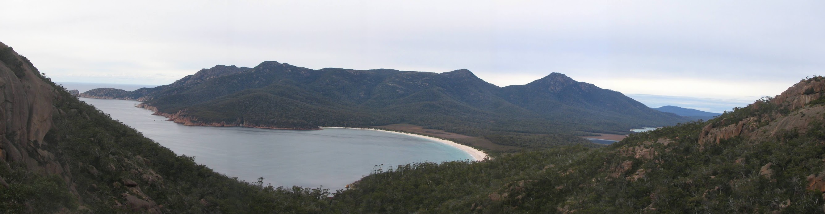
A quick climb of 30 minutes took us up between two of the Hazards to the Wineglass Bay lookout where we admired the classic postcard vista in more subdued and overcast conditions. A little scramble up the rocks at the side of the lookout gave us a better position for photos. We set out again at 11am and in 25 minutes reached the white sands of Wineglass Bay. We were certainly not alone, with several people along the beach and a porpoise breaking the water 50m off the beach.
We then headed along the track across the isthmus, stopping for morning tea beside a lagoon. It was an overcast and cool day, but with plenty more bird life in the scrubby forest and higher trees.
The track hit Hazards Beach just after midday and we walked south for a kilometre before stopping for lunch. My first experience of 'beachwalking', rather than bushwalking. Oyster catchers and Pacific Gulls claimed their territory on the sand and in the water and a wombat at the southern end of the beach took no notice of us.
The track entered the bush again and by 2.30pm we had reached the dry Regatta Creek and the northern end of Cooks Beach. The signage indicated another 30 minutes to Cooks Hut. We reached the substantial stone hut (plus water tanks) with plenty of campsites in the surrounding scrub. We chose a rise overlooking the beach and set up house. Tea and in bed by 6pm with the gentle, lulling wash of the waves on the shore. An inquisitive wallaby nosed into my annex several times until I brought all my gear (and scraps) into the tent and zipped it up.
Distance: 11km Climb: 150m.


___________________________________________


