15-16 July 2005 15-16 Jul Southern Ben Lomond, Tasmania Photos
Maps: Mangana 5639 1:25000; Stacks 5439 1:25000
Days 11-12 - 13-14 July. Freycinet Peninsula

Walk

Day 13 - 15 July.  To Ben Lomond plateau and near Lake Youl

It was a beautiful sleep on a soft bed, but the next adventure waited.  Up at 7am to a breakfast of freshly cut fruit, home made bread toast and honey and brewed coffee (why do I focus nearly as much on food as on walking?).  We drove up a track towards the southern end of Ben Lomond as far as a new Subaru Forester with 4 people and 3 packs could go.

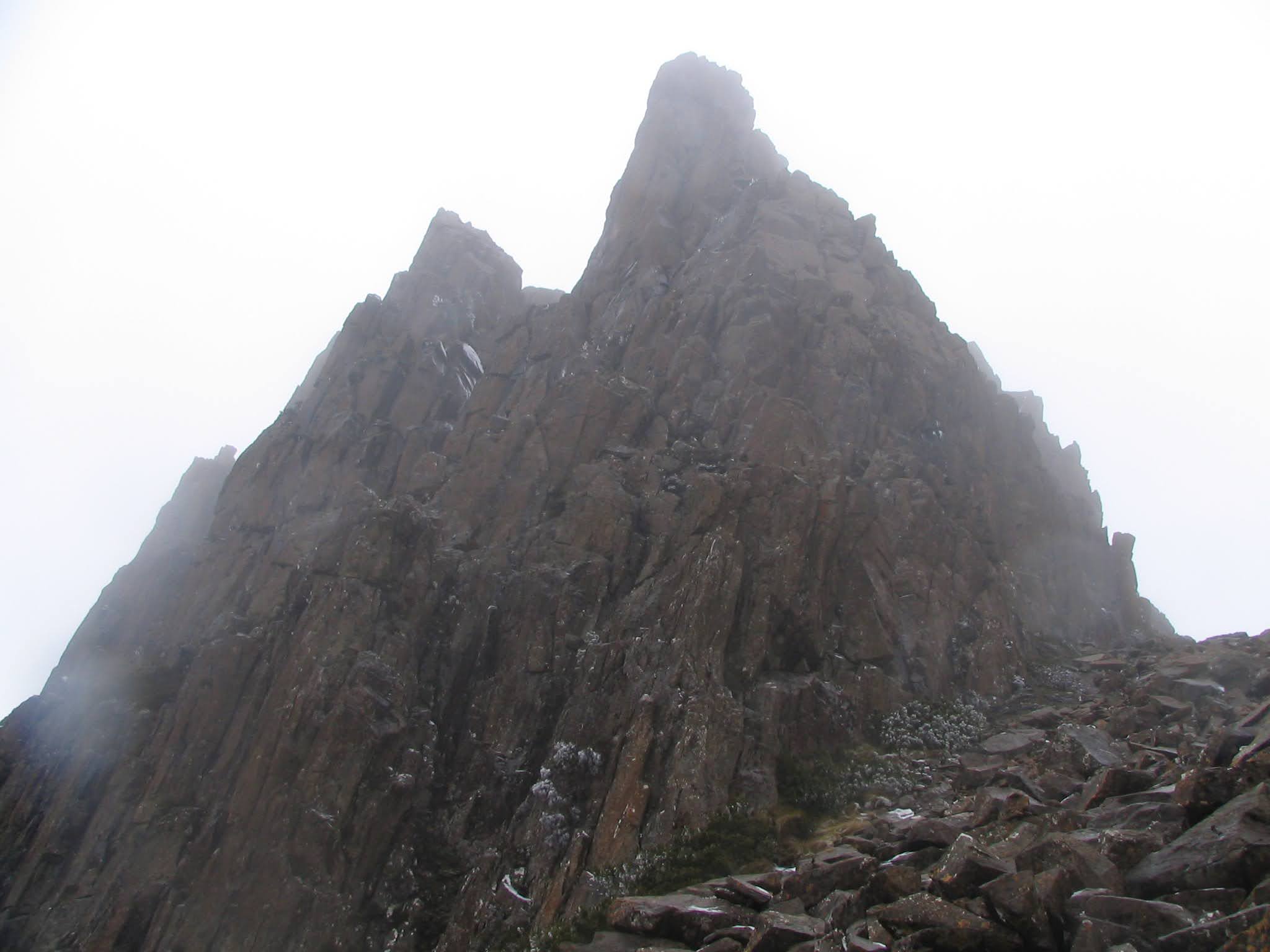
The 3 of us were were walking by 10.15am, with my GPS at last becoming useful, as this was a very exploratory walk.  We followed a reasonably well marked track up through the dry forest, then through wet and overhanging bushes which thoroughly soaked us, through the snow line to the plateau entrance between Bent and Broken Bluffs.  The scenery was spectacular!

Our objective was to explore at least around Lake Baker and Lake Youl, so we headed in a generally NW direction.  There was a little snow and ice around, with the cloud alternating between low cover and clear patches.  It was cccold!  The plateau was utterly treeless and nearly featureless.  But there was some colour in the winter alpine plants.  We gave a radio check at 12.30pm and stopped in a gully out of the wind for lunch at 1.20pm.  Tuna again.

By 2.35pm we were overlooking Lake Youl.  Both lakes were mainly frozen.  There was little point in closely approaching the lakes, so we headed between them, then west across the creek joining them.  At 4.05pm we crossed the Nile River (who needs to travel to foreign parts?) and headed for the cover of a small scree ridge.  It took about 30 minutes to find 3 small and uncomfortable camp sites, the next morning revealing that they were the only ones around.

There wasn't many cm of snow, but it was icy and cold.  We quickly put up our tents and cooked tea.  I put on every piece of clothing I had and got in my sleeping bag to drink my coffee.  I'd borrowed a tent, down bag and down jacket from RE, with whom I'd done our April walk.  I think I was the only warm and happy camper that night!  -2degC at 6.15pm with the frost settling.

Distance: 7km  Climb: 400m.

37 Iced bushes
38 Creek between Lake Baker and Lake Youl
39 View from the campsite
 

___________________________________________

Day 14 - 16 July.  Lake Youl campsite to Denison Crag exit

It was a lovely night, but bitterly cold.  Silent at first - no wind (in contrast to wind in the trees or waves lapping on the shore).  But the wind came up later in the night and the snow fell.  It was -4degC when we rose at 6.45am.

We made breakfast and packed and were walking by 8.15am.  There was a climb up from the campsite and, with the cloud cover down, we headed south west by dead reckoning for 2.5km until the cloud rose and we could see the edge of the plateau.  Although it was cold, I thought we were coasting - a quick drop off and walk down and we were out to a hot shower.  Wrong, Johnny boy!

At 10.30am we reached the edge of the plateau, but it didn't look familiar to our local host.  The cloud rolled down and my adrenalin coursed up.  It wasn't obvious to me, but Rupert knew what we should do.  We first went SW for around 700m and saw an exit going west.  No good, as the one we were looking for faced south east.  The GPS gave a reading but, at the time (either because of mis-hearing or of mis-placement on the map) it was the lie of the land that determined what we should do.  We headed NE for 1km, picking up a line of cairns at 12 noon and finding the exit chute we needed.  Coasting, I thought.

I have never seen or experienced anything like the Denison Crag exit chute.  The wind was howling down the funnel, the huge snow-covered scree blocks were potentially dangerously slippery and the slope fell away dramatically down towards Tranquil Tarn (what a misnomer!).  But home lay that way, so we snapped several pics and carefully picked our way down.  My thoughts were with bare-footed hobbits.

We were down to the tree line by 1.40pm and out of the scree.  At 2.15pm we were at the top of an old vehicular track and at 2.30pm our hostess appeared with the car, as far as she could drive up the track.  At last I could breathe a sigh of relief, having experienced a series of adventures I'd never forget.

Back, again, to fine hospitality and a soft bed.

Distance: 8km  Climb: 90m.

40 Denison Crag exit with Tranquil Tarn below
41 Storys Bluff and Sphinx Bluff
42 Denison Crag
 

___________________________________________

Day 15 - 17 July.  Home

Home